
Portal:Myanmar
ကြိုဆိုပါတယ်။ / Welcome to the Myanmar Portal 

Myanmar, officially the Republic of the Union of Myanmar and also referred to as Burma (the official English name until 1989), is a country in northwest Southeast Asia. It is the largest country by area in Mainland Southeast Asia and has a population of about 55 million. It is bordered by India and Bangladesh to its northwest, China to its northeast, Laos and Thailand to its east and southeast, and the Andaman Sea and the Bay of Bengal to its south and southwest. The country's capital city is Naypyidaw, and its largest city is Yangon (formerly Rangoon).
Myanmar is a member of the East Asia Summit, Non-Aligned Movement, ASEAN, and BIMSTEC, but it is not a member of the Commonwealth of Nations despite once being part of the British Empire. Myanmar is a Dialogue Partner of the Shanghai Cooperation Organization. The country is very rich in natural resources, such as jade, gems, oil, natural gas, teak and other minerals, as well as endowed with renewable energy, having the highest solar power potential compared to other countries of the Great Mekong Subregion. However, Myanmar has long suffered from instability, factional violence, corruption, poor infrastructure, as well as a long history of colonial exploitation with little regard to human development. In 2013, its GDP (nominal) stood at US$56.7 billion and its GDP (PPP) at US$221.5 billion. The income gap in Myanmar is among the widest in the world, as a large proportion of the economy is controlled by cronies of the military junta. Myanmar is one of the least developed countries. Since 2021, more than 600,000 people have been displaced across Myanmar due to the civil war post-coup, with more than three million people in dire need of humanitarian assistance. According to the United Nations High Commissioner for Refugees (UNHCR), there are over 1.3 million people counted as refugees and asylum seekers, and 3.5 million people displaced internally as of December 2024. (Full article...)
Selected articles -
-

The Burma Railway, also known as the Siam–Burma Railway, Thai–Burma Railway and similar names, or as the Death Railway, is a 415 km (258 mi) railway between Ban Pong, Thailand, and Thanbyuzayat, Burma (now called Myanmar). It was built from 1940 to 1943 by Southeast Asian civilians abducted and forced to work by the Japanese and by captured Allied soldiers, to supply troops and weapons in the Burma campaign of World War II. It completed the rail link between Bangkok, Thailand, and Rangoon, Burma. The name used by the Imperial Japanese Government was Tai–Men Rensetsu Tetsudō (泰緬連接鉄道), which means Thailand-Burma-Link-Railway.
At least 250,000 Southeast Asian civilians were subjected to forced labour to ensure the construction of the Death Railway and more than 90,000 civilians died building it, as did around 12,000 Allied soldiers. The workers on the Thai side of the railway were Tamils, Malays, and fewer Chinese civilians from Malaya. (Full article...) -
The Golden Triangle is a large, mountainous region of approximately 200,000 km2 (77,000 sq mi) in northeastern Myanmar, northwestern Thailand and northern Laos, centered on the confluence of the Ruak and Mekong rivers. The name "Golden Triangle" was coined by Marshall Green, a U.S. State Department official, in 1971 in a press conference on the opium trade. Today, the Thai side of the river confluence, Sop Ruak, has become a tourist attraction, with the House of Opium Museum, a Hall of Opium, a Golden Triangle Park, and no opium cultivation.
The Golden Triangle has been one of the largest opium-producing areas of the world since the 1950s. Most of the world's heroin came from the Golden Triangle until the early 21st century when opium production in Afghanistan increased. Myanmar was the world's second-largest source of opium after Afghanistan up to 2022, producing some 25% of the world's opium, forming part of the Golden Triangle. While opium poppy cultivation in Myanmar had declined year-on-year since 2015, the cultivation area increased by 33% totalling 40,100 ha (99,000 acres) alongside an 88% increase in yield potential to 790 t (780 long tons; 870 short tons) in 2022 according to the latest data from the United Nations Office on Drugs and Crime (UNODC) Myanmar Opium Survey 2022. The United Nations Office on Drugs and Crime has also warned that opium production in Myanmar may rise again if the economic crunch brought on by COVID-19 and the country's 2021 Myanmar coup d'état persists, with significant public health and security consequences for much of Asia. (Full article...) -

China–Myanmar relations (Chinese: 中缅关系; Burmese: တရုတ်မြန်မာဆက်ဆံရေး) are the international relations between the People's Republic of China and Myanmar. China and Myanmar have active bilateral relations with each other. The relation is often described as a pauk-phaw relationship (Burmese: ပေါက်ဖော်), based on a Burmese term for kinsfolk that implicates special asymmetric obligations between the two countries.
Generally, China has maintained positive relationships with both the military and elected governments in Myanmar. In recent years, bilateral relations between China and the current Myanmar government (Junta) have faced difficulties after the 2021 coup, due to alleged Chinese backing of rebels in Myanmar's territories and ongoing clashes between ethnic Chinese rebels and the Myanmar military near the China–Myanmar border. (Full article...) -
The early Pagan kingdom (Burmese: ခေတ်ဦး ပုဂံ ပြည်) was a city-state that existed in the first millennium CE before the emergence of the Pagan empire in the mid 11th century. The Burmese chronicles state that the "kingdom" was founded in the second century CE. The seat of power of the small kingdom was first located at Arimaddana, Thiri Pyissaya, and Tampawaddy until 849 CE when it was moved to Pagan (Bagan).
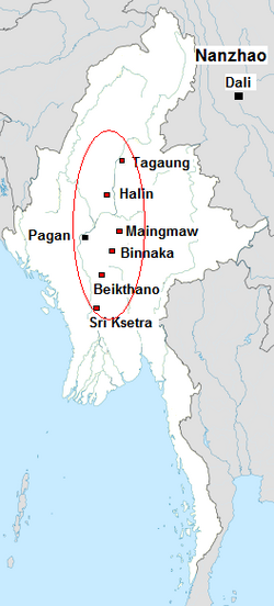
Radiocarbon dating shows the earliest human settlement in the Pagan region dates only from the mid-7th century CE. It existed alongside Pyu city-states that dominated Upper Burma. The city-state of Pagan, according to mainstream scholarship, was founded in the mid 9th century by the Mranma of Nanzhao kingdom. Burmans at Pagan expanded irrigation-based cultivation while borrowing extensively from the Pyus' predominantly Buddhist culture. It was one of many competing city-states in the Pyu realm until the late 10th century when the principality began absorbing its surrounding states. The expansion accelerated in the 1050s and 1060s when King Anawrahta founded the Pagan Empire, the first ever unification of the Irrawaddy valley and its periphery. (Full article...) -
The Tenasserim Hills or Tenasserim Range (Burmese: တနင်္သာရီ တောင်တန်း, [tənɪ̀ɰ̃θàjì tàʊɰ̃dáɰ̃]; Thai: ทิวเขาตะนาวศรี, RTGS: Thio Khao Tanao Si, pronounced [tʰīw kʰǎw tā.nāːw sǐː]; Malay: Banjaran Tanah Seri/Banjaran Tenang Sari) is the geographical name of a roughly 1,700 km long mountain chain, part of the Indo-Malayan mountain system in Southeast Asia.
Despite their relatively scant altitude these mountains form an effective barrier between Thailand and Myanmar in their northern and central region. There are only two main transnational roads and cross-border points between Kanchanaburi and Tak, at the Three Pagodas Pass and at Mae Sot. The latter is located beyond the northern end of the range, where the Tenasserim Hills meet the Dawna Range. Minor cross-border points are Sing Khon, near Prachuap Khiri Khan, as well as Bong Ti and Phu Nam Ron west of Kanchanaburi. The latter is expected to gain in importance if the planned Dawei Port Project goes ahead, along with a highway and a railway line between Bangkok and that harbor. (Full article...) -
Nyi Nyi Lwin (Burmese: ညီညီလွင်; MLCTS: Nyi Nyi Lwang; born 19 June 1979), more widely known by his monastic name U Gambira (Burmese: ရှင်ဂမ္ဘီရ), is a former Buddhist monk, activist and a leader of the All-Burma Monks' Alliance, a group which helped lead the 2007 protests against Burma's military government. Following the protests, he went into hiding and published two editorials critical of the Burmese government in The Washington Post and The Guardian on 4 November 2007. He was arrested the same day.
In November 2008, he was sentenced to 68 years in prison, including 12 years hard labour; the sentence was reduced to 65 years on appeal. Gambira reportedly protested his imprisonment by organising chanting with other imprisoned monks, boycotting his trial, and going on hunger strike. Human rights groups including Amnesty International and Human Rights Watch also protested his imprisonment. (Full article...) -

Shan State (Shan: မိူင်းတႆး, Möng Tai; Burmese: ရှမ်းပြည်နယ်, pronounced [ʃáɰ̃ pjìnɛ̀]) is a state of Myanmar. Shan State borders China (Yunnan) to the north, Laos (Louang Namtha and Bokeo Provinces) to the east, and Thailand (Chiang Rai, Chiang Mai and Mae Hong Son Provinces) to the south, and five administrative divisions of Myanmar in the west (Kachin State, Mandalay Region, Kayin State, Kayah State, and Sagaing Region). The largest of the 14 administrative divisions by land area, Shan State covers 155,800 km2, almost a quarter of the total area of Myanmar. The state gets its name from the Burmese name for the Tai peoples: "Shan people". The Tai (Shan) constitute the majority among several ethnic groups that inhabit the area. Shan State is largely rural, with only three cities of significant size: Lashio, Kengtung, and the capital, Taunggyi. Taunggyi is 150.7 kilometres (93.6 mi) northeast of the nation's capital Naypyitaw.
The Shan state, with many ethnic groups, is home to several armed ethnic groups. While the military government has signed ceasefire agreements with most groups, vast areas of the state, especially those east of the Salween River, remain outside the central government's control, and in recent years have come under heavy ethnic-Han Chinese economic and political influence. Other areas are under the control of military groups such as the Shan State Army. (Full article...) -
Buddhism (Burmese: ဗုဒ္ဓဘာသာ), specifically Theravāda Buddhism (Burmese: ထေရဝါဒဗုဒ္ဓဘာသာ), is the official and state religion of Myanmar since 1961, and practiced by nearly 90% of the population. It is the most religious Buddhist country in terms of the proportion of monks in the population and proportion of income spent on religion. With approximately 48 million Buddhists, Myanmar has the fourth largest Buddhist population in the world, after China, Thailand and Japan. Adherents are most likely found among the Bamar, Shan, Rakhine, Mon, Karen, and Chinese who are well integrated into Burmese society. Monks, collectively known as the sangha (community), are venerated members of Burmese society. Among many ethnic groups in Myanmar, including the Bamar and Shan, Theravada Buddhism is practiced in conjunction with the worship of nats, which are spirits who can intercede in worldly affairs. Buddhists in Myanmar are governed by Burmese customary law.
Regarding the practice of Buddhism, two popular practices stand out: merit-making and vipassanā meditation. There is also the less popular weizza path. Merit-making is the most common path undertaken by Burmese Buddhists. This path involves the observance of the Five precepts and accumulation of good merit through charity (dana, often to monks) and good deeds to obtain a favorable rebirth. The meditation path, which has gained ground since the early 20th century, is a form of Buddhist meditation which is seen as leading to awakening and can involve intense meditation retreats. The weizza path is an esoteric system of occult practices (such as recitation of spells, samatha and alchemy) believed to lead to life as a weizza (Burmese: ဝိဇ္ဇာ Pali: vijjā), a semi-immortal and supernatural being who awaits the appearance of the future Buddha, Maitreya (Burmese: အရိမေတ္တေယျ Pali: Arimetteyya). (Full article...) -
Bagan (/bəˈɡæn/ bə-GAN; Burmese: ပုဂံ Băgam [bəɡàɰ̃]; formerly Pagan) is an ancient city and a UNESCO World Heritage Site in the Mandalay Region of Myanmar. From the 9th to 13th centuries, the city was the capital of the Pagan Kingdom, the first kingdom that unified the regions that would later constitute Myanmar. During the kingdom's height between the 11th and 13th centuries, more than 10,000 Buddhist temples, pagodas and monasteries were constructed in the Bagan plains alone, of which the remains of over 2200 temples and pagodas survive.
The Bagan Archaeological Zone is a main attraction for the country's nascent tourism industry. (Full article...) -
Hkakaborazi National Park is a national park in northern Myanmar with an area of 1,472 sq mi (3,810 km2). It was established in 1998.
It surrounds Hkakabo Razi, the highest mountain in the country.
It ranges in elevation from 2,950 to 18,730 ft (900 to 5,710 m) comprising evergreen forest and mixed deciduous forests in Nogmung Township, Kachin State. It is managed by the Nature and Wildlife Conservation Division.
It is contiguous with Bumhpa Bum Wildlife Sanctuary and Hukaung Valley Wildlife Sanctuary. These protected areas together with Hponkanrazi Wildlife Sanctuary comprise the largest continuous expanse of natural forest called the Northern Forest Complex stretching over an area of 11,624 sq mi (30,110 km2). Its objective is to conserve the biodiversity of the Ayeyarwady and Chindwin river basins. (Full article...)


Did you know (auto-generated) -

- ... that Molly Burman resumed releasing music three years later after finding that "Happy Things" had accrued a million streams on Spotify?
- ... that Thinzar Shunlei Yi hid in the Burmese jungle for a month and joined a rebel militia following the 2021 Myanmar coup d'état?
- ... that Rolling Stone named Mission of Burma's "Academy Fight Song" as one of the 100 greatest debut singles of all time?
- ... that the DI MA-1 Mk. III rifle was made in Myanmar as a reverse-engineered copy of the Chinese QBZ-97?
- ... that the Myanmar Photo Archive (example photograph shown) revealed "a side of modern Myanmar that, until very recently, remained hidden in dusty attics"?
- ... that Myinsaing withstood a ten-week siege by the Mongols because its three brother leaders bribed the invaders to withdraw?
- ... that former Burmese actress Honey Nway Oo turned rebel and took up arms against the military junta following the 2021 Myanmar coup d'état?
- ... that one academic described the introduction of femboys to Myanmar as a tactic to achieve an "ideological revolution"?
Related portals and projects
General images -
-
 Former US President Barack Obama poses barefoot on the grounds of Shwedagon Pagoda, one of Myanmar's major Buddhist pilgrimage sites. (from Culture of Myanmar)
 -
 A group of Buddhist worshipers at Shwedagon Pagoda, an important religious site for Burmese Buddhists (from Culture of Myanmar)
 -
 The paddle steamer Ramapoora (right) of the British India Steam Navigation Company on the Rangoon river having just arrived from Moulmein. 1895. Photographers: Watts and Skeen. (from History of Myanmar)
 -
 Grandfather Island, Dawei (from Geography of Myanmar)
 -
 Salween river at Mae Sam Laep on the Thai-Myanmar border (from Geography of Myanmar)
 -
 Jade Mine in Hpakant (from Geography of Myanmar)
 -
 Mount Popa, a dormant volcano in the Central Lowlands (from Geography of Myanmar)
 -
 A theatrical performance of the Mon dance (from Culture of Myanmar)
 -

-

-

-
 The restored Taungoo or Nyaungyan dynasty, c. 1650 CE (from History of Myanmar)
 -
 Pagan Kingdom during Narapatisithu's reign. Burmese chronicles also claim Kengtung and Chiang Mai. Core areas shown in darker yellow. Peripheral areas in light yellow. Pagan incorporated key ports of Lower Burma into its core administration by the 13th century. (from History of Myanmar)
 -
 Portuguese ruler and soldiers mounting an elephant. Jan Caspar Philips (draughtsman and engraver). (from History of Myanmar)
 -
 Mountains near Pindaya on the Shan Plateau (from Geography of Myanmar)
 -
 Myanmar (Burma) map of Köppen climate classification (from Geography of Myanmar)
 -
 Aung San Suu Kyi addresses crowds at the NLD headquarters shortly after her release. (from History of Myanmar)
 -
 Temples at Mrauk U, the capital of the Mrauk U Kingdom, which ruled over what is now Rakhine State (from History of Myanmar)
 -
 Protesters in Yangon with a banner that reads "non-violence: national movement" in Burmese. In the background is Shwedagon Pagoda. (from History of Myanmar)
 -
![Image 20Military situation in Myanmar as of 2024[update]. Areas controlled by the Tatmadaw are highlighted in red. (from History of Myanmar)](//upload.wikimedia.org/wikipedia/commons/thumb/c/c1/Myanmar_civil_war.svg/120px-Myanmar_civil_war.svg.png) Military situation in Myanmar as of 2024[update]. Areas controlled by the Tatmadaw are highlighted in red. (from History of Myanmar)
Military situation in Myanmar as of 2024[update]. Areas controlled by the Tatmadaw are highlighted in red. (from History of Myanmar) -
 Saint Mary's Cathedral in Downtown Yangon is the largest Roman Catholic cathedral in Burma. (from Culture of Myanmar)
 -
 A bull fight, 19th-century watercolour (from Culture of Myanmar)
 -
 Hlei pyaingbwè - a Burmese regatta (from Culture of Myanmar)
 -
 Boxing match, 19th-century watercolour (from Culture of Myanmar)
 -
 British soldiers remove their shoes at the entrance of Shwedagon Pagoda. To the left, a sign reads "Foot wearing is strictly prohibited" in Burmese, English, Tamil, and Urdu. (from Culture of Myanmar)
 -
 British soldiers dismantling cannons belonging to King Thibaw's forces, Third Anglo-Burmese War, Ava, 27 November 1885. Photographer: Hooper, Willoughby Wallace (1837–1912). (from History of Myanmar)
 -
 19th-century funeral cart and spire, which would form part of the procession from the home to the place of cremation (from Culture of Myanmar)
 -

-
 A large fracture on the Mingun Pahtodawgyi caused by the 1839 Ava earthquake. (from Geography of Myanmar)
 -
 Two female musicians play the saung at a performance in Mandalay. (from Culture of Myanmar)
 -
 A wide range of Burmese lacquerware from Bagan (from Culture of Myanmar)
 -
 The shores of Irrawaddy River at Nyaung-U, Bagan (from Geography of Myanmar)
 -
 British soldiers on patrol in the ruins of the Burmese town of Bahe during the advance on Mandalay, January 1945 (from History of Myanmar)
 -
 Recorder's Court on Sule Pagoda Road, with the Sule Pagoda at the far end, Rangoon, 1868. Photographer: J. Jackson. (from History of Myanmar)
 -
 Vegetable stall on the roadside at the Madras Lancer Lines, Mandalay, January 1886. Photographer: Hooper, Willoughby Wallace (1837–1912). (from History of Myanmar)
 -
 Aerial view of a burned Rohingya village in Rakhine state, September 2017 (from History of Myanmar)
 -
 Sculpture of Myanmar mythical lion (from Culture of Myanmar)
 -
 Protesters in Yangon carrying signs reading "Free Daw Aung San Suu Kyi" on 8 February 2021 (from History of Myanmar)
 -
 Myinhkin thabin - equestrian sport (from Culture of Myanmar)
 -
 Political map of Burma (Myanmar) c. 1450 CE. (from History of Myanmar)
 -
 British invasion of Burma in 1824 (from History of Myanmar)
 -
 A wedding procession, with the groom and bride dressed in traditional Burmese wedding clothes, reminiscent of royal attire (from Culture of Myanmar)


_headquarter.jpg)


![Image 20Military situation in Myanmar as of 2024[update]. Areas controlled by the Tatmadaw are highlighted in red. (from History of Myanmar)](/wiki/File:Myanmar_civil_war.svg)


Major topics
Categories

More topics

Associated Wikimedia
The following Wikimedia Foundation sister projects provide more on this subject:
-
 Commons
Free media repository -
 Wikibooks
Free textbooks and manuals -
 Wikidata
Free knowledge base -
 Wikinews
Free-content news -
 Wikiquote
Collection of quotations -
 Wikisource
Free-content library -
 Wikiversity
Free learning tools -
 Wikivoyage
Free travel guide -
 Wiktionary
Dictionary and thesaurus


