Wadi Madnan
| Wadi Madnan Wādī Midnān | |
|---|---|
 | |
| Native name | وادي مدنان (Arabic) |
| Location | |
| Country | |
| Emirate | |
| Physical characteristics | |
| Source | Northeast slope of Jabal Yibir (1,527 m (5,010 ft)) |
| • elevation | 1,430 m (4,690 ft), approximately |
| Mouth | Confluence with Wadi Naqab |
• coordinates | 25°42′48″N 56°06′51″E / 25.71333°N 56.11417°E |
• elevation | 211 m (692 ft) |
| Length | 10.4 km (6.5 mi) |
| Basin size | 107 km2 (41 sq mi) |
| Basin features | |
| Progression | Wadi. Intermittent flow |
| River system | Wadi Naqab |
| Tributaries | |
| • right | Wadi Sharih, Wadi Samarat / Wadi Khalkhal |
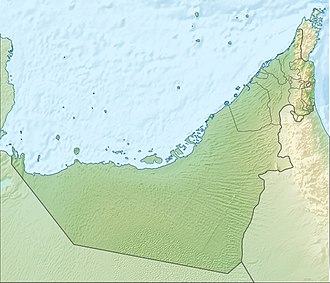
Wadi Madnan (Arabic: وادي مدنان, romanized: Wādī Midnān) [1][2][3] is a valley or dry river, with ephemeral or intermittent flow, flowing almost exclusively during the rainy season, located in the east of the United Arab Emirates, in the emirates of Fujairah and Ras Al Khaimah.
It is a left tributary of the Wadi Naqab, to whose 107 km2 (41 sq mi) drainage basin it belongs,[4] and which is bordered to the north by the Wadi Qada'ah basin,;[5] to the west with that of Wadi Nahela;[6] and to the south and east, with that of Wadi Tawiyean.[7][8][9]
The entire Wadi Naqab basin, whose highest peak is Jabal Yibir (1,527 m (5,010 ft)),[9][10] brings together approximately 91 independent streams, most of them without known names, all classified into five grades or levels according to the Horton-Strahler numbering. Of these, the main one, due to its length and flow rate, is the Wadi Madnan.[11]
Among the main tributaries of the Wadi Madnan (sub-tributaries of the Wadi Naqab), the Wadi Sharih and Wadi Samarat (also known as Wadi Khalkhal) stand out.[1][2]
Course
[edit]

The total approximate length of Wadi Madnan is 10.4 km (6.5 mi). It flows from south to north, and its main source is located on the northeast slope of Jabal Yibir, at an altitude of approximately 1,430 m (4,690 ft).[9]
In its upper course, about 2 km (1.2 mi) long, it surrounds Jabal Dardur (1,398 m (4,587 ft))[12] and the village of Dardur (Arabic: ديرة الدردور), which extends around its summit, forming a large ravine with abrupt and very steep sections.

At the beginning of its middle course, the wadi passes through the village of Wab Saqar (Arabic: واب صقر) and for the next 3 km (1.9 mi), until reaching the village of Khanaan (Arabic: خنان),[13] it has a wide and deep channel, with high cliffs on its sides, but with a moderate slope that facilitates its use as a transit and communication route (on foot or with donkeys), between the small villages and cultivated areas of the area.
In the second half of its course, Wadi Madnan also has a very rugged channel, and past the village of Shairi[1] it forms a large canyon, with several spectacular dry waterfalls, between 40 and 60 m (130 and 200 ft) high, only accessible with rock climbing techniques and equipment.[14]
This area of waterfalls is known to enthusiasts of canyoning named Kirithon Canyon.[15][16]
A few meters before its mouth in the Wadi Naqab, the Wadi Madnan receives on its right the confluence of the Wadi Samarat (Wādī Khalkhāl).[1]
Toponymy
[edit]Alternative names: Wadi Midnan, Wādī Midnān, Wādī Madnan.
The name of Wadi Madnan (with that same spelling), its tributaries, mountains, and nearby towns was recorded in the documentation and maps produced between 1950 and 1960 by the British Arabist, cartographer, military officer, and diplomat Julian F. Walker, during the work carried out to establish borders between the then called Trucial States,[13] later completed by the UK Ministry of Defence, on 1:100,000 scale maps published in 1971.[2]
In The National Atlas of the United Arab Emirates appears with the spelling Wādī Midnān (Arabic: وادي مدنان).[1]
Population
[edit]The entire area around Wadi Naqab, including its tributaries and sub-tributaries, although initially populated by the Naqbiyin tribe (Arabic: النقبي), also called Naqabi or Al-Naqabi (from which the wadi gets its name),[10] was occupied from approximately 1800 by the Habus tribe,[17][18] which extended, among other territories, through the tribal areas of Ahl Ghayl and Bani Hasan.
See also
[edit]- List of wadis of the United Arab Emirates
- List of mountains in the United Arab Emirates
- List of wadis of Oman
- List of mountains in Oman
References
[edit]- ^ a b c d e Jāmiʿat al-Imārāt al-ʿArabīyah al-Muttaḥidah (1993). The national atlas of the United Arab Emirates. Al Ain, United Arab Emirates: United Arab Emirates University with GEOprojects (U.K.) Ltd. ISBN 9780863511004.
- ^ a b c Map of Trucial States, Muscat and Oman - Rams - Scale 1:100 000 - Published by D Survey, Ministry of Defence, United Kingdom (1971) - Edition 3-GSGS - The National Archives, London, England <https://www.agda.ae/en/catalogue/tna/fco/18/1785>
- ^ Mindat.org - Wādī Madnan, Ra’s al Khaymah, United Arab Emirates https://www.mindat.org/feature-291577.html
- ^ OpenStreetMap.org - Via: Wadi Naqab drainage basin (1266108848) https://www.openstreetmap.org/way/1266108848#map=12/25.7057/56.0963
- ^ Relation: Wadi Qada'ah drainage basin (19054264) https://www.openstreetmap.org/relation/19054264#map=13/25.75692/56.11318&layers=P
- ^ OpenStreetMap.org - Via: Wadi Nahela drainage basin (1274096521) https://www.openstreetmap.org/way/1274096521#map=13/25.65882/56.05569
- ^ OpenStreetMap.org - Via: Wadi Tawiyean Drainage Basin (1286229718) https://www.openstreetmap.org/way/1286229718#map=11/25.6031/56.0936
- ^ Application of a hydrological model in a data poverty arid region catchment: a case study of Wadi Ham - Mohamed Mustafa Al Mulla PhD Thesis Academic Year 2005-2006 - Supervisor: Dr Ian P. Holman - December 1, 2005 - Cranfield University at Silsoe - Institute of Water and Environment <https://dspace.lib.cranfield.ac.uk/items/c116d8d5-f80b-4c8b-b754-7507d3abec27>
- ^ a b c Water Resources and Integrated Management of the United Arab Emirates - Abdulrahman S. Alsharhan, Zeinelabidin E. Rizk - Springer Nature, Mar 17, 2020 - 850 pages - pag. 204-205 <https://books.google.com/books?id=lF7XDwAAQBAJ&pg=PA103&hl=es&source=gbs_selected_pages&cad=1#v=onepage&q&f=false>
- ^ a b Lancaster, William, 1938- (2011). Honour is in contentment : life before oil in Ras al-Khaimah (UAE) and some neighboring regions. Lancaster, Fidelity. Berlin: De Gruyter. ISBN 978-3-11-022340-8. OCLC 763160662.
{{cite book}}: CS1 maint: multiple names: authors list (link) CS1 maint: numeric names: authors list (link) - ^ OpenStreetMap.org - Via: Wadi Wadi Madnan (1146556326) https://www.openstreetmap.org/way/1146556326
- ^ Jabal Dardur (1398 m) - PeakFinder <https://www.peakfinder.com/es/?lat=25.65440&lng=56.12920&ele=1398&azi=358.26&alt=0.06&fov=47.78&cfg=s&name=Jabal%20Dardur>
- ^ a b FCO 18/1896 1959 Oman: Dibba - The National Archives, London, England <https://www.agda.ae/en/catalogue/tna/fco/18/1896/n/1>
- ^ Gary R. Feulner (2011). "Tribulus: The Flora of the Ru'us al-Jibal -the Mountains of the Musandam Peninsula: An Annotated Checklist and Selected Observations" (PDF). Tribulus. Vol. 19. Abu Dhabi, United Arab Emirates: Emirates Natural History Group. Retrieved 27 May 2025.
- ^ climbing7.com - Kirithon Gorge, Wadi Naqab <https://climbing7.com/2020/10/29/kirithon-gorge-wadi-naqab/>
- ^ Canyon exploration (Kirithon) - Ras Al Khaima - United Arab Emirates - Journey On Route - YouTube - 2023 <https://www.youtube.com/watch?v=FI8JX0736XY>
- ^ Tribes of Trucial States coast - 1958- Ref. FO 371/132894 <https://www.agda.ae/en/catalogue/tna/fo/371/132894/n/43>
- ^ Mindat.org - Al Ḩabūs, Umm al Qaywayn, United Arab Emirates <https://www.mindat.org/feature-289290.html>
External links
[edit]![]() Media related to Wadi Madnan at Wikimedia Commons
Media related to Wadi Madnan at Wikimedia Commons


