Wadi Tawiyean
| Wadi Tawiyean Wādī Aṭ Ṭawyēn | |
|---|---|
 | |
| Native name | وادي الطويين (Arabic) |
| Location | |
| Country | |
| Emirate | |
| Physical characteristics | |
| Source | Southwest of the village of Hiyar, from its confluence with the Wadi al-Khurush.[1] |
| • elevation | 190 m (620 ft), approximately |
| Mouth | Southwest of the Wadi Tawiyean Dam (Batha Mahani)[2] |
• coordinates | 25°33′55″N 56°02′44″E / 25.56528°N 56.04556°E |
• elevation | 146 m (479 ft) |
| Length | 6.5 km (4.0 mi) |
| Basin size | 208 km2 (80 sq mi) |
| Basin features | |
| Progression | Wadi. Intermittent flow |
| River system | Wadi Tawiyean.[1] |
| Tributaries | |
| • left | Wadi Sayraq |
| • right | Wadi Khabb, Wadi Awsaq, Wadi al Khurush |
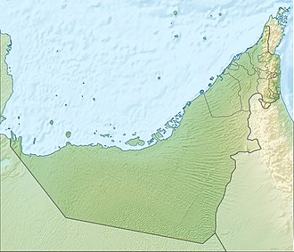
Wadi Tawiyean (Arabic: وادي الطويين, romanized: Wādī Aṭ Ṭawyēn) [3][4][5] is a valley, or dry river, with ephemeral or intermittent flow, which flows almost exclusively during the rainy season, located in the east of the United Arab Emirates, in the emirate of Fujairah.
It forms its own drainage basin of 208 km²,[6] which is bordered to the north by the Wadi Khabb Shamsi basins,[7] Wadi Naqab[8] and Wadi Nahela;[9] and to the south and west by those of Wadi Mu'taridah / Wadi Mutarid and Wadi Basseirah.[10][11]
The entire Wadi Tawiyean catchment area, whose highest peak is Jabal Yibir 1,527 m (5,010 ft),[2] brings together approximately 222 independent streams,[11] most of them without known name, all of them classified into five grades or levels according to the Horton-Strahler numbering.
Of these, the most significant in terms of length and flow is by far the Wadi Khabb (27 km (17 mi)), to the point that its course is sometimes mistakenly identified as the Wadi Tawiyean itself. Other important tributaries are the Wadi Awsaq, the Wadi al Khurush, and the Wadi Sayraq.[4][2]
They all flow into the Wadi Tawiyean, in the Sayh Muruq depression.[4][12] next to the city of Tawiyean (Arabic: الطويين, romanized: Aţ Ţawyēn).[3]
Although the total approximate length of the Wadi Tawiyean is only 6.5 km (4.0 mi) (much smaller than several of its tributaries),[13] the watershed gets its name from the wadi where the river mouth is concentrated.
Course
[edit]
The Wadi Tawiyean flows from west to east, from the confluence of the Wadi al Khurush,[2] descending from the area of the historic Qaliddi Pass,[14] and flows into the Batha Mahani, the flat, sandy bed of the Wadi Mahani, formed by the deposition of sediments. [2] [4]
The entire mouth of Wadi Tawiyean, and the Batha Mahani area west of the dam, is occupied by large-scale quarrying, which has affected the course of the wadi and caused considerable environmental impact on its surroundings.[15]
Dams and reservoirs
[edit]As in other regions of the UAE, the Wadi Tawiyean geographical area has occasionally been affected by unusually heavy rains and flooding.[16][17][18]

To prevent the danger of flash floods and increase the recharge potential of groundwater, a large dam was built along its course in 1992,[19] taking advantage of the confluence of its major tributaries in the Sayh Muruq depression.[4][20]
The dam is 23.5 m (77 ft) high, has a reservoir of 3.75 km2 (1.45 sq mi) with a capacity of 18.5 million cubic metres, and was officially named Wadi Tawiyean Dam (coordinates: 25°33′57″N, 56°2′56″E).[21][22]
Toponymy
[edit]Alternative names: Wadi Tawiyean, Wadi Al Tawiyeen, Wādī Aṭ Ṭawyēn, Wadi Tawiyeen, Wadi Tawiyayn, Wādī Ţawīyayn, Wadi Tawiyain.
The name of Wadi Tawiyean (spelled as Wādī Ţawīyayn and Wadi Tawiyain), its tributaries, mountains and nearby towns, was recorded in the documentation and maps drawn up between 1950 and 1960 by the British Arabist, cartographer, military officer and diplomat Julian F. Walker, during the work carried out to establish the borders between the then called Trucial States,[23] later completed by the Ministry of Defence of the United Kingdom, on scale maps 1:100,000 published in 1971.[4]
In the National Atlas of the United Arab Emirates it appears with the spelling Wādī Aṭ Ṭawyēn (Arabic: وادي الطويين).[3]
Population
[edit]The Wadi Tawiyean area was populated mainly by the Sharqiyin tribe, sections or tribal zones of Hafaitat / Ḩufaitāt and Jamahi / Jamaḩah.[24][25]
Throughout the Wadi Tawiyean watershed and its tributaries, archaeological remains exist that attest to human presence in this area since very ancient times.[26]
See also
[edit]- List of wadis of the United Arab Emirates
- List of mountains in the United Arab Emirates
- List of wadis of Oman
- List of mountains in Oman
References
[edit]- ^ a b Sherif, Mohsen & Akram, Salim & Shetty, Ampar & El Mahmoudi, Ahmed & Ibraheem, Abdel & Mahrizy, Ahmed & Ahmed, Imad & Harron, Khaled. (2004). Geomorphological and Geological Setting of Selected Wadis in the Northern Emirates. The Fifth Annual U.A.E. University Research Conference. <https://www.researchgate.net/publication/258440771_Geomorphological_and_Geological_Setting_of_Selected_Wadis_in_the_Northern_Emirates>
- ^ a b c d e El Mahmoudi, Ahmed & Akram, Salim & Ebraheem, A. & Shetty, Ampar. (2005). GIS-based Hydrogeological and Geophysical Studies for Groundwater Exploration in Wadi Tawiyean Area, UAE. <https://www.researchgate.net/publication/258446959_GIS-based_Hydrogeological_and_Geophysical_Studies_for_Groundwater_Exploration_in_Wadi_Tawiyean_Area_UAE>
- ^ a b c Jāmiʿat al-Imārāt al-ʿArabīyah al-Muttaḥidah (1993). The national atlas of the United Arab Emirates. Al Ain, United Arab Emirates: United Arab Emirates University with GEOprojects (U.K.) Ltd. ISBN 9780863511004.
- ^ a b c d e f Map FCO 18/1787 - 1972 - Oman and the United Arab Emirates (UAE): Dibba, with handwritten annotations - Scale 1:100 000 - Published by D Survey, Ministry of Defense, United Kingdom (1971) - Edition 3-GSGS - The National Archives, London, England <https://www.agda.ae/en/catalogue/tna/fco/18/1787>
- ^ Mindat.org - Wādī Ţawīyayn, Al Fujayrah, United Arab Emirates <https://www.mindat.org/feature-290669.html>
- ^ OpenStreetMap.org - Way: Wadi Tawiyean Drainage Basin (1286229718) <https://www.openstreetmap.org/way/1286229718>
- ^ OpenStreetMap.org - Way: Karsha / Wadi Khabb Shamsi Drainage Basin (1284496100) <https://www.openstreetmap.org/way/1284496100#map=11/25.7220/56.2376>
- ^ OpenStreetMap.org - Via: Wadi Naqab drainage basin (1266108848) <https://www.openstreetmap.org/way/1266108848#map=12/25.7057/56.0963>
- ^ OpenStreetMap.org - Vía: Wadi Nahela drainage basin (1274096521) <https://www.openstreetmap.org/way/1274096521#map=13/25.65882/56.05569>
- ^ Application of a hydrological model in a data poor arid region catchment: a case study of Wadi Ham - Mohamed Mustafa Al Mulla PhD Thesis Academic Year 2005-2006 - Supervisor: Dr Ian P. Holman - December 1, 2005 - Cranfield University at Silsoe - Institute of Water and Environment <https://dspace.lib.cranfield.ac.uk/items/c116d8d5-f80b-4c8b-b754-7507d3abec27>
- ^ a b Water Resources and Integrated Management of the United Arab Emirates - Abdulrahman S. Alsharhan, Zeinelabidin E. Rizk - Springer Nature, Mar 17, 2020 - 850 pages - pag. 204-205 <https://books.google.com/books?id=lF7XDwAAQBAJ&pg=PA103&hl=es&source=gbs_selected_pages&cad=1#v=onepage&q&f=false>
- ^ Mindat.org - Sayh Muruq, Al Fujayrah, United Arab Emirates <https://www.mindat.org/feature-291325.html>
- ^ OpenStreetMap.org - Via: Wadi Tawiyean (1249434219) <https://www.openstreetmap.org/way/1249434219#map=14/25.56015/56.07458>
- ^ Gazetteer of the Persian Gulf. Vol. II. Geographical and Statistical. J G Lorimer. 1908', British Library: India Office Records and Private Papers, IOR/L/PS/20/C91/4, in Qatar Digital Library <http://www.qdl.qa/en/archive/81055/vdc_100023515718.0x00009e>
- ^ Metso - Riddhi Siddhi benefits from Metso's expertise in the aggregates industry - Youtube - 2016
- ^ "سكان في المنطقة الشرقيــة يطالبـون بسدٍّ يحجز مياه الأمطار - Ciencias de la casa - Emiratos Árabes Unidos: Domine la naturaleza con infraestructura moderna|". www.aletihad.ae (in Arabic). Retrieved 2025-04-16.
- ^ "سكان في المنطقة الشرقيــة يطالبـون بسدٍّ يحجز مياه الأمطار - Residents of the Eastern Province demand a dam to contain rainwater|". www.emaratalyoum.com (in Arabic). Retrieved 2025-04-16.
- ^ "بالفيديو.. تعرّف إلى أخطر وادٍ تسبب في تضرر 120 أسرة برأس الخيمة - Video: Discover the most dangerous valley that has affected 120 families in Ras Al Khaimah|". www.emaratalyoum.com (in Arabic). Retrieved 2025-04-16.
- ^ Wadi Al Tawyeen - Fujairah Tourism & Antiquities Department <https://fujairah.ae/en/Pages/placevisitDetails.aspx?placeToVisitID=13>
- ^ Mindat.org - Sayh Muruq, Al Fujayrah, United Arab Emirates <https://www.mindat.org/feature-291325.html>
- ^ Food and Agriculture Organization of the United Nations AQUASTAT - FAO's Global Information System on Water and Agriculture https://www.fao.org/aquastat/en/databases/dams
- ^ Ministry of Energy and Infrastructure in UAE - Federal Dams https://admin.bayanat.ae/Home/DatasetInfo?dID=lFWr8jmvtTwdCtQd7uDtLjOq-EB6rfmemu-OtkcDuCo&langKey=en>
- ^ FCO 18/1969 - 1959 - Sketch map drawn by Julian Walker for boundary delimitation: Dibba - The National Archives, London, England <https://www.agda.ae/en/catalogue/tna/fco/18/1969>
- ^ Lancaster, William, 1938- (2011). Honour is in contentment : life before oil in Ras al-Khaimah (UAE) and some neighboring regions. Lancaster, Fidelity. Berlin: De Gruyter. ISBN 978-3-11-022340-8. OCLC 763160662.
{{cite book}}: CS1 maint: multiple names: authors list (link) CS1 maint: numeric names: authors list (link) - ^ Gazetteer of the Persian Gulf. Vol. II. Geographical and Statistical. J G Lorimer. 1908', British Library: India Office Records and Private Papers, IOR/L/PS/20/C91/4, in Qatar Digital Library <https://www.qdl.qa/en/archive/81055/vdc_100023515720.0x00005d>
- ^ Britton, Georgia. “An Archaeological Survey of Northern Fujairah, United Arab Emirates.” Arabian Archaeology and Epigraphy, 2004. <:https://www.academia.edu/48243045/An_archaeological_survey_of_northern_Fujairah_United_Arab_Emirates>
External links
[edit]![]() Media related to Wadi Tawiyean at Wikimedia Commons
Media related to Wadi Tawiyean at Wikimedia Commons


