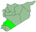
Mazraat Beit Jinn
Appearance
Mazraat Beit Jinn
مزرعة بيت جن Mazraat Beit Jenn | |
|---|---|
Village | |
| Coordinates: 33°20′N 35°55′E / 33.333°N 35.917°E | |
| Country | |
| Governorate | Rif Dimashq Governorate |
| District | Qatana District |
| Nahiyah | Beit Jen |
| Population (2004 census)[1] | |
• Total | 5,073 |
| Time zone | UTC+2 (EET) |
| • Summer (DST) | UTC+3 (EEST) |
Mazraat Beit Jinn (Arabic: مزرعة بيت جن), also known as Mazraat Beit Jenn or Mazraat Bayt Jinn, is a Syrian village in the Qatana District of the Rif Dimashq Governorate. According to the Syria Central Bureau of Statistics, Mazraat Beit Jen had a population of 5,073 at the 2004 census.[1] Its inhabitants are predominantly Sunni Muslims.[2]
Nearby localities include Beit Jinn to the west, Arnah to the northwest, Darbal to the north, Hinah to the north-northeast, Maghar al-Mir to the east, Harfa to the south, and Hader to the southwest.
References
[edit]- ^ a b . It was the site of a fierce battle in the 1973 War. General Census of Population and Housing 2004.[permanent dead link] Syria Central Bureau of Statistics (CBS). Rif Dimashq Governorate. (in Arabic)
- ^ https://www.imlebanon.org/newspaper/aldiyyar-editorial-3/


