
Walden, Colorado
Walden, Colorado | |
|---|---|
 Main Street in Walden, July 2010 | |
 Location of Walden in Jackson County, Colorado. | |
| Coordinates: 40°43′54″N 106°16′53″W / 40.73167°N 106.28139°W | |
| Country | |
| State | |
| County[1] | Jackson County - seat[2] |
| Established | 1889 |
| Incorporated | December 2, 1890[3] |
| Named after | Marcus Aurelius Walden (former postmaster) |
| Government | |
| • Type | Statutory Town[1] |
| Area | |
• Total | 0.34 sq mi (0.87 km2) |
| • Land | 0.34 sq mi (0.87 km2) |
| • Water | 0.00 sq mi (0.00 km2) |
| Elevation | 8,098 ft (2,468 m) |
| Population | |
• Total | 606 |
| • Density | 1,800/sq mi (700/km2) |
| Time zone | UTC−7 (Mountain (MST)) |
| • Summer (DST) | UTC−6 (MDT) |
| ZIP codes[7] | 80430, 80480 |
| Area code | 970 |
| FIPS code | 08-82130 |
| GNIS feature ID | 2413440[5] |
| Website | www |
Walden is the Statutory Town that is the county seat, the most populous community, and the only incorporated municipality in Jackson County, Colorado, United States.[1][8] It is situated in the center of a large open valley called North Park. People from Walden and the surrounding area refer to themselves as "North Parkers".[citation needed] The town population was 606 at the 2020 census.[6] The town sits at an elevation of 8,099 feet (2,469 meters). It was established in 1889 and was incorporated December 2, 1890.[3] Mark A. Walden, an early postmaster, gave the community his name.[9]
Demographics
[edit]| Census | Pop. | Note | %± |
|---|---|---|---|
| 1890 | 64 | — | |
| 1900 | 141 | 120.3% | |
| 1910 | 162 | 14.9% | |
| 1920 | 260 | 60.5% | |
| 1930 | 284 | 9.2% | |
| 1940 | 668 | 135.2% | |
| 1950 | 696 | 4.2% | |
| 1960 | 809 | 16.2% | |
| 1970 | 907 | 12.1% | |
| 1980 | 947 | 4.4% | |
| 1990 | 890 | −6.0% | |
| 2000 | 734 | −17.5% | |
| 2010 | 608 | −17.2% | |
| 2020 | 606 | −0.3% | |
| U.S. Decennial Census | |||
This section needs to be updated. (May 2025) |
As of the census[10] of 2000, there were 734 people, 330 households, and 207 families residing in the town. The population density was 2,166.9 inhabitants per square mile (836.6/km2). There were 397 housing units at an average density of 1,172.0 per square mile (452.5/km2). The racial makeup of the town was 96.32% White, 0.14% African American, 1.36% Native American, 0.14% Asian, 0.82% from other races, and 1.23% from two or more races. Hispanic or Latino of any race were 6.95% of the population.
There were 330 households, out of which 29.7% had children under the age of 18 living with them, 44.8% were married couples living together, 12.1% had a female householder with no husband present, and 37.0% were non-families. 34.5% of all households were made up of individuals, and 12.1% had someone living alone who was 65 years of age or older. The average household size was 2.21 and the average family size was 2.82.
In the town, the population was spread out, with 25.9% under the age of 18, 6.8% from 18 to 24, 25.5% from 25 to 44, 26.0% from 45 to 64, and 15.8% who were 65 years of age or older. The median age was 40 years. For every 100 females, there were 98.4 males. For every 100 females age 18 and over, there were 99.3 males.

The median income for a household in the town was $29,313, and the median income for a family was $34,423. Males had a median income of $31,111 versus $18,611 for females. The per capita income for the town was $16,964. About 14.2% of families and 20.3% of the population were below the poverty line, including 35.3% of those under age 18 and 8.8% of those age 65 or over.
The 2010 census shows that the population decreased to 608 individuals, 377 households, and 291 families residing in the town. There were 318 males, 290 females, 116 individuals under the age of 18, and 492 individuals over the age of 18, with a distribution as follows: 20-24=29, 25-34=63, 35-49=121, 50-64=151, and 65 and over=113. Ethnically, 82 individuals are Hispanic or Latino and 526 individuals are Non-Hispanic or Latino. The race distribution is as follows: 554 White, 0 African American, 0 Asian, 8 American Indian and Alaska Native, 0 Native Hawaiian and Pacific Islander, 34 Other, and 12 who identified by two or more races.[11]
Geography
[edit]According to the United States Census Bureau, the town has a total area of 0.3 square miles (0.78 km2), all of it land. The town has declared itself the moose viewing capital of Colorado.[12]
Climate
[edit]Due to its elevation, Walden has a semi-arid climate (BSk), closely bordering on a subalpine climate (Köppen climate classification Dfc). The hottest temperature recorded in Walden was 94 °F (34 °C) on July 6, 1989, August 1, 2000 and July 15, 2002, while the coldest temperature recorded was −48 °F (−44 °C) on January 12, 1963, February 2, 2011 and January 6, 2017.[13]
| Climate data for Walden, Colorado, 1991–2020 normals, extremes 1897–present | |||||||||||||
|---|---|---|---|---|---|---|---|---|---|---|---|---|---|
| Month | Jan | Feb | Mar | Apr | May | Jun | Jul | Aug | Sep | Oct | Nov | Dec | Year |
| Record high °F (°C) | 56 (13) |
54 (12) |
70 (21) |
74 (23) |
84 (29) |
92 (33) |
94 (34) |
94 (34) |
89 (32) |
78 (26) |
66 (19) |
58 (14) |
94 (34) |
| Mean maximum °F (°C) | 43.6 (6.4) |
45.9 (7.7) |
56.5 (13.6) |
66.2 (19.0) |
75.4 (24.1) |
82.1 (27.8) |
86.9 (30.5) |
85.0 (29.4) |
80.2 (26.8) |
70.8 (21.6) |
57.1 (13.9) |
46.4 (8.0) |
86.9 (30.5) |
| Mean daily maximum °F (°C) | 26.7 (−2.9) |
29.6 (−1.3) |
38.6 (3.7) |
47.4 (8.6) |
58.1 (14.5) |
68.8 (20.4) |
76.1 (24.5) |
74.1 (23.4) |
66.4 (19.1) |
52.9 (11.6) |
38.3 (3.5) |
27.7 (−2.4) |
50.4 (10.2) |
| Daily mean °F (°C) | 14.3 (−9.8) |
17.0 (−8.3) |
25.8 (−3.4) |
33.7 (0.9) |
42.9 (6.1) |
51.7 (10.9) |
57.3 (14.1) |
55.2 (12.9) |
47.9 (8.8) |
36.8 (2.7) |
25.1 (−3.8) |
15.4 (−9.2) |
35.3 (1.8) |
| Mean daily minimum °F (°C) | 1.9 (−16.7) |
4.4 (−15.3) |
13.1 (−10.5) |
20.0 (−6.7) |
27.6 (−2.4) |
34.5 (1.4) |
38.4 (3.6) |
36.3 (2.4) |
29.4 (−1.4) |
20.7 (−6.3) |
11.8 (−11.2) |
3.2 (−16.0) |
20.1 (−6.6) |
| Mean minimum °F (°C) | −22.2 (−30.1) |
−19.7 (−28.7) |
−8.4 (−22.4) |
4.9 (−15.1) |
15.5 (−9.2) |
27.5 (−2.5) |
32.4 (0.2) |
28.9 (−1.7) |
17.4 (−8.1) |
2.1 (−16.6) |
−10.4 (−23.6) |
−21.2 (−29.6) |
−28.9 (−33.8) |
| Record low °F (°C) | −48 (−44) |
−48 (−44) |
−34 (−37) |
−16 (−27) |
2 (−17) |
17 (−8) |
21 (−6) |
19 (−7) |
5 (−15) |
−28 (−33) |
−32 (−36) |
−39 (−39) |
−48 (−44) |
| Average precipitation inches (mm) | 0.58 (15) |
0.64 (16) |
0.72 (18) |
1.14 (29) |
1.53 (39) |
1.21 (31) |
1.34 (34) |
1.27 (32) |
1.34 (34) |
0.98 (25) |
0.75 (19) |
0.62 (16) |
12.12 (308) |
| Average snowfall inches (cm) | 9.3 (24) |
9.0 (23) |
7.7 (20) |
10.1 (26) |
3.8 (9.7) |
0.5 (1.3) |
0.0 (0.0) |
0.0 (0.0) |
1.0 (2.5) |
6.0 (15) |
9.5 (24) |
10.2 (26) |
67.1 (171.5) |
| Average precipitation days (≥ 0.01 in) | 7.9 | 8.1 | 7.3 | 9.4 | 10.3 | 7.7 | 9.9 | 10.6 | 8.3 | 7.3 | 7.8 | 8.3 | 102.9 |
| Average snowy days (≥ 0.1 in) | 8.3 | 8.5 | 6.2 | 6.7 | 2.6 | 0.3 | 0.0 | 0.0 | 0.7 | 3.6 | 7.3 | 8.8 | 53.0 |
| Source 1: NOAA[14] | |||||||||||||
| Source 2: National Weather Service[13] | |||||||||||||
Transportation
[edit]OATS (Older Americans Transport Service) provides seniors with transportation to Laramie, Wyoming or Steamboat Springs, CO and to Denver International Airport.
See also
[edit]References
[edit]- ^ a b c "Active Colorado Municipalities". State of Colorado, Department of Local Affairs. Archived from the original on December 12, 2009. Retrieved September 1, 2007.
- ^ "Colorado County Seats". State of Colorado, Department of Public Health and Environment. Retrieved December 31, 2007.
- ^ a b "Colorado Municipal Incorporations". State of Colorado, Department of Personnel & Administration, Colorado State Archives. December 1, 2004. Archived from the original on August 23, 2003. Retrieved September 2, 2007.
- ^ "2019 U.S. Gazetteer Files". United States Census Bureau. Retrieved July 1, 2020.
- ^ a b U.S. Geological Survey Geographic Names Information System: Walden, Colorado
- ^ a b United States Census Bureau. "Walden town; Colorado". Retrieved April 23, 2023.
- ^ "ZIP Code Lookup". United States Postal Service. Archived from the original (JavaScript/HTML) on November 22, 2010. Retrieved January 8, 2008.
- ^ "Find a County". National Association of Counties. Retrieved June 7, 2011.
- ^ Dawson, John Frank (1954). Place names in Colorado: why 700 communities were so named, 150 of Spanish or Indian origin. Denver, CO: The J. Frank Dawson Publishing Co. p. 51.
- ^ "U.S. Census website". United States Census Bureau. Retrieved January 31, 2008.
- ^ "2010 Demographic Profile". Archived from the original on September 23, 2011. Retrieved December 5, 2017.
- ^ "'No chain stores, but moose on every corner': as Colorado herds thrive, clashes with people rise". The Guardian. June 27, 2024. ISSN 0261-3077. Retrieved July 10, 2024.
- ^ a b "NOAA Online Weather Data". National Weather Service. Retrieved September 9, 2022.
- ^ "U.S. Climate Normals Quick Access". National Oceanic and Atmospheric Administration. Retrieved September 9, 2022.
External links
[edit]- Official website
- Walden/North Park Chamber of Commerce
- Jackson County Colorado's Travel and Tourism site
Municipalities and communities of Jackson County, Colorado, United States | ||
|---|---|---|
| Town | 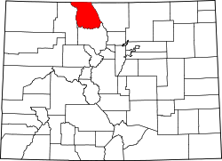 | |
| Unincorporated communities | ||
| Ghost town | ||
| International | |
|---|---|
| National | |