Wadi Al Hayilah
| Wadi Al Hayilah Wādī Al Hayīlah | |
|---|---|
 | |
| Native name | وادي الحييله (Arabic) |
| Location | |
| Country | |
| Emirate | |
| Physical characteristics | |
| Source | On the western slope of the Jabal Qada'ah |
| • elevation | 971 m (3,186 ft), approximately |
| Mouth | In the Wadi Bih |
• coordinates | 25°47′54″N 56°05′57″E / 25.79833°N 56.09917°E |
• elevation | 127 m (417 ft) |
| Length | 4.7 km (2.9 mi) |
| Basin size | 6.5 km2 (2.5 sq mi) (subbasin) |
| Basin features | |
| Progression | Wadi. Intermittent flow |
| River system | Wadi Bih |
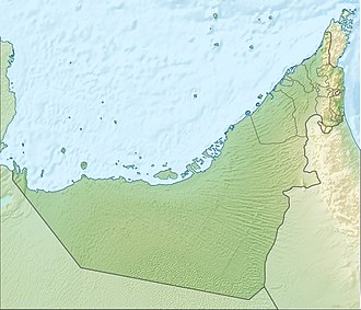
Wadi Al Hayilah (Arabic: وادي الحييله, romanized: Wādī Al Hayīlah) [1][2] is a valley or dry river with ephemeral or intermittent flow, flowing mainly during the rainy season, located in the emirate of Ras Al Khaimah, in the eastern United Arab Emirates.
It forms a small sub-basin of 6.5 km2 (2.5 sq mi) belonging to the Wadi Bih drainage basin, which as a whole covers a large drainage area, with a surface area between 460 km2 (180 sq mi) and 483 km2 (186 sq mi), divided between the territory of the UAE and Oman (approximately 172 km2 (66 sq mi) in the UAE and 298 km2 (115 sq mi) in Oman),[3][4][5][6][7] and whose highest peak is Jabal Al Harim (2,087 m (6,847 ft)).[2][8]
This sub-basin is bordered to the north and east by the Wadi Ar Ra'ilah;[1] to the south by the Wadi Qada'ah; and to the west by the main course of Wadi Bih.
Course
[edit]
Wadi Al Hayilah flows from southeast to northwest and has a total length of approximately 4.7 km (2.9 mi).[9]
Its main source is located at an altitude of approximately 971 m (3,186 ft) above sea level, on the western slope of Jabal Qada'ah (minor), a secondary summit of the main peak, located 600 m (2,000 ft) away.
In its upper reaches, Wadi Al Hayilah descends with a considerable gradient, forming spectacular dry cascades in some places.

In its middle and lower reaches, there are some small farms and cultivated terraces, and almost at the mouth is the village of Al Hayilah (Arabic: الحييله), bordered by formidable cliffs or large rock faces that reach 500 m (1,600 ft) in height and attract the interest of climbers.[10]
Dams and Reservoirs
[edit]Like other regions of the UAE, the Wadi Al Hayilah area has occasionally been affected by unusually heavy rainfall and flooding, but so far no dams have been built on its channel.
Toponymy
[edit]
Alternative names: Wadi Al Hayilah, Wadi Hijailah, Wadi Hijaila, Wadi Al Hila, Wadi Hila.
The name of Wadi Al Hayilah (spelled Wadi Hiyaila), its tributaries, mountains and nearby towns were recorded in the documentation and maps produced between 1950 and 1960 by the British Arabist, cartographer, military officer and diplomat Julian F. Walker, during the work carried out to establish the borders between the then called Trucial States,[11] later completed by the UK Ministry of Defence, with 1:100,000 scale maps published from 1971 onwards.[2]
In the National Atlas of the United Arab Emirates it appears as Wādī Al Hayīlah (Arabic: وادي الحييله).[1]
Population
[edit]The area near Wadi Al Hayilah was populated mainly by the Habus tribe,[12][13] and corresponded to the Banī Sā‘ad tribal area.[14]
See also
[edit]- List of wadis of the United Arab Emirates
- List of mountains in the United Arab Emirates
- List of wadis of Oman
- List of mountains in Oman
References
[edit]- ^ a b c Jāmiʿat al-Imārāt al-ʿArabīyah al-Muttaḥidah (1993). The national atlas of the United Arab Emirates. Al Ain, United Arab Emirates: United Arab Emirates University with GEOprojects (U.K.) Ltd. ISBN 9780863511004.
- ^ a b c Map of Trucial States, Muscat and Oman - Rams - Scale 1:100 000 - Published by D Survey, Ministry of Defence, United Kingdom (1971) - Edition 3-GSGS - The National Archives, London, England <https://www.agda.ae/en/catalogue/tna/fco/18/1785>
- ^ Location and catchment area of Wadi Bih in Ras Al Khaimah Emirate (Source Ebraheem et al. 2012) - Natural Disaster Science and Mitigation Engineering: DPRI Reports Wadi Flash Floods - Challenges and Advanced Approaches for Disaster Risk Reduction - Evaluation of the Effect of the Wadi Bih Dam on Groundwater Recharge, UAE - Mohsen Sherif, Abdel Azim Ebraheem, Ampar Shetty, Ahmed Sefelnasr, Khaled Alghafli, and Mohamed Al Asam - January 2022 DOI:10.1007/978-981-16-2904-4_21 LicenseCC BY 4.0 In book: Wadi Flash Floods (pp.509-527) <https://www.researchgate.net/figure/Location-and-catchment-area-of-Wadi-Bih-in-Ras-Al-Khaimah-Emirate-Source-Ebraheem-et-al_fig1_355305388>
- ^ Application of a hydrological model in a data poor arid region catchment: a case study of Wadi Ham - Mohamed Mustafa Al Mulla PhD Thesis Academic Year 2005-2006 - Supervisor: Dr Ian P. Holman - December 1, 2005 - Cranfield University at Silsoe - Institute of Water and Environment <https://dspace.lib.cranfield.ac.uk/bitstream/handle/1826/3061/Mohamed%20Al%20Mulla%20Thesis%202005.pdf?sequence=1&isAllowed=y>
- ^ Water Resources and Integrated Management of the United Arab Emirates - Abdulrahman S. Alsharhan, Zeinelabidin E. Rizk - Springer Nature, March 17, 2020 - 850 pages - p. 204-205 <https://books.google.com/books?id=lF7XDwAAQBAJ&pg=PA103&hl=es&source=gbs_selected_pages&cad=1#v=onepage&q&f=false>
- ^ Enhancement of Groundwater Recharge from Wadi Al Bih Dam, UAE - Sefelnasr, A.; Ebraheem, A.A.; Faiz, M.A.; Shi, X.; Alghafli, K.; Baig, F.; Al-Rashed, M.; Alshamsi, D.; Ahamed, M.B.; Sherif, M.- Water 2022, 14(21), 3448. <https://doi.org/10.3390/w14213448>
- ^ Elmahdy, Samy. (2012). Influence of geological structures on groundwater accumulation and groundwater salinity in Musandam Peninsula, UAE and Oman. Geocarto International. 28. 453-472. 10.1080/10106049.2012.724455. <https://www.researchgate.net/publication/261709103_Influence_of_geological_structures_on_groundwater_accumulation_and_groundwater_salinity_in_Musandam_Peninsula_UAE_and_Oman
- ^ http://peakbagger.com - Jebel al Harim, Oman <https://www.peakbagger.com/peak.aspx?pid=13231>
- ^ OpenStreetMap.org - Way: Wadi Al Hayilah (1236587701) <https://www.openstreetmap.org/way/1236587701>
- ^ "UAE Climbing - 2005" (PDF). A Stark. Foordkelcey.net. Retrieved 2025-04-28.
- ^ FCO 18/1966 1958 Sketch map drawn by Julian Walker for boundary delimitation: Ras Al Khaimah - The National Archives, London, England <https://www.agda.ae/en/catalogue/tna/fco/18/1966/n/1>
- ^ Tribes of Trucial States coast - 1958- Ref. FO 371/132894 <https://www.agda.ae/en/catalogue/tna/fo/371/132894/n/43>
- ^ "Mindat.org - Al Ḩabūs, Umm al Qaywayn, United Arab Emirates|". www.mindat.org. Retrieved 2024-03-26.
- ^ "Mindat.org - Banī Sā'ad, Ra's al Khaymah, United Arab Emirates|". www.mindat.org. Retrieved 2024-04-15.


