
User:Wowzers122
| This is a Wikipedia user page. This is not an encyclopedia article or the talk page for an encyclopedia article. If you find this page on any site other than Wikipedia, you are viewing a mirror site. Be aware that the page may be outdated and that the user whom this page is about may have no personal affiliation with any site other than Wikipedia. The original page is located at https://en.wikipedia.org/wiki/User:Wowzers122. |
|

woah is me
Fav Maps
[edit]Africa
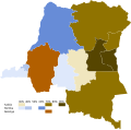
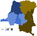
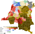
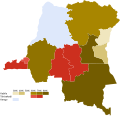
[edit]DRC
[edit]-
 1960 Belgian Congo Chamber of Deputies election
 -
 1960 Belgian Congo Provincial Assembly elections
 -
 1960 Belgian Congo Senate elections
 -
 1965 Chamber of Deputies election
 -
 2005 constitutional referendum
 -
 2006 presidential election (Round 1)
 -
 2006 presidential election (Round 2)
 -
 2011 presidential election by territory
 -
 2011 presidential election by province
 -
 2018 presidential election CENCO leak mapped by territory
 -
 2018 presidential election CENI leak mapped by territory
 -
 2023 presidential election by territory
 -
 2023 presidential election by province
 -
 2023 parliamentary election


.svg)
.svg)


Sudan
[edit]-
 1986 parliamentary election
 -
 Al-Fashaga dispute


Uganda
[edit]-
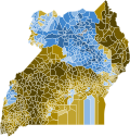 2006 Uganda presidential election

Western Togoland
[edit]-
 1956 British Togoland status plebiscite
Asia
[edit]Artsakh
[edit]-
 2020 Artsakhian presidential election
 -
 2012 Artsakhian presidential election


Cyprus
[edit]-
 2019 European Parliament election
 -
 2024 European Parliament election


Malaysia
[edit]-
 1955 election

Papua New Guinean
[edit]-
 2022 Papua New Guinean general election district seats

Solomon Islands
[edit]-
 2024 Solomon Islands general election

North America
[edit]Democratic Primaries
[edit]-
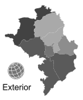
 2008 Democrats Abroad presidential primary
 -
 2024 Democrats Abroad presidential primary


US Presidential Elections
[edit]-
 1852 by county

Data
[edit]-
 US population density in 1820

Ongoing Projects
[edit]- Create and map every Georgia gubernatorial election since 1825
- Map every Uganda presidential election by district
- Map every US House election
- Update US Presidential maps
- Create a page for DRC coalitions
- Finish Draft:Portugal–Angoche conflict
- Clean up Mali War
Future Projects
[edit]Expand
[edit]Create
[edit]Source
[edit]Election Map Projects
[edit]While my maps aren't the best or most impressive things out there, I love creating them for Wikipedia because they can bring more insights into elections that aren't possible just through boring text, especially for visual learners. Feel free to help me in my goal of mapping every election possible :D
Tutorials and Databases
[edit]To create a map, you first have to find a shapefile if an svg of the thing you're trying to map isn't on wikimedia commons. Then, once you find a shapefile (it has to be under a creative commons license) plug it into https://mapshaper.org/ and convert to an svg. Then import it into https://inkscape.org/ or any app that allows for svgs and edit it how you please for the election. Category:WikiProject Elections and Referendums has some established colors for parties in several countries. I prefer these colors
Tutorials
[edit]Tutorial to make simple vector maps for more recent US elections: https://x.com/_JeanLannes/status/1798783616882741584
Tutorial to make simple vector maps for old US elections: https://x.com/FoundFiend574/status/1661784136779018258
Databases
[edit]Any
[edit]For most elections, the Humanitarian Data Exchange is useful as most stuff on there is under some kind of Creative Commons license
US
[edit]For historical county boundaries: Atlas of Historical County Boundaries
For historical congressional district boundaries: https://cdmaps.polisci.ucla.edu/
Nigerian
[edit]For Nigerian elections, Grid3 has a dataset of administrative boundaries for each state
Mapping
[edit]Missing data
[edit]- 1788 Polish-Lithuanian legislative election - There is already a map of the Voivodeships now I just need to find each member and their party
- 1793 French National Convention election election in Saint-Domingue - I have a map of seat disruption
- 1795 French legislative election in Saint-Domingue - above
- April 1796 French legislative election in Saint-Domingue - above
- September 1796 French legislative election in Saint-Domingue -above
Missing map data
[edit]- 1797 Batavian Republic constitutional referendum - By department
- 1798 Batavian Republic constitutional referendum - By department
- 1798 Cisrhenian Republic annexation referendum - On the orders of the French Directorate, Commissioner Rudler collected signatures in order to give the de facto annexation of the Cisrhenian Republic a democratic cloak. Here and here are the results of the election by department and canton. Numbers are disputed.
- 1801 Batavian Republic constitutional referendum - By department
- 1848 Swiss constitutional referendum - By canton
- 1860 Emilia annexation referendum - The province of Emilia (comprised of what was Parma, Modena, and Romagna) voted for annexation into the Kingdom of Sardinia. Here are the results by province.
- 1860 Marche annexation referendum - The Marche voted for annexation into the Kingdom of Sardinia. Here are the results by province.
- Kars, Ardahan, and Batum annexation referendum - Kars, Ardahan, and Batum voted for annextion into the Ottoman Empire. Here are the results of each.
- 1993 Eritrean independence referendum - By old provinces
- 2022 Abkhazian parliamentary election - By constituency
- 2022 Dominican general election - By constituency
- 2022 Gambian parliamentary election - By constituency
- 2022 Vanuatuan general election - By constituency
- 2023 Beninese parliamentary election - By electoral district
- 2023 Guinea-Bissau parliamentary election - By electoral district
- 2023 Kuwaiti general election - By electoral district
To be made
[edit]- 1970 Gambian republic referendum - results
- 2003 Cypriot presidential election - results
- 2011 Ugandan general election - results
- 2013 Cypriot presidential election - first and second round
- 2023 Djiboutian parliamentary election - results and seat distribution
- 2023 Malagasy presidential election - results (the results are broken down by communes and not any other unit so uh good luck cause the thing is nearly 2,500 pages long)
- 2023 Turkmen parliamentary election - seat distribution
Redo
[edit]- 2006 Ugandan general election - very ugly district map
- 2016 Ugandan general election - very ugly map that also might be wrong in a place
- 2022 Papua New Guinean general election - update open electorate map for a later election
- 2022 Papua New Guinean general election - the provincial electorate map is a compressed png
- 2023 Liberian general election - I'm pretty sure the electoral districts are the old ones before redistricting (only slight changes needed)