
User:Ɱ/Portal:Columbus, Ohio
Portal maintenance status: (October 2021)
|
Introduction

Columbus (/kəˈlʌmbəs/, kə-LUM-bəs) is the capital and most populous city of the U.S. state of Ohio. With a population of 905,748 at the 2020 census, it is the 14th-most populous city in the U.S., second-most populous city in the Midwest (after Chicago), and third-most populous U.S. state capital (after Phoenix, Arizona, and Austin, Texas), while the Columbus metropolitan area with an estimated 2.23 million residents is the largest metropolitan area entirely in Ohio and 32nd-largest metropolitan area in the U.S. Columbus is the county seat of Franklin County; it also extends into Delaware and Fairfield counties.
Columbus originated as several Native American settlements along the Scioto River. The first European settlement was Franklinton, now a city neighborhood, in 1797. Columbus was founded in 1812 at the confluence of the Scioto and Olentangy rivers and was planned as the state capital due to its central location. Named after Italian explorer Christopher Columbus, it officially became the capital in 1816. The city grew steadily through the 19th century as a transportation and industrial hub via the National Road, Ohio and Erie Canal, and several railroads. Starting in the 1950s, Columbus experienced rapid growth, becoming Ohio's largest city by land and population by the early 1990s. In the late 20th and early 21st centuries, it further diversified as a center for finance, insurance, education, and technology. (Full article...)
Selected general articles
-


The Spirit of Columbus at the Steven F. Udvar-Hazy Center
The Spirit of Columbus is a Cessna 180 Skywagon that was flown by Geraldine "Jerrie" Fredritz Mock from March 19 to April 17, 1964, on the first solo flight by a woman around the world. She nicknamed the plane Charlie.
The trip began March 19, 1964, in Columbus, Ohio, and ended April 17, 1964, in Columbus, Ohio. It took 29 days, 11 hours and 59 minutes, with 21 stopovers and almost 22,860 miles (36,790 km). The flight was part of a "race" that developed between Jerrie Mock and Joan Merriam Smith who had flown from a field near San Francisco, CA on March 17, 1964; Smith's departure date and flight path was the same as the aviator Amelia Earhart's last flight. Although they were not in direct competition with each other, media coverage soon began tracking the progress of each pilot, fascinated with who would complete the journey first. Mock was the first to finish. The story of this race is told in a book written by Taylor Phillips entitled, Racing to Greet the Sun, Jerrie Mock and Joan Merriam Smith Duel to Become the First Woman to Solo Around the World (2015). Jerrie Mock was subsequently awarded the Louis Blériot medal from the Fédération Aéronautique Internationale in 1965. In 1970 she published the story of her round-the-world flight in the book Three-Eight Charlie. While that book is now out of print, a 50th anniversary edition was later published including maps, weather charts and photos. Three-Eight Charlie is a reference to the call sign, N1538C, of the Cessna 180 Skywagon Mock used to fly around the world.
The airplane hangs in the National Air and Space Museum of the Smithsonian. In June 2007, Mock flew to Chantilly, Virginia, to see the Spirit of Columbus for the first time in many years. Mock "was so pleased to see her plane 'airborne' again". The plane previously was in storage, but with the opening of the Udvar-Hazy Center, is now back on display. (Full article...) -
Budd Dairy Food Hall is a food hall in the Italian Village neighborhood of Columbus, Ohio. The Cameron Mitchell Restaurants-run hall holds ten foodservice locations, three bars, and indoor, patio, and rooftop seating. It is situated in the historic Budd Dairy Company building, a former milk processing and distribution facility. The space was renovated beginning in 2018, and opened in April 2021. (Full article...) -

The Columbus Crew are an American professional soccer club based in Columbus, Ohio. The club competes in Major League Soccer (MLS) as a member of the Eastern Conference. The team began play in 1996 as one of the 10 charter clubs of the league. The Crew are currently operated by an ownership group led by the Haslam family (also owners of the Cleveland Browns and Pilot Corporation) and former team physician Pete Edwards. The Haslam/Edwards group is the third ownership group in club history.
The franchise was founded in 1994. Its stadium is Lower.com Field, opened in 2021. From 1999 to 2021, the Crew played home games at Historic Crew Stadium (formerly Mapfre Stadium and Columbus Crew Stadium), the first soccer-specific stadium built for an MLS team, with a seating capacity of 19,968 as of the 2015 season. From 1996 to 1998, the Crew played its home games at Ohio Stadium on the campus of Ohio State University. In 2023, the team set club attendance records for both most cumulative attendance and most sellouts.
The Crew have won eight major trophies: the MLS Cup in 2008, 2020 and 2023; the Supporters' Shield in 2004, 2008, and 2009; the 2002 U.S. Open Cup; and the Leagues Cup in 2024. The Crew have qualified for the CONCACAF Champions Cup (or its predecessor, the CONCACAF Champions League) six times, reaching the quarter-finals on five occasions. In 2021, the club won their first continental trophy by winning the Campeones Cup, and in 2024, the Crew advanced to their first Champions' Cup final. (Full article...) -

Entrance of Forest Park.
The community of Forest Park consists of almost 2900 private residential properties (single-family homes and duplexes), plus apartments, condominiums, commercial properties, city-owned parks and schools, in approximately 1.4 square miles (3.6 km2) of the Northland area of northeast Columbus, Ohio. These properties adjoin a total of 132 distinct streets and courts maintained by the City of Columbus. The community's approximate center is near the intersection of Karl Road and Sandalwood Place in Columbus. (Full article...) -
Linden is a neighborhood in northeastern Columbus, Ohio. It was established in 1908 as Linden Heights Village, and was annexed into Columbus in 1921. The neighborhood saw high levels of development in the 1920s. By the 1960s, suburban development, city income taxation and racial factors caused families, especially white residents, to leave the neighborhood. Since this time, Linden has struggled with poverty, crime, vacancies, and health and societal problems. (Full article...) -
Hilltop is one of the largest neighborhoods in Columbus, Ohio, located west of Franklinton and Downtown. The Greater Hilltop area contains newer and historic neighborhoods, schools, various stores, industrial areas, and recreational facilities. The development pattern is considered a distinct suburb. The majority of the area is predominantly single family residential. (Full article...) -
Topiary Park is a 9.2-acre (3.7 ha) public park and garden in Columbus, Ohio's Discovery District. The park's topiary garden, officially the Topiary Garden at Old Deaf School Park, is designed to depict figures from Georges Seurat's 1884 painting, A Sunday Afternoon on the Island of La Grande Jatte. It is the only park based entirely on a painting.
The park is officially named Old Deaf School Park, as it was part of the campus of the Ohio Institution for the Deaf and Dumb, known today as the Ohio School for the Deaf. It is owned by the city of Columbus and maintained by the Columbus Recreation and Parks Department. (Full article...) -

Historic Crew Stadium, previously known as Columbus Crew Stadium and Mapfre Stadium, is a soccer-specific stadium in Columbus, Ohio, United States. It primarily served as the home stadium of the Columbus Crew of Major League Soccer from 1999 until 2021, when the team moved to Lower.com Field. Historic Crew Stadium is the current home of the Crew's training facility, the OhioHealth Performance Center and MLS Next Pro team Columbus Crew 2. Historic Crew Stadium is also the site of a variety of additional events in amateur and professional soccer, American football, lacrosse, and rugby, and is a regular site for outdoor concerts due to the permanent stage in the north end zone.
Built in 1999, it was the first soccer-specific stadium built by a Major League Soccer team, starting an important trend in MLS stadium construction. The stadium was named for Madrid-based Mapfre Insurance after the company signed a 5-year sponsorship agreement announced on March 3, 2015. In December 2020, the deal expired and the Crew renamed the stadium. The listed seating capacity is 19,968. In 2015, Mapfre Stadium and Director of Grounds Weston Appelfeller were honored with the prestigious Field of the Year award by the Sports Turf Managers Association (STMA) for the professional soccer division. (Full article...) -

Columbus State Community College (CSCC) is a public community college in Columbus, Ohio. Founded as Columbus Area Technician's School in 1963, it was renamed Columbus Technical Institute in 1965 and was renamed again to its current name in 1987. The college has grown from an initial enrollment of 67 students in 1963, to its current enrollment of over 27,000 students over two campuses, nine regional learning centers, and online courses. (Full article...) -
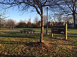
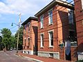
Weinland Park is a neighborhood north of downtown Columbus, Ohio and encompassed by the boundaries of the University District. A development boom in the 1930s and 1940s resulting from new streetcar lines and the blossoming of factories brought working and middle-class families to the neighborhood. Current housing stock consists primarily of single family residential buildings that have been converted to rentals or multifamily housing. Row-homes and apartment buildings are also ubiquitous in the neighborhood. Renters currently outnumber owners. Commercial and entertainment facilities are concentrated on the North High Street corridor, but also pocket the inner part of the neighborhood as well. Weinland Park saw the sapping of its population and wealth with the rise of newer suburbs ringing the outer reaches of the city and the collapse of local industry and streetcar lines. The neighborhood has been plagued with crime and drug problems for decades but has recently seen a flood of new investment that has brought growth and revitalization to this long struggling neighborhood. Investment into the community includes the South Campus Gateway providing retail and residential finished in 2005, and a new food district and employment center. (Full article...) -
Milo-Grogan is a neighborhood of Columbus, Ohio. The neighborhood was settled as the separate communities of Milo and Grogan in the late 1870s. Large-scale industrial development fueled the neighborhood's growth until the 1980s, when the last factories closed. The community has received urban renewal efforts in recent years fueled by the Columbus Department of Development and Milo-Grogan Area Commission. (Full article...)
-
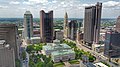
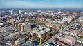
Downtown Columbus is the central business district of Columbus, Ohio. Downtown is centered on the intersection of Broad and High Streets, and encompasses all of the area inside the Inner Belt. Downtown is home to most of the tallest buildings in Columbus.
The state capitol, the Ohio Statehouse, is located in the center of downtown on Capitol Square. Downtown is also home to Columbus State Community College, Franklin University, Columbus College of Art and Design, Grant Medical Center, Capital University Law School, as well as the Main Library of the Columbus Metropolitan Library, the pioneering Main Street Bridge, and many parks.
Downtown has many neighborhoods or districts, but it can be separated into three main areas: the Discovery District, the High Street Corridor, and the Riverfront. Downtown also includes the Arena District, Capitol Square, and the Columbus Civic Center. The Short North, Italian Village, and Victorian Village are directly north of downtown. The Warehouse District, Olde Towne East and King-Lincoln Bronzeville are directly east, while the Brewery District and German Village are directly south of Downtown. Franklinton is to the west of downtown. (Full article...) -
West Columbus, sometimes referred to as westside or the West Side, is a neighborhood in Columbus, Ohio, United States. Unlike other Columbus neighborhoods, it is a broad geographical term used by locals rather than a subdivision or suburb. West Columbus is defined as the entire southwest side of Columbus, bordered on the north by interstates 70 and 670, within Interstate 71 on the east, and on the south and west by the city limits that reach several miles to the outside of the I-270 outerbelt. It covers the ZIP Codes 43223, 43204, 43228, and 43222. (Full article...)
-
Interstate 270 (I-270) is an auxiliary interstate highway that forms a beltway loop freeway in the Columbus metropolitan area in the US state of Ohio, commonly known locally as The Outerbelt or the Jack Nicklaus Freeway. The zero-milepost is at the junction with Interstate 71 east of Grove City, intersecting with I-71 again near Worthington as well as connecting with Interstate 70 twice with the western junction near Lincoln Village and the eastern junction near Reynoldsburg. The route furthermore links to the eastern terminus of Interstate 670 near Gahanna and provides indirect access to John Glenn Columbus International Airport. The entire length of I-270 is 54.97 miles (88.47 km). It is one of four Interstate loops not to run concurrently with another Interstate freeway, the others being I-295 in Florida, I-485 in North Carolina, and I-610 in Texas. (Full article...)
-
The 1910 streetcar strike was a union protest against labor practices by the Columbus Railway and Light Co. in Columbus, Ohio in 1910. The summertime strike began as peaceful protests, but led to thousands rioting throughout the city, injuring hundreds of people. (Full article...) -

Ohio History Connection, formerly The Ohio State Archaeological and Historical Society and Ohio Historical Society, is a nonprofit organization incorporated in 1885. Headquartered at the Ohio History Center in Columbus, Ohio, Ohio History Connection provides services to both preserve and share Ohio's history, including its prehistory, and manages over 50 museums and sites across the state. An early iteration of the organization was founded by Brigadier General Roeliff Brinkerhoff in 1875. Over its history, the organization changed its name twice, with the first occurring in 1954 when the name was shortened to Ohio Historical Society. In 2014, it was changed again to Ohio History Connection, in what members believed was a more modern and welcoming representation of the organization's image. (Full article...) -
Mount Vernon is a predominantly African-American historic neighborhood in Columbus, Ohio, United States. The neighborhood lies within the historic Near East Side community, north of King-Lincoln Bronzeville. Mount Vernon borders Interstates 71 and 670. Its main thoroughfares, Mount Vernon Avenue, Long Street, Atcheson Street, and Champion Avenue define the community's limits.
The neighborhood is named for Mount Vernon Avenue, the center of a once-thriving economy. In the 19th century into the 1970s, the area (including the present-day King-Lincoln Bronzeville) held thousands of Black families and businesses, with a variety of businesses lining the avenue. It was during an era of segregation and isolation for the community, and thus Black families were self-sustaining in the area. Beginning in the 1950s, interstate highways were constructed in Columbus. The highways physically divided parts of the neighborhood and their large land uses forced families and businesses to relocate, leading to more vacancies and an overall neighborhood decline.
The Leonard Pearl Henderson House in the neighborhood is a historically-significant house near an Ohio State University medical center. The building was proposed for demolition in 2023. (Full article...) -
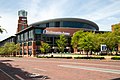
Nationwide Arena is a multi-purpose arena in the Arena District of Columbus, Ohio, United States. Since completion in 2000, the arena has served as the home of the Columbus Blue Jackets of the National Hockey League (NHL). It is one of two facilities in Columbus, along with the Greater Columbus Convention Center, that hosts events during the annual Arnold Classic, a sports and fitness event hosted by actor, bodybuilder, and former governor of California Arnold Schwarzenegger. (Full article...) -
Columbus Japanese Language School (コロンバス日本語補習校, Koronbasu Nihongo Hoshūkō; CJLS) is a weekend supplementary Japanese school, based in the Columbus, Ohio metropolitan area.
The classes are held in Creekview Intermediate School, of the Marysville Exempted Village Schools District (MEVSD) in Marysville. The school office is located in Worthington. (Full article...) -
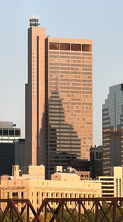
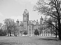
The James A. Rhodes State Office Tower is a 41-story, 629-foot (192 m) state office building and skyscraper on Capitol Square in Downtown Columbus, Ohio. The Rhodes Tower is the tallest building in Columbus and the fifth tallest in Ohio. The tower is named for James A. Rhodes, the longest-serving Ohio governor, and features a statue of Rhodes outside the entrance. The building's interior includes a large open lobby with 22 elevators. Higher floors have offices for numerous state agencies. The tower's 40th floor contains an observation deck, open to the public.
The Rhodes Tower was designed by Brubaker/Brandt and Dalton, Dalton, Little, and Newport in a Modernist style. It was conceived in 1969 as a way to consolidate state offices in one building and give more space to legislative offices in the Ohio Statehouse. Construction spanned from 1971 to 1974; it has held state offices since mid-1974, including the Supreme Court of Ohio until it moved to the renovated Ohio Judicial Center in 2004. The Rhodes Tower was renovated from 2018 to 2022 for energy savings and façade maintenance. (Full article...) -

Columbus College of Art & Design (CCAD) is a private art school in Columbus, Ohio. It was founded in 1879 as the Columbus Art School and is one of the oldest private art and design colleges in the United States. Located in downtown Columbus, CCAD's campus consists of 11 buildings (including 2 residence halls) on 9 acres (36,000 m2) and is adjacent to the Columbus Museum of Art. Approximately 900 full-time students are enrolled. (Full article...) -
This is a list of the National Register of Historic Places entries in Columbus, Ohio, United States. The National Register is a federal register for buildings, structures, and sites of historic significance. This is intended to be a complete list of the properties and districts in Columbus.
There are 360 properties and districts listed on the National Register in Franklin County, including 3 National Historic Landmarks. The city of Columbus is the location of 183 of these properties and districts, including all of the National Historic Landmarks; they are listed here, while the remaining properties and districts are listed separately. Another 3 properties were once listed but have been removed. Of the sites on the National Register in Columbus, 54 are also on the Columbus Register of Historic Properties, the city's list of local landmarks. (Full article...) -
Northwest Columbus is a region in Franklin County, Ohio. It has about 45,000 residents, according to the 2010 U.S. census.
Northwest Columbus is bounded by the Scioto River on the west, the Olentangy River on the east, State Route 161 on the north, and Highland Drive and Henderson Road on the south.
The region includes parts of Perry Township, Sharon Township, the City of Dublin, and the City of Worthington. (Full article...) -
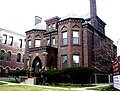
The Old Beechwold Historic District is a neighborhood and historic district in Clintonville, Columbus, Ohio. The site was listed on the Columbus Register of Historic Properties in 1985 and the National Register of Historic Places in 1987. The district is significant for its architecture, landscape architecture, and community planning. The houses are of the early 20th century, using stone, brick, and stucco.
The land was originally part of a large tract owned by a single family, but in 1902, 75 of those acres were sold to the Columbus Zoological Company. The company established one of the first zoos in Columbus, known as "The Zoo", that failed after only five months, opening in May and closing in November of 1905. In 1906, Joseph A. Jeffrey acquired the land, and created a suburban estate named "Beechwalde". He built the two oldest houses in the district. The former monkey house can still be seen on the property of 150 West Beechwold Boulevard where it is used as a barn. The zoo's original brick entrance can also be seen on North High Street at Beechwold Road. (Full article...) -
Northland is a residential and commercial area in northeast Columbus, Ohio. The area is served by the Northland Community Council, which oversees land east of Worthington, roughly north of Morse Road, south of I-270, and west of New Albany, including the neighborhood Forest Park and the independent village of Minerva Park.
The area has one of the largest populations of new American citizens in Columbus, including thousands of refugees from Nepal, Somalia, and Bhutan. (Full article...)


Need help?
Do you have a question about Columbus, Ohio that you can't find the answer to?
Consider asking it at the Wikipedia reference desk.
Selected images
-
 Racial distribution in Columbus in 2020: ⬤ White ⬤ Black ⬤ Asian ⬤ Hispanic ⬤ Mixed or Other (from Columbus, Ohio)
 -
 North Market (from Columbus, Ohio)
 -

-
-

-
 Barlouie (from Neighborhoods in Columbus, Ohio)
 -

-
-
 Ohio Stadium, on the campus of Ohio State University, is the 5th-largest non-racing stadium in the world. (from Columbus, Ohio)
 -
 The Columbus Museum of Art collects and exhibits American and European modern and contemporary art, folk art, glass art, and photography. (from Columbus, Ohio)
 -
 The Scioto Mile includes nine parks along both banks of the Scioto River between downtown Columbus and Franklinton. (from Columbus, Ohio)
 -
-
 The Art Deco LeVeque Tower is the city's second-tallest skyscraper. (from Columbus, Ohio)
 -
 Four of the city's five tallest buildings are around Capitol Square (from List of tallest buildings in Columbus, Ohio)
 -
 COSI (east entrance pictured) features themed, interactive science exhibits. (from Columbus, Ohio)
 -
 Audubon nature center at Scioto Audubon Metro Park, the first built close to a major city's downtown (from Columbus, Ohio)
 -
 Shrum Mound in Campbell Memorial Park (from Columbus, Ohio)
 -
 Aerial satellite image of Columbus (from Columbus, Ohio)
 -
-
 Indianola Junior High School was the first middle school in the U.S. (from Columbus, Ohio)
 -

-
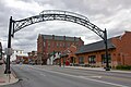
 The Merion Village arch (from Neighborhoods in Columbus, Ohio)
 -
 Lou Berliner Sports Park (from List of parks in Columbus, Ohio)
 -
-
 2010 Census-based map: red dots indicate white Americans, blue dots for African Americans, green for Asian Americans, orange for Hispanic Americans, yellow for other races. Each dot represents 25 residents. (from Neighborhoods in Columbus, Ohio)
 -
-
Audubon nature center at Scioto Audubon Metro Park, the first built close to a major city's downtown (from Columbus, Ohio)
-
 Skyline of Columbus (Use cursor to identify buildings) (from List of tallest buildings in Columbus, Ohio)
 -
 Italian Village rowhouse (from Neighborhoods in Columbus, Ohio)
 -
 Eastern side of Olentangy Commons (from Neighborhoods in Columbus, Ohio)
 -
The Columbus Museum of Art collects and exhibits American and European modern and contemporary art, folk art, glass art, and photography. (from Columbus, Ohio)
-
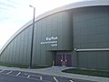
 Columbus City Hall (from Columbus, Ohio)
 -
 The Santa Maria Ship & Museum, a Santa María replica, was docked downtown from 1991 to 2014. (from Columbus, Ohio)
 -
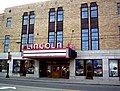 The historic Lincoln Theatre (from Neighborhoods in Columbus, Ohio)
 -
-

-
 Municipal offices, including the Columbus Division of Police Headquarters, in the city's Civic Center (from Columbus, Ohio)
 -
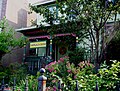 Historic Home in Harrison West (from Neighborhoods in Columbus, Ohio)
 -

-
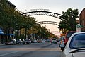 The iconic arches of the Short North (from Neighborhoods in Columbus, Ohio)
 -
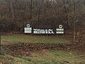 Hilltop signage (from Neighborhoods in Columbus, Ohio)
 -
-
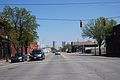 West Broad Street in Franklinton (from Neighborhoods in Columbus, Ohio)
 -
Shrum Mound in Campbell Memorial Park (from Columbus, Ohio)
-
Racial distribution in Columbus in 2020: ⬤ White ⬤ Black ⬤ Asian ⬤ Hispanic ⬤ Mixed or Other (from Columbus, Ohio)
-
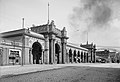
 View of the city from Capital University in 1854 (from Columbus, Ohio)
 -

-
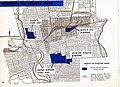 1954 urban renewal map of Columbus (from List of demolished buildings and structures in Columbus, Ohio)
 -
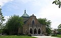 St. Mary Magdalene Church in Westgate (from Neighborhoods in Columbus, Ohio)
 -
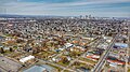 Aerial view of Reeb-Hosack (from Neighborhoods in Columbus, Ohio)
 -

-
North Market (from Columbus, Ohio)
-
 Home in Old Oaks (from Neighborhoods in Columbus, Ohio)
 -
-
 Big Run Sports Complex, in Big Run Park (from Neighborhoods in Columbus, Ohio)
 -
 Hungarian Reform Church, in Hungarian Village (from Neighborhoods in Columbus, Ohio)
 -
View of the city from Capital University in 1854 (from Columbus, Ohio)
-
 Aerial view of the Ohio State University campus (from Columbus, Ohio)
 -
-
-
 The Ohio State Fair is held in late July to early August. (from Columbus, Ohio)
 -
Columbus City Hall (from Columbus, Ohio)
-
-
-
Ohio Stadium, on the campus of Ohio State University, is the 5th-largest non-racing stadium in the world. (from Columbus, Ohio)
-
The Ohio State Fair is held in late July to early August. (from Columbus, Ohio)
-
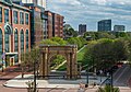 Located in the Arena District, McFerson Commons is home to the Union Station arch. (from Columbus, Ohio)
 -
The Santa Maria Ship & Museum, a Santa María replica, was docked downtown from 1991 to 2014. (from Columbus, Ohio)
-

-
 Brewery District Scene (from Neighborhoods in Columbus, Ohio)
 -
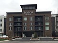 Taylor House on Bethel Rd. (from Neighborhoods in Columbus, Ohio)
 -
 Dutch Colonial Style residences in Hungarian Village (from Neighborhoods in Columbus, Ohio)
 -
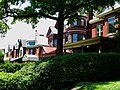 Victorian-style homes located along Goodale Park (from Neighborhoods in Columbus, Ohio)
 -
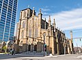
 Holy Rosary and Saint John Church (from Neighborhoods in Columbus, Ohio)
 -
-
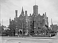
 The Pontifical College Josephinum (1888-1931) (from List of demolished buildings and structures in Columbus, Ohio)
 -
Aerial view of the Ohio State University campus (from Columbus, Ohio)
-

-
 The LeVeque Tower was the tallest building in Columbus from 1927 to 1973. (from List of tallest buildings in Columbus, Ohio)
 -
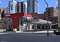 COTA's Spring Street Terminal, one of its five transit centers (from Columbus, Ohio)
 -
COSI (east entrance pictured) features themed, interactive science exhibits. (from Columbus, Ohio)
-
The Art Deco LeVeque Tower is the city's second-tallest skyscraper. (from Columbus, Ohio)
-
-
-
Municipal offices, including the Columbus Division of Police Headquarters, in the city's Civic Center (from Columbus, Ohio)
-

-
Indianola Junior High School was the first middle school in the U.S. (from Columbus, Ohio)
-
-
Aerial satellite image of Columbus (from Columbus, Ohio)
-

-
 Homes in German Village (from Neighborhoods in Columbus, Ohio)
 -
The Scioto Mile includes nine parks along both banks of the Scioto River between downtown Columbus and Franklinton. (from Columbus, Ohio)
-
-
 Old North Columbus Arch (from Neighborhoods in Columbus, Ohio)
 -
-
 Camp Chase as it stands today, a memorial to fallen soldiers from the American Civil War. (from Neighborhoods in Columbus, Ohio)
 -
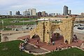
Located in the Arena District, McFerson Commons is home to the Union Station arch. (from Columbus, Ohio)
-
-
COTA's Spring Street Terminal, one of its five transit centers (from Columbus, Ohio)


.png)


.jpg)


_-_exterior_2.jpg)


.jpg)

_crop.jpg)


Subcategories

- Select [►] to view subcategories
Subtopics
| Topics |  | ||||||
|---|---|---|---|---|---|---|---|
| Neighborhoods | |||||||
| Enclaves | |||||||
| History |
| ||||||
| Attractions | |||||||
| Government |
| ||||||
| Education |
| ||||||
| Transportation |
| ||||||
| Sports |
| ||||||
| Museums |
| ||||||
| |||||||
Associated Wikimedia
The following Wikimedia Foundation sister projects provide more on this subject:
-
 Commons
Free media repository -
 Wikibooks
Free textbooks and manuals -
 Wikidata
Free knowledge base -
 Wikinews
Free-content news -
 Wikiquote
Collection of quotations -
 Wikisource
Free-content library -
 Wikiversity
Free learning tools -
 Wiktionary
Dictionary and thesaurus
Category:United States portals by city Category:Portals needing placement of incoming links