Tuzsér
Appearance
Tuzsér | |
|---|---|
 | |
 | |
| Country | |
| County | Szabolcs-Szatmár-Bereg |
| Area | |
• Total | 15.51 km2 (5.99 sq mi) |
| Population (2001) | |
• Total | 3,373 |
| • Density | 217.47/km2 (563.2/sq mi) |
| Time zone | UTC+1 (CET) |
| • Summer (DST) | UTC+2 (CEST) |
| Postal code | 4623 |
| Area code | 45 |

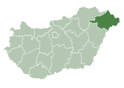
Tuzsér is a village in Szabolcs-Szatmár-Bereg county, in the Northern Great Plain region of eastern Hungary.
Geography
[edit]It covers an area of 15.51 km2 (6 sq mi) and has a population of 3205 according to the 2022 census. [1]
References
[edit]- ^ "Tuzsér (Záhony, Szabolcs-Szatmár-Bereg, Hungary) - Population Statistics, Charts, Map, Location, Weather and Web Information". citypopulation.de. Retrieved 2025-04-15.
- Lafferton, E., "Death by Hypnosis: An 1894 Hungarian Case and its European Reverberations", Endeavour, Vol.30, No.2, (June 2006), pp. 65–70.
- (Provides an extended account of the death of a hypnotic subject, 22 years old Ella Salomon, during a hypnotic séance in the Salomon Castle in Tuzsér in September 1894.)
48°21′N 22°08′E / 48.350°N 22.133°E


