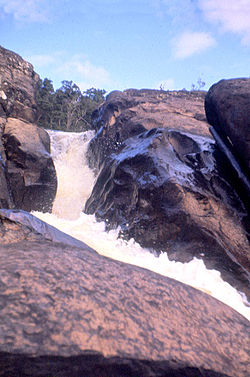
Tully Falls
Appearance
| Tully Falls | |
|---|---|
 Tully Falls, in 1959 | |
| Location | Far North Queensland, Australia |
| Coordinates | 17°47′00″S 145°34′00″E / 17.78333°S 145.56667°E[1][2] |
| Type | Horsetail chute |
| Elevation | 673 metres (2,208 ft) AHD[3] |
| Total height | 180–210 metres (590–690 ft)[4] |
| Number of drops | 1 |
| Watercourse | Tully River |
The Tully Falls, a horsetail chute waterfall on the Tully River, is located in the UNESCO World Heritage-listed Wet Tropics in the Far North region of Queensland, Australia. It formed the eastern boundary of the Dyirbal.
Location and features
[edit]From the Atherton Tableland at an approximate elevation of 673 metres (2,208 ft)[3] above sea level, the falls descend in the range of 180–210 metres (590–690 ft)[4] into the Tully Gorge National Park, near the town of Ravenshoe. Access to the falls is via a 1.6-kilometre (0.99 mi) graded track.[5]
Most of the water that would have otherwise flowed over the falls has been diverted to the Kareeya Hydro Power Station and dammed by Koombooloomba Dam. As a result, the falls flow only during a big wet season.[5]
See also
[edit]References
[edit]- ^ "Tully Falls (QLD)". Gazetteer of Australia online. Geoscience Australia, Australian Government.
- ^ "Tully Falls (entry 35300)". Queensland Place Names. Queensland Government. Retrieved 13 September 2015.
- ^ a b "Map of Tully Falls, QLD (the town)". Bonzle Digital Atlas of Australia. Retrieved 30 May 2014.
- ^ a b "Tully Falls". World Waterfall Database. 21 May 2011. Retrieved 30 May 2014.
- ^ a b "Things to Do Tully Falls". Wet Tropics Management Authority. Archived from the original on 17 September 2008. Retrieved 29 January 2008.

