Rock Sound International Airport
Appearance
Rock Sound International Airport | |||||||||||
|---|---|---|---|---|---|---|---|---|---|---|---|
| Summary | |||||||||||
| Location | Rock Sound | ||||||||||
| Elevation AMSL | 10 ft / 3 m | ||||||||||
| Coordinates | 24°53′30″N 076°10′40″W / 24.89167°N 76.17778°W | ||||||||||
| Map | |||||||||||
 | |||||||||||
| Runways | |||||||||||
| |||||||||||
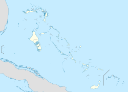
Rock Sound International Airport (IATA: RSD, ICAO: MYER) is an airport in the South Eleuthera district of The Bahamas. Its name comes from the former district of Rock Sound.
Airlines and destinations
[edit]| Airlines | Destinations |
|---|---|
| Bahamasair | George Town, Governor's Harbour, Nassau, San Salvador |
| Flamingo Air | Bimini, Black Point, Freeport, Great Harbour Cay, Mangrove Cay, Marsh Harbour, Nassau, Staniel Cay |
References
[edit]- ^ "Airport information for MYER". World Aero Data. Archived from the original on 5 March 2019. Data current as of October 2006. Source: DAFIF.

