Ratna Chuli
Appearance
| Ratna Chuli | |
|---|---|
| Highest point | |
| Elevation | 7,035 m (23,081 ft)[1][2][a] |
| Prominence | 903 m (2,963 ft)[2] |
| Isolation | 11.27 km (7.00 mi)[2] |
| Listing | |
| Coordinates | 28°51′52″N 84°22′38″E / 28.86444°N 84.37722°E[3] |
| Naming | |
| Native name |
|
| Geography | |
| Countries | Nepal and China |
| Region | Tibet Autonomous Region (China) |
| District | Manang (Nepal) |
| Parent range | Himalayas |
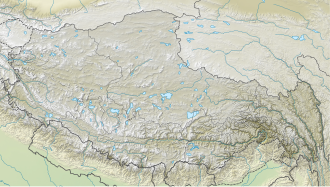
Ratna Chuli is a mountain peak in the Peri Himal mountain range on the border of Nepal and Tibet Autonomous Region. Ratna Chuli is 7,035 m (23,081 ft) above sea level and sits north-west of Manaslu.[3]
Climbing history
[edit]The first ascent was in 1996, by a team from Japan's Shinshu University and the Nepalese Police Mountaineering Foundation. The team ascended via the west ridge and put three groups of climbers on the summit on October 14, 16 and 18.[1]
References
[edit]- ^ a b Hawley, Elizabeth (1997). "Mount Ratnachuli, First Ascent". American Alpine Journal. 39 (71). American Alpine Club: 291. Retrieved 2025-06-17.
- ^ a b c "Ratna Chuli". Peakbagger.com. Retrieved 2022-04-21.
- ^ a b c "Ratna Chuli". Nepal Himal Peak Profile. Government of Nepal. Retrieved 2022-04-21.
- Notes
External link
[edit]- "Mt. Ratna Chuli Expedition". Himalayan Adventure Intl Trek. Retrieved 22 April 2022.


