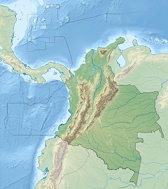
Quita Sueño Bank
 Landsat image of Quita Sueño Bank | |
| Geography | |
|---|---|
| Location | Caribbean Sea |
| Coordinates | 14°19′N 81°10′W / 14.317°N 81.167°W |
| Administration | |
Quita Sueño Bank (claimed as Quitasueño) is a reef formation controlled by Colombia and within the Archipelago of San Andrés, Providencia and Santa Catalina. The United States, under the Guano Islands Act, claimed the reef in 1869, and retained its claim until 1981. The United States constructed a lighthouse in 1919.
History
[edit]In 1869, James Jennett claimed the bank for the United States under the Guano Islands Act of 1856.[1] An agreement between the United States and Colombia on 10 April 1928 left the area under American control.[2][3] On 8 September 1972, the United States and Colombia signed a treaty in which the United States renounced its claims to the Quita Sueño Bank, Roncador Bank, and Serrana Bank. The United States regarded Quita Sueño Bank as having no emergent land and thus ineligible for the basis of a sovereignty claim.[3] The treaty came into effect on 17 September 1981.[4]
In the northern part of the eastern reef is Quita Sueño Light.[5][6][7] The location is named Cayo Quitasueño on the government nautical chart at 14°28′57.2298″N 81°7′39.7632″W / 14.482563833°N 81.127712000°W.[8][9] The light is erected on top of a square platform.[10] A lighthouse at this location had originally been established by the United States in 1919. The current structure, erected in 1977, is now called Faro Quitasueño Norte. In 2008, a second lighthouse, Faro Quitasueño Sur, was established in the southern part of the reef at 14°09′17″N 81°9′40″W / 14.15472°N 81.16111°W.[11]
Nicaragua also had a claim to the bank. On 19 November 2012, the International Court of Justice upheld Colombia's claim to Quitasueño, plus a 12-NM territorial zone, and re-defined Nicaragua's exclusive economic zone (EEZ), thus surrounding the island bank.[12][13][14] It deemed one of the bank's 54 features to be an island at high tide eligible for a sovereignty claim (elevation 70 cm, area 1 m2)[15] and created enclaves as an equitable solution.[16] The area of the bank, excluding the 12-mile zone, is ~290 km2.[17]
See also
[edit]References
[edit]- ^ (in Spanish) Treaty of exchange between Colombia and the United States, 1972 Archived 24 May 2011 at the Wayback Machine
- ^ Goldhamer 1972, pp. 11–12.
- ^ a b Rovine 1973, p. 118.
- ^ Fallon 1991, p. 32.
- ^ American Maritime Cases. Vol. 3. Maritime Law Association of the United States. 1976. pp. 2562–2564.
- ^ "COLOMBIAN ISLANDS - Quita Sueño Bank - N End light". World of Lighthouses. Retrieved 2025-07-21.
- ^ "Online List of Lights | The Online Beacon Directory". Listoflights.org. Retrieved 2025-07-21.
- ^ "Catálogo de cartas náuticas de Colombia". Dirección General Marítima. Retrieved 2025-07-21.
- ^ "Carta 007 | El Gran Caribe". El centro de investigaciones ocenograficas a hidrograficas del caribe (CIOH). 2019. Retrieved 2025-07-21.
- ^ "Lighthouses of Colombia: San Andrés and Providencia". Retrieved 2025-07-21.
Quitasueño Norte (Banco Quita Sueño Norte) (2) 1977 (station established by the U.S. in 1919). Active; focal plane 23 m (75 ft); two white flashes every 15 s. 23 m (75 ft) square skeletal tower, painted with red and white horizontal bands and mounted on a square platform supported by piles.
- ^ Rowlett, Russ. "Lighthouses of San Andrés and Providencia". The Lighthouse Directory. University of North Carolina at Chapel Hill.
- ^ Kraul, Chris (20 November 2012). "Disputed islands belong to Colombia, court rules". Los Angeles Times. Archived from the original on 22 October 2013. Retrieved 2013-08-12.
- ^ "World court rules for Colombia in dispute over Caribbean isles". Fox News Latino. 19 Nov 2012. Archived from the original on 28 Nov 2012.
- ^ "Colombia salva los cayos pero Nicaragua gana mar territorial". Urgente 24. 19 November 2022.
- ^ "Territorial and Maritime Dispute (Nicaragua v. Colombia). Judgment" (PDF). International Court of Justice. (para. 37, 202). 19 November 2012. Archived from the original (PDF) on 1 December 2017. Retrieved 2017-11-28.
- ^ Bekker, Pieter (15 January 2013). "The World Court Awards Sovereignty Over Several Islands in the Caribbean Sea to Colombia and Fixes a Single Maritime Boundary between Colombia and Nicaragua" (PDF). Insight (American Society of International Law). 17 (3). Archived (PDF) from the original on 6 January 2018. Retrieved 2018-01-06.
- ^ Cortes, Jorge (2003). Latin American Coral Reefs. Gulf Professional Publishing. p. 283. ISBN 978-0444540256.
Works cited
[edit]Books
[edit]- Goldhamer, Herbert (1972). The Foreign Powers in Latin America. Princeton University Press. ISBN 9780691619873.
Journals
[edit]- Fallon, Joseph (1991). "Federal Policy and U.S. Territories: The Political Restructuring of the United States of America". Pacific Affairs. 64 (1). University of British Columbia: 23–41. doi:10.2307/2760361. JSTOR 2760361.
- Rovine, Arthur (1973). "Contemporary Practice of the United States Relating to International Law". American Journal of International Law. 67 (1). Cambridge University Press: 118–126. doi:10.2307/2199101. JSTOR 2199101.
- Caribbean islands claimed under the Guano Islands Act
- Former regions and territories of the United States
- International territorial disputes of the United States
- Territorial disputes of Colombia
- Territorial disputes of Nicaragua
- Islands of the Archipelago of San Andrés, Providencia and Santa Catalina
- Reefs of Colombia
- Caribbean islands of Colombia
- Former disputed islands


