Province of Terni
Province of Terni
Provincia di Terni (Italian) | |
|---|---|
 Palazzo Bazzani, the provincial seat | |
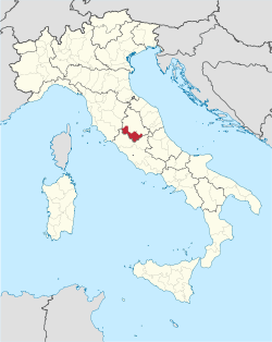
 Location of the province of Terni in Italy | |
| Country | |
| Region | Umbria |
| Capital(s) | Terni |
| Municipalities | 33 |
| Government | |
| • President | Stefano Bandecchi |
| Area | |
• Total | 2,127.18 km2 (821.31 sq mi) |
| Population (2025)[2] | |
• Total | 215,423 |
| • Density | 100/km2 (260/sq mi) |
| GDP | |
| • Total | €5.030 billion (2015) |
| • Per capita | €21,885 (2015) |
| Time zone | UTC+1 (CET) |
| • Summer (DST) | UTC+2 (CEST) |
| Postal code | 05010-05018, 05020-05026, 05028-05032, 05034-05035, 05039, 05100 |
| Telephone prefix | 075, 0744, 0763 |
| Vehicle registration | TR |
| ISTAT | 055 |
The province of Terni (Italian: provincia di Terni) is the smaller of the two provinces in the region of Umbria in Italy, comprising one-third of both the area and population of the region. Its capital is the city of Terni. The province came into being in 1927, when it was carved out of the original unitary province of Umbria.
It has an area of 2,127.18 km2 and a population of 215,423 as of 2025.[1][2] The only towns with a population over 10,000 are Terni, Orvieto, Narni and Amelia.
History
[edit]In the 2nd millennium BC the province was occupied by a population called Umbri, who founded the cities of Amelia, Narnia Nahars, Otricolum and Interamna Nahars. With the development of the Etruscan civilization, their territory was reduced to the valleys of the Black and Velino. One of the most important and richest Etruscan cities in province of Terni was Orvieto and an unidentified place called Fanum Voltumnae. For centuries, Umbrian and Etruscan fought hard for the rule of the Tiber Valley, until, in 299 BC when Roman legions began the invasion of Umbria.
The provincial territory was part of the Roman Republic and then the Roman Empire until the latter's western part fell in the 5th century AD. In 571 the Lombards, after invading the Po Plain, went down the Apennines and, in 575, founded the Duchy of Spoleto in what is now Umbria and the neighbouring areas; this state remained formally independent until 1250. In 1527 Terni was used a camp of the Landsknecht army that would subsequently take part in the Sack of Rome and fought at Spoleto and Todi, where the League of Cognac troops were located.
In 1926, it became the seat of a separate province, detached from Perugia, including the countryside around the main centres of Terni and Orvieto.
Geography
[edit]It is bordered to the north with the province of Perugia, to the east, south and west with the Lazio (province of Rieti and province of Viterbo) and to north-west with the Tuscany (province of Siena). The province extends into the south-west of the Umbria region, occupying the last section of the Nera Valley near the confluence with the River Velino, and the eastern part of the valley of the Tiber Valley.
The province of Terni is characterized by its slopes encountered along the path of rivers, allowing the exploitation of hydro catchment areas, so as to have led to the creation of several artificial lakes:
- Lake Corbara
- Lake Alviano
- Lake Recentino
- Lake San Liberato
- Lake Arezzo
- Lake Piediluco
Municipalities
[edit]There are 33 municipalities (comuni) in the province.
- Acquasparta
- Allerona
- Alviano
- Amelia
- Arrone
- Attigliano
- Avigliano Umbro
- Baschi
- Calvi dell'Umbria
- Castel Giorgio
- Castel Viscardo
- Fabro
- Ferentillo
- Ficulle
- Giove
- Guardea
- Lugnano in Teverina
- Montecastrilli
- Montecchio
- Montefranco
- Montegabbione
- Monteleone d'Orvieto
- Narni
- Orvieto
- Otricoli
- Parrano
- Penna in Teverina
- Polino
- Porano
- San Gemini
- San Venanzo
- Stroncone
- Terni
Demographics
[edit]
|
| ||||||||||||||||||||||||||||||||||||||||||||||||||||||
| Source: ISTAT[4][5] | |||||||||||||||||||||||||||||||||||||||||||||||||||||||
Gallery
[edit]See also
[edit]References
[edit]- ^ a b "Superficie di Comuni Province e Regioni italiane al 9 ottobre 2011" (in Italian). ISTAT.
- ^ a b "Monthly Demographic Balance". ISTAT.
- ^ Regions and Cities > Regional Statistics > Regional Economy > Regional Gross Domestic Product (Small regions TL3), OECD.Stats. Accessed on 16 November 2018.
- ^ "Popolazione residente e presente dei comuni. Censimenti dal 1861 al 1971" [Resident and present population of the municipalities. Censuses from 1861 to 1971] (PDF) (in Italian). ISTAT. 1971-10-24.
- ^ "Dashboard Permanent census of population and housing". ISTAT.
External links
[edit]- Official website (in Italian)


