Portal:Maryland
|
Maryland Portal
|
Baltimore Task Force
|
Frederick Task Force
|
Montgomery Task Force
|
WikiProject Maryland
|
|
Main page
|
Discussion
|
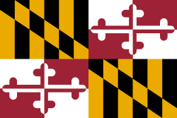
Introduction Maryland (US: /ˈmɛrɪlənd/ ⓘ MERR-il-ənd) is a state in the Mid-Atlantic region of the United States. It borders the states of Virginia to its south, West Virginia to its west, Pennsylvania to its north, and Delaware to its east, as well as with the Atlantic Ocean to its east, and the national capital and federal district of Washington, D.C. to the southwest. With a total area of 12,407 square miles (32,130 km2), Maryland is the ninth-smallest state by land area, and its population of 6,177,224 ranks it the 18th-most populous state and the fifth-most densely populated. Maryland's capital city is Annapolis, and the state's most populous city is Baltimore. Maryland's coastline was first explored by Europeans in the 16th century. Prior to that, it was inhabited by several Native American tribes, mostly the Algonquian peoples. One of the original Thirteen Colonies, the Province of Maryland was founded in 1634 by George Calvert, 1st Baron Baltimore, a Catholic convert who sought to provide a religious haven for Catholics persecuted in England. In 1632, Charles I of England granted Lord Baltimore a colonial charter, naming the colony after his wife, Henrietta Maria. In 1649, the Maryland General Assembly passed an Act Concerning Religion, which enshrined the principle of toleration. Religious strife was common in Maryland's early years, and Catholics remained a minority, albeit in greater numbers than in any other English colony. Maryland's early settlements and population centers clustered around waterways that empty into the Chesapeake Bay. Its economy was heavily plantation-based and centered mostly on the cultivation of tobacco. Demand for cheap labor from Maryland colonists led to the importation of numerous indentured servants and enslaved Africans. In 1760, Maryland's current boundaries took form following the settlement of a long-running border dispute with Pennsylvania. Many of its citizens played key political and military roles in the American Revolutionary War. Although it was a slave state, Maryland remained in the Union during the American Civil War, and its proximity to Washington D.C. and Virginia made it a significant strategic location. After the Civil War ended in 1865, Maryland took part in the Industrial Revolution, driven by its seaports, railroad networks, and mass immigration from Europe. (Full article...) This is a Featured article, which represents some of the best content on English Wikipedia..
Charles Carroll I (1661 – 1720), sometimes called Charles Carroll the Settler to differentiate him from his son and grandson, was an Irish-born planter and lawyer who spent most of his life in the English Province of Maryland. Carroll, a Catholic, is best known for his efforts to hold office in the Protestant-dominated colony which eventually resulted in the disfranchisement of Maryland's Catholics. The second son of Irish Catholic parents, Carroll was educated in France as a lawyer before returning to England, where he pursued the first steps in a legal career. Before that career developed, he secured a position as Attorney General of the young colony of Maryland. Its founder George Calvert, 1st Baron Baltimore and his descendants intended it as a refuge for persecuted Catholics. Carroll supported Charles Calvert, 3rd Baron Baltimore, the colony's Catholic proprietor, in an unsuccessful effort to prevent the Protestant majority from gaining political control over Maryland. Following the overthrow of the Calvert proprietorship and the subsequent exclusion of Catholics from colonial government, Carroll turned his attention to owning slave plantations, law, business, and various offices in the proprietor's remnant organization. He was the wealthiest man in the colony by the time of his death. In the last years of his life, Carroll attempted to regain some vestige of political power for Catholics in the colony, but the Protestant colonial assembly and Governor John Hart disfranchised them. His son, Charles Carroll II of Annapolis, became a wealthy planter and his grandson, Charles Carroll III of Carrollton, also wealthy, was the only Catholic signer of the United States Declaration of Independence. (Full article...) General imagesIn the news
On this day...Births
This is a Good article, an article that meets a core set of high editorial standards.
 William Daniel (January 24, 1826 – October 13, 1897) was an American politician from the state of Maryland. A lawyer, he was a noted prohibitionist and abolitionist. He served in both houses of the Maryland state legislature, first as a Whig, and later as a member of the American Party. Later, as a Republican, he was a member of the convention that wrote Maryland's constitution in 1864. He helped found the Maryland Temperance Alliance in 1872 and served as its president for twelve years. Daniel was the vice presidential nominee and running mate of John St. John on the Prohibition Party ticket in the presidential election of 1884. Placing third in the election that year, he continued his involvement with the cause of temperance until his death in 1897. (Full article...) Selected article -The COVID-19 pandemic was confirmed to have reached the U.S. state of Maryland in March 2020. The first three cases of the virus were reported in Montgomery County on March 5, 2020. As of December 16, 2022[update], the Maryland Department of Health (MDH) reported 1,303,829 positive cases, 15,575 confirmed deaths, and 4,914,005 are fully vaccinated with the primary vaccination series. County fully vaccinated rates range from 93% in Montgomery County to 52% in Somerset County. (Full article...) Did you know?

SubcategoriesSelect [+] to view subcategories
TopicsRelated portalsAssociated WikimediaThe following Wikimedia Foundation sister projects provide more on this subject:
Discover Wikipedia using portals |


