
Paultown, Missouri
Paultown | |
|---|---|
 Paultown Location of Paultown in Missouri  Paultown Paultown (the United States) | |
| Coordinates: 40°09′38″N 92°21′54″W / 40.160556°N 92.365000°W | |
| Country | United States |
| State | Missouri |
| County | Adair County |
| Time zone | UTC-6 (Central Standard Time) |
| • Summer (DST) | UTC-5 (Central Daylight Time) |
Paultown (also known as Paulville) is an unincorporated community in eastern Adair County, in the U.S. state of Missouri.[1] The community was approximately one mile northeast of Brashear and the Paultown Cemetery is about one-half mile to the east above Big Deer Branch.[2]
History
[edit]Paultown (Paulville) was platted in the 1850s by Walker Paul, and named for him.[3] A post office called Paulville was established in 1857, and remained in operation until 1873.[4]
References
[edit]- ^ U.S. Geological Survey Geographic Names Information System: Paultown, Missouri
- ^ Hurdland, MO, 7.5 Minute Topographic Quadrangle, USGS, 1066
- ^ "Adair County Place Names, 1928-1945 (archived)". The State Historical Society of Missouri. Archived from the original on June 24, 2016. Retrieved August 30, 2016.
{{cite web}}: CS1 maint: bot: original URL status unknown (link) - ^ "Post Offices". Jim Forte Postal History. Retrieved August 27, 2016.
Municipalities and communities of Adair County, Missouri, United States | ||
|---|---|---|
| Cities | 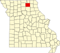 | |
| Villages | ||
| Townships | ||
| CDP | ||
| Other communities | ||
| Ghost towns | ||
| Footnotes | ‡This populated place also has portions in an adjacent county or counties | |
40°09′38″N 92°21′54″W / 40.16056°N 92.36500°W
This Adair County, Missouri state location article is a stub. You can help Wikipedia by expanding it. |