Mont Trapèze
Appearance
| Mont Trapèze | |
|---|---|
 | |
| Highest point | |
| Elevation | 807 m (2,648 ft)[1] |
| Prominence | 731 m (2,398 ft)[1] |
| Coordinates | 49°13′58″S 69°58′30″E / 49.23278°S 69.97500°E[1] |
| Geography | |
| Location | Kerguelen Islands, French Southern and Antarctic Lands |
| Climbing | |
| First ascent | Unknown |
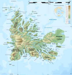
Mont Trapèze is a mountain in the French Southern and Antarctic Lands. Located on the Courbet Peninsula, Grande Terre, Kerguelen Islands, it rises to a height of 807 metres (2,648 ft) above sea level.[2]
The name of this mountain was chosen by French geographer Edgar Aubert de la Rüe.[3]
References
[edit]- ^ a b c "Mont Trapèze". PeakVisor.
- ^ Google Earth
- ^ Aubert de la Rüe, Edgar (1932). "Etude géologique et géographique de l'archipel de Kerguelen". Revue de Géographie Physique et de Géologie Dynamique (in French). 5 (1–2): 19 and 38. Retrieved 20 May 2025.


