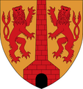
Leopoldsdorf
Appearance
Leopoldsdorf | |
|---|---|
 Leopoldsdorf Castle | |
| Coordinates: 48°07′00″N 16°23′00″E / 48.11667°N 16.38333°E | |
| Country | Austria |
| State | Lower Austria |
| District | Bruck an der Leitha |
| Government | |
| • Mayor | Fritz Blasnek (ÖVP) |
| Area | |
• Total | 6.98 km2 (2.69 sq mi) |
| Elevation | 161 m (528 ft) |
| Population (2018-01-01)[2] | |
• Total | 5,078 |
| • Density | 730/km2 (1,900/sq mi) |
| Time zone | UTC+1 (CET) |
| • Summer (DST) | UTC+2 (CEST) |
| Postal code | 2333 |
| Area code | 02235 |
| Vehicle registration | BL |
| Website | www.leopoldsdorf.gv.at |
Leopoldsdorf is a municipality in the district of Bruck an der Leitha in the Austrian state of Lower Austria. Under Nazi rule, it belonged to Greater Vienna from 1938 onwards. It regained its status as a municipality in 1954.[citation needed]
It belonged to Wien-Umgebung District which was dissolved in 2016.[3][4]
Population
[edit]| Year | Pop. | ±% |
|---|---|---|
| 1971 | 2,424 | — |
| 1981 | 2,413 | −0.5% |
| 1991 | 2,627 | +8.9% |
| 2001 | 3,436 | +30.8% |
| 2011 | 4,697 | +36.7% |
| 2021 | 5,250 | +11.8% |
References
[edit]- ^ "Dauersiedlungsraum der Gemeinden Politischen Bezirke und Bundesländer - Gebietsstand 1.1.2018". Statistics Austria. Retrieved 10 March 2019.
- ^ "Einwohnerzahl 1.1.2018 nach Gemeinden mit Status, Gebietsstand 1.1.2018". Statistics Austria. Retrieved 9 March 2019.
- ^ "Bezirk Wien Umgebung wird aufgelöst". 10 September 2015.
- ^ "Wien-Umgebung: Aufteilung geändert", artikel in Niederösterreichische Nachrichten (NÖN.at), 24-9-2015


