
Lebanon, Oklahoma
Lebanon, Oklahoma | |
|---|---|
 Lebanon  Lebanon | |
| Coordinates: 33°58′25″N 96°55′03″W / 33.97361°N 96.91750°W | |
| Country | United States |
| State | Oklahoma |
| County | Marshall |
| Area | |
• Total | 4.07 sq mi (10.55 km2) |
| • Land | 3.09 sq mi (8.01 km2) |
| • Water | 0.98 sq mi (2.54 km2) |
| Elevation | 653 ft (199 m) |
| Population | |
• Total | 210 |
| • Density | 67.92/sq mi (26.22/km2) |
| Time zone | UTC-6 (Central (CST)) |
| • Summer (DST) | UTC-5 (CDT) |
| ZIP Code | 73440 |
| Area code | 580 |
| FIPS code | 40-41950 |
| GNIS feature ID | 2629927[2] |
Lebanon is a census-designated place (CDP) and unincorporated community in Marshall County, Oklahoma, United States. It has a post office with the ZIP code 73440.[4] As of the 2020 census, the population was 210.[3]
History
[edit]Lebanon was settled in the late 19th century as part of the Chickasaw Indian Nation and was part of Pickens County. A Chickasaw tribal courthouse was located in Lebanon. About a mile to the east of Hauani Creek is the remains of the Burney School, a tribal school operated by the Chickasaws.[5]
Geography
[edit]Lebanon is in southwestern Marshall County at the western end of Lake Texoma, near where the Red River enters the lake. It is bordered to the west by Love County, Oklahoma, and to the south, across the lake, by Grayson County, Texas. Madill, the Marshall county seat, is 13 miles (21 km) to the northeast. Oklahoma State Highway 32 passes through the community, leading east 11 miles (18 km) to Kingston and west 13 miles (21 km) to Marietta.
According to the U.S. Census Bureau, the Lebanon CDP has a total area of 4.07 square miles (10.54 km2), of which 3.09 square miles (8.00 km2) are land and 0.98 square miles (2.54 km2), or 24.1%, are water.[1] The water area includes the main stem of Lake Texoma as well as Hauani Creek, an arm of the lake forming the eastern border of the community.
Demographics
[edit]| Census | Pop. | Note | %± |
|---|---|---|---|
| 2010 | 303 | — | |
| 2020 | 210 | −30.7% | |
| U.S. Decennial Census[6][3][7] | |||
As of the census of 2000, the population of the ZCTA for ZIP Code 73440, covering more area than the current CDP, was 327.[8]
Economy
[edit]Lebanon is primarily a farming area. There is one Dollar General, a gas station, and a few other small businesses.
References
[edit]- ^ a b "2024 U.S. Gazetteer Files: Oklahoma". United States Census Bureau. Retrieved May 7, 2025.
- ^ a b U.S. Geological Survey Geographic Names Information System: Lebanon, Oklahoma
- ^ a b c "P1. Race – Lebanon CDP, Oklahoma: 2020 DEC Redistricting Data (PL 94-171)". U.S. Census Bureau. Retrieved May 7, 2025.
- ^ USPS – Cities by ZIP Code
- ^ Heritage and Culture - Historic Sites Archived 2008-03-24 at the Wayback Machine, Chickasaw Nation Archived 2005-12-11 at the Wayback Machine (accessed February 26, 2008).
- ^ "P1. Race – Lebanon CDP, Oklahoma: 2010 DEC Redistricting Data (PL 94-171)". U.S. Census Bureau. Retrieved May 7, 2025.
- ^ "Census of Population and Housing". Census.gov. Retrieved June 4, 2016.
- ^ 73440 - Fact Sheet US Census Bureau. Retrieved on 2008-02-21.
Municipalities and communities of Marshall County, Oklahoma, United States | ||
|---|---|---|
| City | 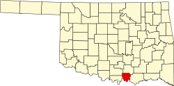 | |
| Towns | ||
| CDPs | ||
| Other communities | ||
| Indian reservation | ||
| Footnotes | ‡This populated place also has portions in an adjacent county or counties | |
| International | |
|---|---|
| National | |