Kojátky
Kojátky | |
|---|---|
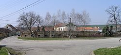
 Centre of Kojátky | |
| Coordinates: 49°10′19″N 17°1′34″E / 49.17194°N 17.02611°E | |
| Country | |
| Region | South Moravian |
| District | Vyškov |
| First mentioned | 1358 |
| Area | |
• Total | 5.82 km2 (2.25 sq mi) |
| Elevation | 249 m (817 ft) |
| Population (2025-01-01)[1] | |
• Total | 370 |
| • Density | 64/km2 (160/sq mi) |
| Time zone | UTC+1 (CET) |
| • Summer (DST) | UTC+2 (CEST) |
| Postal code | 685 01 |
| Website | www |
Kojátky is a municipality and village in Vyškov District in the South Moravian Region of the Czech Republic. It has about 400 inhabitants.
Administrative division
[edit]Kojátky consists of two municipal parts (in brackets population according to the 2021 census):[2]
- Kojátky (261)
- Šardičky (101)
Etymology
[edit]The name is derived from the personal name Kojata.[3]
Geography
[edit]Kojátky is located about 12 kilometres (7 mi) south of Vyškov and 27 km (17 mi) east of Brno. It lies in an agricultural landscape in the Litenčice Hills. The highest point is a nameless hill at 347 m (1,138 ft) above sea level.
History
[edit]The first written mention of Kojátky is from 1358. Šardičky was first mentioned in 1356. Both villages were owned by various less important noblemen and had different owners until 1714, when their owner became Knight Bernard Brabanský of Chobřany.[3]
Demographics
[edit]
|
|
| ||||||||||||||||||||||||||||||||||||||||||||||||||||||
| Source: Censuses[4][5] | ||||||||||||||||||||||||||||||||||||||||||||||||||||||||
Transport
[edit]There are no railways or major roads passing through the municipality.
Sights
[edit]The only protected cultural monument in the municipality is the statue of Saint John of Nepomuk. It is a Baroque statue from the 18th century.[6]
References
[edit]- ^ "Population of Municipalities – 1 January 2025". Czech Statistical Office. 2025-05-16.
- ^ "Public Census 2021 – basic data". Public Database (in Czech). Czech Statistical Office. 2022.
- ^ a b "Historie" (in Czech). Obec Kojátky. Retrieved 2024-03-11.
- ^ "Historický lexikon obcí České republiky 1869–2011" (in Czech). Czech Statistical Office. 2015-12-21.
- ^ "Population Census 2021: Population by sex". Public Database. Czech Statistical Office. 2021-03-27.
- ^ "Výsledky vyhledávání: Kulturní památky, obec Kojátky". Ústřední seznam kulturních památek (in Czech). National Heritage Institute. Retrieved 2025-03-11.


