Kharta Changri
Appearance
| Kharta Changri | |
|---|---|
| Khartachangri, Kardachangri, Kaerdazhanggeli | |
| Highest point | |
| Elevation | 7,056 m (23,150 ft)[1] |
| Prominence | 426 m (1,398 ft)[1] |
| Listing | Mountains of China |
| Coordinates | 28°6′51″N 86°59′36″E / 28.11417°N 86.99333°E[1] |
| Geography | |
| Location | Tibet |
| Parent range | Mahalangur, Himalayas |
| Climbing | |
| First ascent | 27 July 1935[note 1] |
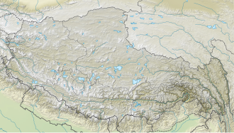
Kharta Changri is a mountain in the Himalayas which lies at the head of the Kharta valley in Tibet, a few km from the border with Nepal.
Location
[edit]The Himalayan peak is located at 7,056 m (23,150 ft) above sea level, 15.6 km north northeast of Mount Everest in the Tingri district of Shigatse, Tibet.
Climbing history
[edit]Towards the end of the 1935 British Mount Everest reconnaissance expedition Charles Warren, Edwin Kempson and Michael Spender set out to survey the area east of Everest. On 27 July 1935, whilst Spender was surveying, Kempson and Warren made the first ascent of Kharta Changri.[2][4][3]
Notes
[edit]- ^ The report in the Alpine Journal of 1936[2] gives the date of the first ascent as 29 August but the 1995 article in the Alpine Journal by Warren,[3] who was one of the first ascentionists, gives the date as 27 July. The 1935 AJ article also records that Kempson left the party before 23 August so the date given for first ascent in that article must be an error (it may be the date that the photograph of Kharta Changri was taken).
References
[edit]- ^ a b c "High Asia summits over 6,750 metres high with 500 metres of re-ascent". viewfinderpanoramas.org. Retrieved 1 July 2025.
- ^ a b Shipton, E.E. (1936). "The Mount Everest reconnaissance" (PDF). Alpine Journal. 48 (252): 1–14. Retrieved 7 June 2025.
- ^ a b Warren, Charles (1995). "Everest 1935: The Forgotten Adventure" (PDF). Alpine Journal. Retrieved 1 July 2025.
- ^ Shipton, Eric (1936). "The Mount Everest reconnaissance, 1935". Himalayan Journal. 8. Retrieved 7 June 2025.

