
Kelling
| Kelling | |
|---|---|
 St Mary’s Church | |
 Kelling Location within Norfolk | |
| Area | 3.09 sq mi (8.0 km2) |
| Population | 173 (2021 census) |
| • Density | 56/sq mi (22/km2) |
| OS grid reference | TG094429 |
| • London | 130 miles (210 km) |
| Civil parish |
|
| District | |
| Shire county | |
| Region | |
| Country | England |
| Sovereign state | United Kingdom |
| Post town | HOLT |
| Postcode district | NR25 |
| Dialling code | 01263 |
| Police | Norfolk |
| Fire | Norfolk |
| Ambulance | East of England |
| UK Parliament | |
Kelling (also known as Low Kelling or Lower Kelling) is a village and a civil parish in the English county of Norfolk.
Kelling is located 10.1 miles (16.3 km) west of Cromer and 26 miles (42 km) north of Norwich, along the A149 and within the Norfolk Coast AONB.
History
[edit]Kelling's name is of Anglo-Saxon origin and derives from the Old English for Cylla's people.[1]
In the Domesday Book, Kelling is listed as a settlement of 81 households in the hundred of Holt. In 1086, the village was part of the East Anglian estates of Hugh d'Avranches, Roger, son of Rainard and Ralph, son of Hagni.[2]
Between 1903 and 1905, Home Place was built as the residence of the Reverend Percy R. Lloyd by Edward Schroeder Prior in the Arts and Crafts Style.[3]
Kelling Hall was built in 1913 by Sir Edward Maufe in the Arts and Crafts style for Henri Deterding KBE, one of the founders of the Royal Dutch Shell.[4]
During the Second World War, numerous static defences were built in the parish to defend against a possible German invasion.[5]
Geography
[edit]According to the 2021 census, Kelling has a population of 173 people which shows a decrease from the 177 people recorded in the 2011 census.[6]
Kelling Heath is a Site of Special Scientific Interest.
The A149, between King's Lynn and Great Yarmouth, passes through the village.
St. Mary's Church
[edit]Kelling's parish church is dedicated to Saint Mary and dates from the medieval period. St. Mary's is located on 'The Street' and has been Grade II listed since 1960.[7] The church is open twice a month for Sunday service.[8]
St. Mary's holds a font dating from the Fifteenth Century and holds stained-glass windows from the same period depicting various female saints. There is also a stained-glass window from the 1930s designed by Harry Mileham which depicts Saint Francis and a set of royal arms from the reign of King George III which may be earlier.[9]
Amenities
[edit]The village has a reading room, which is now a book shop, gallery and tea-room. There is a small Victorian school house built in 1876 and opened October 1877,[10] still in use as a primary school today on the coastal side of the A149 just opposite the reading room.
Governance
[edit]Kelling is part of the electoral ward of Coastal for local elections and is part of the district of North Norfolk.
The village's national constituency is North Norfolk, which has been represented by the Liberal Democrat Steff Aquarone MP since 2024.
War Memorial
[edit]Kelling War Memorial is a memorial cross located at the junction of the A149 and 'The Street'[11] which lists the following names for the First World War:[12][13]
| Rank | Name | Unit | Date of Death | Burial/Commemoration |
|---|---|---|---|---|
| Sjt. | William E. Dix | 9th Bn., Norfolk Regiment | 25 May 1916 | Lijssenthoek Military Cemetery |
| Sjt. | John C. Read | 9th Bn., Norfolk Regt. | 18 Oct. 1916 | Bancourt British Cemetery |
| Sgt. | George F. Duffield CdG | 3rd Bn., Worcestershire Regt. | 14 Aug. 1918 | Pernes British Cemetery |
| Cpl. | Robert J. Dewing | 4th Bn., Norfolk Regiment | 19 Apr. 1917 | Jerusalem Memorial |
| Dvr. | William Woodhouse | 367th Bty., Royal Field Artillery | 28 Apr. 1915 | Menin Gate |
| Pnr. | Benjamin Risborough | 254th Coy., Royal Engineers | 2 Aug. 1917 | Brandhoek New Cemetery |
| Pte. | John W. Wright | 2/4th Bn., Loyal Regiment | 26 Oct. 1917 | Tyne Cot |
| Pte. | James E. Crane DCM | 2nd Bn., Norfolk Regiment | 31 Oct. 1916 | North Gate War Cemetery |
| Pte. | Arthur Moy | 9th Bn., North Staffords Regt. | 12 Oct. 1917 | Outtersteene Cemetery |
The following names were added after the Second World War:
| Rank | Name | Unit | Date of Death | Burial/Commemoration |
|---|---|---|---|---|
| Maj. | Charles C. Swainson MC | 2nd Bn., Royal Norfolk Regiment | 13 Jul. 1944 | Kohima War Cemetery |
| Capt. | John R. Levitt | 113 Regt., Royal Artillery | 8 Dec. 1944 | Forlì War Cemetery |
| FLt. | Harry L. Furnell | No. 24 Squadron RAF (Dakota) | 17 Apr. 1945 | Epsom Cemetery |
Gallery
[edit]-
 The street circa 1911
 -
 The Street
 -
 The Street
 -
 The Old Reading Room
 -
 The Old Reading Room
 -
 Kelling Village School
 -
 Kelling War Memorial
 -
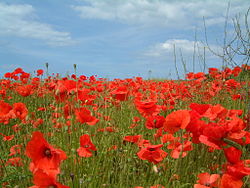 Poppies in field near Kelling June 2002
 -
 World War II Type 22 Pillbox on the shingle beach at Kelling
 -
 World War II Norcon pillbox on Kelling Hard


.JPG)


See also
[edit]References
[edit]- ^ "Key to English Place-names". kepn.nottingham.ac.uk. Retrieved 4 June 2025.
- ^ "Kelling | Domesday Book". opendomesday.org. Retrieved 4 June 2025.
- ^ "mnf6489 - Norfolk Heritage Explorer". www.heritage.norfolk.gov.uk. Retrieved 4 June 2025.
- ^ "KELLING HALL, Kelling - 1151974 | Historic England". historicengland.org.uk. Retrieved 4 June 2025.
- ^ "TNF376 - Norfolk Heritage Explorer". www.heritage.norfolk.gov.uk. Retrieved 4 June 2025.
- ^ "Kelling (Parish, United Kingdom) - Population Statistics, Charts, Map and Location". www.citypopulation.de. Retrieved 4 June 2025.
- ^ "Church of St. Mary, Kelling - 1373476 | Historic England". historicengland.org.uk. Retrieved 4 June 2025.
- ^ "St Mary's, Kelling". www.achurchnearyou.com. Retrieved 4 June 2025.
- ^ "Norfolk Churches". www.norfolkchurches.co.uk. Retrieved 4 June 2025.
- ^ "kelling school 1900". www.salthousehistory.co.uk.
- ^ "Kelling War Memorial, Kelling - 1433008 | Historic England". historicengland.org.uk. Retrieved 4 June 2025.
- ^ "Geograph:: Ickburgh to Knapton :: War Memorials in Norfolk". www.geograph.org.uk. Retrieved 4 June 2025.
- ^ "Roll of Honour - Norfolk - Kelling". roll-of-honour.com. Retrieved 4 June 2025.
Neighbouring villages
[edit]External links
[edit]- "WW2 Coastal Defences". Archived from the original on 10 January 2010.