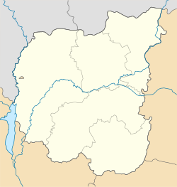
Kachanivka, Chernihiv Oblast
Kachanivka
Качанівка | |
|---|---|
 Kachanivka estate | |
| Coordinates: 50°50′22″N 32°39′53″E / 50.83944°N 32.66472°E | |
| Country | |
| Oblast | Chernihiv Oblast |
| Raion | Pryluky Raion |
| Elevation | 160 m (520 ft) |
| Population (2001) | |
• Total | 48 |
| Postal code | 16735 |
| Area code | +380 4633 |
| Climate | Cfa |
Kachanivka (Ukrainian: Качанівка) is a rural settlement (a selyshche) in Pryluky Raion, Chernihiv Oblast (province) of Ukraine. It belongs to Parafiivka settlement hromada, one of the hromadas of Ukraine.[2]
Until 18 July 2020, Kachanivka was located in Ichnia Raion. The raion was abolished on 18 July 2020 as part of the administrative reform of Ukraine, which reduced the number of raions of Chernihiv Oblast to five.[3][4]
Geography
[edit]The Kachanivka is located in the north of Pryluky raion, 150 km from Chernihiv, 20 km from Ichnia, and 55 km from Pryluky. The height above sea level is 164 m. [5] The territory of the settlement located within the Dnieper Lowland. The relief of the Kachanivka surface is a lowland plain, in places dissected by river valleys. There are many ponds in Parafiivka.[6][7]
The climate of Kachanivka is moderately continental, with warm summers and relatively mild winters. The average temperature in January is about -7°C, and in July - +19°C. The average annual precipitation ranges from 550 to 660 mm, with the highest amount of precipitation in the summer period.[8][9]
The soil cover of the settlement is dominated by chernozem and podzolized soils. The Kachanivka is located the forest steppe, on the Polesia.[10][9]
The National Historical and Cultural Reserve "Kachanivka" is located on the territory of the village, which consists of a palace ensemble and a park with 12 ponds, founded in the 1770s.[11]
Economy
[edit]Transportation
[edit]The nearest railway stop is located in Parafiivka ( Bakhmach-Pryluky line). The road to Parafiivka and Ivanitsa passes through Kachanivka. [7]
References
[edit]- ^ "Kachanivka (Chernihiv Oblast)". weather.in.ua. Retrieved 28 October 2022.
- ^ "Парафеевская громада" (in Russian). Портал об'єднаних громад України. Retrieved 2020-10-03.
- ^ "Про утворення та ліквідацію районів. Постанова Верховної Ради України № 807-ІХ". Голос України (in Ukrainian). 2020-07-18. Retrieved 2020-10-03.
- ^ "Нові райони: карти + склад" (in Ukrainian). Міністерство розвитку громад та територій України. Retrieved 2020-10-03.
- ^ "Статут громади | Парафіївська селищна рада". parafiivska-sr.gov.ua (Офіційний сайт громади). Retrieved 2025-07-11.
- ^ Національний атлас України/НАН України, Інститут географії, Державна служба геодезії, картографії та кадастру; голов. ред. Л. Г. Руденко; голова ред. кол.Б.Є. Патон. — К.: ДНВП «Картографія», 2007. — 435 с. — 5 тис.прим. — ISBN 978-966-475-067-4. Retrieved 2025-07-11
- ^ a b "Парафіївська територіальна громада | Характеристика громади". parafiivska-sr.gov.ua. Retrieved 2025-07-11.
- ^ "Кліматичні характеристики". Сайт Чернігівського метеоцентра. Retrieved 2025-07-11.
- ^ a b Чернігівська область. Географічний атлас. Серія «Моя мала Батьківщина» – 2003 р. ISBN 966-7620-39-5 Retrieved 2025-07-11.
- ^ Білоус, М. Д. Географія Чернігівської області / М. Д. Білоус. — Чернігів: Ранок, 2010. — 144 с Retrieved 2025-07-11
- ^ "Садиба в Качанівці". ВУЕ (in Ukrainian). Retrieved 2025-07-11.


