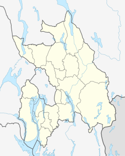
Jar, Norway
Appearance
Jar, Norway | |
|---|---|
Village | |
 A view Jar and Ullern | |
Location in Akershus | |
| Coordinates: 59°55′N 10°36′E / 59.917°N 10.600°E | |
| Country | Norway |
| Region | Østlandet |
| County | Akershus |
| District | Asker og Bærum |
| Municipality | Bærum |
| Jar farm | 1413 (612 years ago) |
| Residential areas | 1923 (102 years ago) |
| Jar stasjon | 1 June 1924 (101 years ago) |
| Area | |
• Total | 2.795 km2 (1.079 sq mi) |
| Elevation | 84 m (276 ft) |
| Population (2025[1]) | |
• Total | 7,271 |
| • Density | 2,601/km2 (6,740/sq mi) |
| Estimate | |
| Time zone | UTC+01:00 (CET) |
| • Summer (DST) | UTC+02:00 (CEST) |
| Post Code | |

Jar is a district in the municipality of Bærum, Norway. Its annual population change (2020 - 2025), was 1.1%.
It is served by the Jar rail station on the Kolsås Line.
Etymology
[edit]The name "Jar" comes, like Jæren, from old norse Jaðarr, meaning "edge". It's named this because it's at the edge of the deep valley of Lysakerelven.
Famous people from Jar
[edit]- Andreas Prestmo - musician
- Jon Larsen - musician, composer, visual artist, researcher
- Per Frydenlund - musician
- Svein Aarbostad - musician
- Anders Beer Wilse - photographer
- Aleksander Hetland - swimmer
- Aleksander Aamodt Kilde - alpinist
Education
[edit]The main school at Jar is Jar skole, opened in 1926. It had 590 students in 2018.[4]
References
[edit]- ^ "City Population".
- ^ Erik, Bolstad (2025-01-21). "Erik Bolstad".
- ^ Erik, Bolstad (2025-01-21). "Erik Bolstad".
- ^ "Udir". Archived from the original on 2019-01-11.


