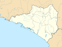
Ixtlahuacán
Appearance
Ixtlahuacán | |
|---|---|
| Coordinates: 18°59′52″N 103°44′09″W / 18.99778°N 103.73583°W | |
| Country | |
| State | Colima |
| Municipality | Ixtlahuacán |
| Population (2020) | |
• Total | 2,985[1] |
Ixtlahuacán is a city and seat of the municipality of Ixtlahuacán, in the Mexican state of Colima.[2]
References
[edit]- ^ https://www.inegi.org.mx/app/cpv/2020/resultadosrapidos/default.html?texto=Ixtlahuacán
- ^ Instituto Nacional de Estadística y Geografía. Principales resultados por localidad 2005 (ITER). Retrieved on November 9, 2008


