
IXL, Oklahoma

IXL (or I.X.L.) is an historical freedmen's town[1] in Okfuskee County, Oklahoma, United States.[2] It is located on Oklahoma State Highway 48, about 9 miles northwest of the county seat of Okemah.[3] Okemah Lake is to its east.[3]
While founded perhaps as early as 1900,[1] it was only incorporated in 2001[4] and had an estimated population of 59 in 2007.[5] The population was still 59 at the time of the 2020 census.[6]
The source of IXL's unusual[7] name is disputed. A 2012 article on the town's website explained that the name derived from Indian Exchange Land, a reference to the town being on Mvskoke land.[8] Other sources claim that the letters were taken from the names of three men.[1][9] Some people think it’s an onomatopoeic boast suggesting "I excel."[10]
This town should not be confused with Oklahoma towns in Kay County and Tillman County which also bears the "IXL" name.[1]
Demographics
[edit]As of 2024, the population for IXL was 59. 56.67% of residents were Black or African American, 20% were two or more races, 16.67% were Native American, and 6.67% of residents were white. [11]
| Census | Pop. | Note | %± |
|---|---|---|---|
| 2010 | 51 | — | |
| 2020 | 59 | 15.7% | |
| U.S. Decennial Census[12] | |||
This section needs expansion. You can help by adding to it. (July 2015) |
References
[edit]- ^ a b c d "IXL | The Encyclopedia of Oklahoma History and Culture". www.okhistory.org. Retrieved December 26, 2018.
- ^ U.S. Geological Survey Geographic Names Information System: IXL, Oklahoma
- ^ a b "Okemah, Oklahoma to Ixl, Oklahoma". Google Maps. Retrieved May 12, 2025.
- ^ "Boundary Changes". Geographic Change Notes: Oklahoma. Population Division, United States Census Bureau. May 19, 2006. Archived from the original on February 6, 2006. Retrieved July 13, 2008.
- ^ "Table 4. Annual Estimates of the Population for Incorporated Places in Oklahoma: April 1, 2000 to July 1, 2007". United States Census Bureau, Population Division. July 10, 2007. Archived from the original (CSV) on September 26, 2008. Retrieved July 13, 2008.
- ^ "IXL (town), Oklahoma". United States Census Bureau. Retrieved August 29, 2023.
- ^ Parker, Quentin (2010). Welcome to Horneytown, North Carolina, Population: 15: An insider's guide to 201 of the world's weirdest and wildest places. Adams Media. pp. x. ISBN 9781440507397.[permanent dead link]
- ^ Wallace, William (March 12, 2012). "What does "IXL" mean?". IXL. Archived from the original on June 18, 2014. Retrieved June 18, 2014.
- ^ Horcher, Gary (September 4, 1999). "Oklahoma's Strangely Named Towns: IXL, Oklahoma". KWTV-DT. Archived from the original on December 18, 2001. Retrieved August 16, 2013.
- ^ "50 Strangest Town Names in America (and Where They Came From)". Coleman Andrews, MSN News, July 14, 2020. Retrieved July 17, 2020.
- ^ "IXL, Oklahoma Population 2024". worldpopulationreview.com. Retrieved February 16, 2024.
- ^ "Census of Population and Housing". Census.gov. Archived from the original on May 7, 2015. Retrieved June 4, 2015.
Municipalities and communities of Okfuskee County, Oklahoma, United States | ||
|---|---|---|
| City | 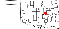 | |
| Towns | ||
| CDP | ||
| Other communities | ||
| Indian reservation | ||
| Footnotes | ‡This populated place also has portions in an adjacent county or counties | |
35°31′21″N 96°23′18″W / 35.52250°N 96.38833°W
This Oklahoma state location article is a stub. You can help Wikipedia by expanding it. |