Heksagon Tarn
| Heksagon Tarn | |
|---|---|
| езеро Хексагона (Bulgarian) | |
| Location | South Bay, Livingston Island, South Shetland Islands |
| Coordinates | 62°38′46″S 60°34′59″W / 62.64611°S 60.58306°W |
| Type | Lake |
| Basin countries | Antarctica |
| Max. length | 100 m (330 ft) |
| Max. width | 140 m (460 ft) |
| Surface area | 1.04 ha (2.6 acres) |
| Location | |
 | |
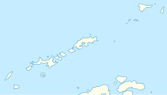
Heksagon Tarn (Bulgarian: езеро Хексагона, romanized: ezero Heksagona, IPA: ['ɛzɛro hɛksɐ'gɔnɐ])[1] is the lake on the northwest coast of South Bay, Livingston Island in the South Shetland Islands, Antarctica extending 140 m (460 ft) in west–east direction and 100 m (330 ft) in south–north direction. It has a surface area of 1.04 ha (2.6 acres) and is situated 130 m (430 ft) from the sea. The area was visited by early 19th century sealers.[2]
The feature is so named because of its supposed hexagon shape ('heksagon' in Bulgarian).
Location
[edit]Heksagon Tarn is located in central part of the island,[3] which is 1.9 km (1.2 mi) northeast of Hannah Point and 1.37 km (0.85 mi) west-southwest of Lukovo Point. British mapping of the area in 1968 and Bulgarian in 2009 and 2017.
Maps
[edit]

- Livingston Island to King George Island. Scale 1:200000. Admiralty Nautical Chart 1776. Taunton: UK Hydrographic Office, 1968
- South Shetland Islands. Scale 1:200000 topographic map No. 3373. DOS 610 - W 62 58. Tolworth, UK, 1968
- L. Ivanov. Antarctica: Livingston Island and Greenwich, Robert, Snow and Smith Islands. Scale 1:120000 topographic map. Troyan: Manfred Wörner Foundation, 2010. ISBN 978-954-92032-9-5 (First edition 2009. ISBN 978-954-92032-6-4)
- L. Ivanov. Antarctica: Livingston Island and Smith Island. Scale 1:100000 topographic map. Manfred Wörner Foundation, 2017. ISBN 978-619-90008-3-0
- Antarctic Digital Database (ADD). Scale 1:250000 topographic map of Antarctica. Scientific Committee on Antarctic Research (SCAR). Since 1993, regularly upgraded and updated
References
[edit]- ^ Lyubomir Ivanov (2025). "СПРАВОЧНИК HA БЪЛГАРСКИТЕ ГЕОГРАФСКИ ИМЕНА В АНТАРКТИКА" [Bulgarian Antarctic Gazetteer] (PDF) (in Bulgarian). Antarctic Place-names Commission of Bulgaria. Retrieved 22 June 2025.
- ^ Ivanov, Lyubomir (2015). Pimpirev, C.; Chipev, N. (eds.). General Geography and History of Livingston Island. In: Bulgarian Antarctic Research: A Synthesis. Sofia: "St. Kliment Ohridski" University Press. pp. 17–28. ISBN 978-954-07-3939-7. Retrieved 22 June 2025.
- ^ Bulgarian Antarctic Gazetteer. Antarctic Place-names Commission
External links
[edit]- Heksagon Tarn. Adjusted Copernix satellite image
This article includes information from the Antarctic Place-names Commission of Bulgaria which is used with permission.


