
Heber, California
Heber | |
|---|---|
 Location in Imperial County and the state of California | |
 Heber Location in the United States | |
| Coordinates: 32°43′51″N 115°31′47″W / 32.73083°N 115.52972°W[1] | |
| Country | United States |
| State | California |
| County | Imperial |
| Area | |
• Total | 1.485 sq mi (3.847 km2) |
| • Land | 1.485 sq mi (3.847 km2) |
| • Water | 0 sq mi (0 km2) 0% |
| Elevation | −10 ft (−3 m) |
| Population | |
• Total | 6,896 |
| • Density | 4,600/sq mi (1,800/km2) |
| Time zone | UTC-8 (Pacific (PST)) |
| • Summer (DST) | UTC-7 (PDT) |
| ZIP code | 92249 |
| Area codes | 442/760 |
| FIPS code | 06-33084 |
| GNIS feature ID | 1660738, 2408367 |
| [1] | |
Heber is a census-designated place (CDP) in Imperial County, California. Heber is located 4.5 miles (7 km) north-northwest of Calexico.[4] The population was 4,275 at the 2010 census, up from 2,566 in 2000.
Geography
[edit]According to the United States Census Bureau, the CDP has a total area of 1.5 square miles (3.9 km2), all land.
History
[edit]Heber was founded in 1903 by the Imperial Land Company.[5] The first post office at Heber opened in 1904, having been established first as Bradtmoore a half mile north.[4] The name honors A.H. Heber, president of the California Development Company.[4]
Demographics
[edit]| Census | Pop. | Note | %± |
|---|---|---|---|
| 1980 | 2,221 | — | |
| 1990 | 2,566 | 15.5% | |
| 2000 | 2,988 | 16.4% | |
| 2010 | 4,275 | 43.1% | |
| 2020 | 6,896 | 61.3% | |
| U.S. Decennial Census[6] 1860–1870[7][8] 1880-1890[9] 1900[10] 1910[11] 1920[12] 1930[13] 1940[14] 1950[15] 1960[16][17] 1970[18] 1980[19] 1990[20] 2000[21] 2010[22] 2020[23] | |||
Heber first appeared as a census designated place in the 1980 U.S. Census as part of the El Centro census county division.[19]
| Race / Ethnicity (NH = Non-Hispanic) | Pop 2000[24] | Pop 2010[25] | Pop 2020[23] | % 2000 | % 2010 | % 2020 |
|---|---|---|---|---|---|---|
| White alone (NH) | 55 | 62 | 123 | 1.84% | 1.45% | 1.78% |
| Black or African American alone (NH) | 6 | 1 | 12 | 0.20% | 0.02% | 0.17% |
| Native American or Alaska Native alone (NH) | 0 | 1 | 6 | 0.00% | 0.02% | 0.09% |
| Asian alone (NH) | 2 | 9 | 22 | 0.07% | 0.21% | 0.32% |
| Native Hawaiian or Pacific Islander alone (NH) | 0 | 0 | 1 | 0.00% | 0.00% | 0.01% |
| Other race alone (NH) | 0 | 1 | 6 | 0.00% | 0.02% | 0.09% |
| Mixed race or Multiracial (NH) | 11 | 4 | 13 | 0.37% | 0.09% | 0.19% |
| Hispanic or Latino (any race) | 2,914 | 4,197 | 6,713 | 97.52% | 98.18% | 97.35% |
| Total | 2,988 | 4,275 | 6,896 | 100.00% | 100.00% | 100.00% |
2020
[edit]The 2020 United States census reported that Heber had a population of 6,896. The population density was 4,802.2 inhabitants per square mile (1,854.1/km2). The racial makeup of Heber was 21.6% White, 0.4% African American, 1.9% Native American, 0.5% Asian, 0.1% Pacific Islander, 42.5% from other races, and 33.0% from two or more races. Hispanic or Latino of any race were 97.3% of the population.[26]
The whole population lived in households. There were 1,770 households, out of which 54.4% included children under the age of 18, 60.6% were married-couple households, 4.9% were cohabiting couple households, 25.9% had a female householder with no partner present, and 8.6% had a male householder with no partner present. 9.3% of households were one person, and 3.7% were one person aged 65 or older. The average household size was 3.9.[26] There were 1,563 families (88.3% of all households).[27]
The age distribution was 30.1% under the age of 18, 10.7% aged 18 to 24, 26.1% aged 25 to 44, 22.2% aged 45 to 64, and 10.8% who were 65 years of age or older. The median age was 33.1 years. For every 100 females, there were 92.5 males.[26]
There were 1,816 housing units at an average density of 1,264.6 units per square mile (488.3 units/km2), of which 1,770 (97.5%) were occupied. Of these, 69.3% were owner-occupied, and 30.7% were occupied by renters.[26]
In 2023, the US Census Bureau estimated that 35.3% of the population were foreign-born. Of all people aged 5 or older, 11.3% spoke only English at home and 88.7% spoke Spanish. Of those aged 25 or older, 77.8% were high school graduates and 23.4% had a bachelor's degree.[28]
The median household income in 2023 was $75,664, and the per capita income was $21,349. About 19.8% of families and 18.0% of the population were below the poverty line.[29]
2010
[edit]The 2010 United States Census[30] reported that Heber had a population of 4,275. The population density was 2,878.3 inhabitants per square mile (1,111.3/km2). The racial makeup of Heber was 2,174 (50.9%) White, 5 (0.1%) African American, 33 (0.8%) Native American, 15 (0.4%) Asian, 0 (0.0%) Pacific Islander, 1,758 (41.1%) from other races, and 290 (6.8%) from two or more races. Hispanic or Latino of any race were 4,197 persons (98.2%).
The Census reported that 4,275 people (100% of the population) lived in households, 0 (0%) lived in non-institutionalized group quarters, and 0 (0%) were institutionalized.
There were 1,094 households, out of which 694 (63.4%) had children under the age of 18 living in them, 657 (60.1%) were opposite-sex married couples living together, 279 (25.5%) had a female householder with no husband present, 65 (5.9%) had a male householder with no wife present. There were 48 (4.4%) unmarried opposite-sex partnerships, and 7 (0.6%) same-sex married couples or partnerships. 77 households (7.0%) were made up of individuals, and 39 (3.6%) had someone living alone who was 65 years of age or older. The average household size was 3.91. There were 1,001 families (91.5% of all households); the average family size was 4.09.
The population was spread out, with 1,454 people (34.0%) under the age of 18, 454 people (10.6%) aged 18 to 24, 1,115 people (26.1%) aged 25 to 44, 830 people (19.4%) aged 45 to 64, and 422 people (9.9%) who were 65 years of age or older. The median age was 28.7 years. For every 100 females, there were 89.9 males. For every 100 females age 18 and over, there were 82.5 males.
There were 1,192 housing units at an average density of 802.6 per square mile (309.9/km2), of which 1,094 were occupied, of which 678 (62.0%) were owner-occupied, and 416 (38.0%) were occupied by renters. The homeowner vacancy rate was 2.0%; the rental vacancy rate was 6.3%. 2,736 people (64.0% of the population) lived in owner-occupied housing units and 1,539 people (36.0%) lived in rental housing units.
Politics
[edit]In the state legislature, Heber is in the 18th senatorial district, represented by Democrat Steve Padilla,[31] and the 36th Assembly district, represented by Republican Jeff Gonzalez.[32]
Federally, Heber is in California's 25th congressional district, represented by Democrat Raul Ruiz.[33]
Climate
[edit]Heber, California, has a semiarid or a hot desert climate.
Government
[edit]The Heber Public Utility District operates water, wastewater, and parks and recreation services for Heber.[34]
References
[edit]- ^ a b c "Heber". Geographic Names Information System. United States Geological Survey, United States Department of the Interior.
- ^ "2010 Census U.S. Gazetteer Files – Places – California". United States Census Bureau.
- ^ "US Census Bureau". www.census.gov. Retrieved September 10, 2024.
- ^ a b c Durham, David L. (1998). California's Geographic Names: A Gazetteer of Historic and Modern Names of the State. Clovis, California: Word Dancer Press. p. 1426. ISBN 1-884995-14-4.
- ^ Harry Thomas Cory; William Phipps Blake (1915). The Imperial Valley and the Salton Sink. San Francisco: John J. Newbegin. p. 1258. Retrieved July 25, 2010.
California Development Company.
- ^ "Decennial Census by Decade". United States Census Bureau.
- ^ "1870 Census of Population - Population of Civil Divisions less than Counties - California - Almeda County to Sutter County" (PDF). United States Census Bureau.
- ^ "1870 Census of Population - Population of Civil Divisions less than Counties - California - Tehama County to Yuba County" (PDF). United States Census Bureau.
- ^ "1890 Census of Population - Population of California by Minor Civil Divisions" (PDF). United States Census Bureau.
- ^ "1900 Census of Population - Population of California by Counties and Minor Civil Divisions" (PDF). United States Census Bureau.
- ^ "1910 Census of Population - Supplement for California" (PDF). United States Census Bureau.
- ^ "1920 Census of Population - Number of Inhabitants - California" (PDF). United States Census Bureau.
- ^ "1930 Census of Population - Number and Distribution of Inhabitants - California" (PDF). United States Census Bureau.
- ^ "1940 Census of Population - Number of Inhabitants - California" (PDF). United States Census Bureau.
- ^ "1950 Census of Population - Number of Inhabitants - California" (PDF). United States Census Bureau.
- ^ "1960 Census of Population - Number of Inhabitants - California" (PDF). United States Census Bureau. Archived from the original (PDF) on June 4, 2024 – via ipums.org.
- ^ "1960 Census of Population - General population Characteristics - California" (PDF). United States Census Bureau.
- ^ "1970 Census of Population - Number of Inhabitants - California" (PDF). United States Census Bureau.
- ^ a b "1980 Census of Population - Number of Inhabitants - California" (PDF). United States Census Bureau.
- ^ "1990 Census of Population - Population and Housing Unit Counts - California" (PDF). United States Census Bureau.
- ^ "2000 Census of Population - Population and Housing Unit Counts - California" (PDF). United States Census Bureau.
- ^ "2010 Census of Population - Population and Housing Unit Counts - California" (PDF). United States Census Bureau.
- ^ a b "P2: Hispanic or Latino, and Not Hispanic or Latino by Race – 2020: DEC Redistricting Data (PL 94-171) – Heber CDP, California". United States Census Bureau.
- ^ "P004: Hispanic or Latino, and Not Hispanic or Latino by Race – 2000: DEC Summary File 1 – Heber CDP, California". United States Census Bureau.
- ^ "P2: Hispanic or Latino, and Not Hispanic or Latino by Race – 2010: DEC Redistricting Data (PL 94-171) – Heber CDP, California". United States Census Bureau.
- ^ a b c d "Heber CDP, California; DP1: Profile of General Population and Housing Characteristics - 2020 Census of Population and Housing". US Census Bureau. Retrieved May 22, 2025.
- ^ "Heber CDP, California; P16: Household Type - 2020 Census of Population and Housing". US Census Bureau. Retrieved May 22, 2025.
- ^ "Heber CDP, California; CP02: Comparative Social Characteristics in the United States - 2023 ACS 5-Year Estimates Comparison Profiles". US Census Bureau. Retrieved May 22, 2025.
- ^ "Heber CDP, California; DP03: Selected Economic Characteristics - 2023 ACS 5-Year Estimates Comparison Profiles". US Census Bureau. Retrieved May 22, 2025.
- ^ "2010 Census Interactive Population Search: CA - Heber CDP". U.S. Census Bureau. Archived from the original on July 15, 2014. Retrieved July 12, 2014.
- ^ "Senators". State of California. Retrieved April 11, 2013.
- ^ "Members Assembly". State of California. Retrieved April 11, 2013.
- ^ "California's 25th Congressional District - Representatives & District Map". Civic Impulse, LLC. Retrieved April 11, 2013.
- ^ "Home | The Heber Public Utility District". heber.ca.gov.
Municipalities and communities of Imperial County, California, United States | ||
|---|---|---|
| Cities | 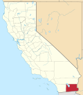 | |
| CDPs | ||
| Unincorporated communities | ||
| Indian reservations | ||
| Ghost towns | ||
| Footnotes | ‡This populated place also has portions in an adjacent county or counties | |