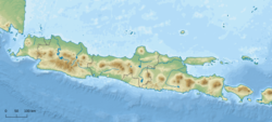
Grindulu River
This article needs additional citations for verification. (April 2025) |
| Grindulu River | |
|---|---|
| Location | |
| Country | Indonesia |
| Provinces | East Java |
| Physical characteristics | |
| Source | Mount Gembes |
| • location | Bandar, Pacitan |
| • elevation | 1,200 m (3,900 ft) |
| 2nd source | Berkala River (-8.07083, 111.3125) |
| • location | Tegalombo, Pacitan |
| • elevation | 232 m (761 ft) |
| Mouth | Teluk Pacitan, Samudra Hindia |
• location | Ploso, Pacitan |
• coordinates | 8°14′02″S 111°06′14″E / 8.2338°S 111.1039°E |
| Length | 70 km (43 mi) |
| Basin size | 715 km2 (276 sq mi)[1] |
| Basin features | |
| River system | DAS Grindulu (DAS230561)[1] |
| River management | BPDAS Solo[1] |
The Grindulu River is a river in East Java, Java, Indonesia. It flows from Mount Gembes (1,200 metres above sea level), Pacitan Recency, at the border of Jeruk Village and Bangunsari Village in the Bandar District. It then flows through the Tegalombo District and the Arjosari District in the Pacitan Regency, and into the Indian Ocean at Ploso Village. Grindulu River is approximately 70 km long, flowing from the northeast to the southwest before turning south.
Hydrology
[edit]The Grindulu river basin stretches through three regencies: the Pacitan Regency, the Ponorogo Regency, and the Wonogiri Regency. The basin covers an area of approximately 655,40 km2. 593,8 km2 of the river basin (90.6%) is in the Pacitan Regency.[2]
Tributary
[edit]Major tributaries include:
- Jelok River
- Ponggok River
- Siru River
- Asemgondok River
- Tengi River
- Ngepoh River
- Ngreco River
- Jaten River
- Plaosan River
- Sungmantung River
- Gemaharjo River
- Kapa River
- Ploso River
- Dungdowo River
- Jati River
- Pasan River
- Ngaglik River
- Pelemsengir River
Geomorphology
[edit]The Grindulu watershed is primarily affected by local residents' control of dry land, which impacts the development of the surface soil conditions of the Grindulu watershed. Soil makes up 61.29% of the area around the river, with very thin solum and lithosol parent rock outcrops. This highly erosive topsoil layer impacts the high levels of sedimentation around the river.
Erosion levels around the Gindulu River watershed are very high, with at least 60 tons of soil per hectare transported annually. Erosion levels are calculated by measuring variables like soil characteristics, land use patterns, land management, and topographic conditions.
In addition to surface flow, the Gindulu River flows underground within the Pringkulu District and Donorojo District. The underground river flows through a complex system of cave passages and underground channels, resulting in limestone (karst) reef facies. The discharge from the underground river reaches 176.70 litres/second.[2]
Geography
[edit]The Gindulu River flows in the south-central region of Java, which typically has a tropical monsoon climate. The average annual temperature is around 23°C, with a high of 26°C in October and a low of 20°C in April.[3]
The average annual rainfall is 2703 mm. Monthly rainfall reaches a high of 477 mm in January and a low of 29 mm in August.[4]
| Grindulu River | ||||||||||||||||||||||||||||||||||||||||||||||||||||||||||||
|---|---|---|---|---|---|---|---|---|---|---|---|---|---|---|---|---|---|---|---|---|---|---|---|---|---|---|---|---|---|---|---|---|---|---|---|---|---|---|---|---|---|---|---|---|---|---|---|---|---|---|---|---|---|---|---|---|---|---|---|---|
| Climate chart (explanation) | ||||||||||||||||||||||||||||||||||||||||||||||||||||||||||||
| ||||||||||||||||||||||||||||||||||||||||||||||||||||||||||||
| ||||||||||||||||||||||||||||||||||||||||||||||||||||||||||||
Utilization
[edit]The Grindulu River watershed area contains many natural resources, such as stones, sand and various types of fish. Residents along the Grindulu River utilize the river for agricultural and fishery (through traditional fishing and netting). The large water discharge of the Grindulu River is also used for traditional irrigation.
The Tukul Reservoir Dam is currently under construction on the Asemgondok River, next to the Karanggede Village in the Arjosari District. The dam has a planned capacity of 8.68M³ and is expected to irrigate 600 hectares of land and provide raw water supply at 0.35M³/second, generating 0.64 MW of electricity.[2]
Reference
[edit]- ^ a b c https://hukumonline.com/pusatdata/detail/lt4f2f760d2fff3/keputusan-menteri-kehutanan-nomor-sk511menhutv2011-tahun-2011
- ^ a b c "Bendungan Tukul". Komite Percepatan Penyediaan Infrastruktur Prioritas. Retrieved 2025-04-25.
- ^ "NASA Earth Observations Data Set Index". NASA Earth Observations. NASA. 30 January 2016. Archived from the original on 2020-05-10. Retrieved 2018-12-04.
- ^ "NASA Earth Observations: Rainfall (1 month - TRMM)". NASA Earth Observations. NASA/Tropical Rainfall Monitoring Mission. 30 January 2016. Archived from the original on 2019-04-19. Retrieved 2018-12-04.


