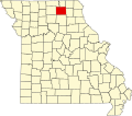
File:Map of Missouri highlighting Adair County.svg
Appearance

Size of this PNG preview of this SVG file: 681 × 599 pixels. Other resolutions: 273 × 240 pixels | 546 × 480 pixels | 873 × 768 pixels | 1,164 × 1,024 pixels | 2,328 × 2,048 pixels | 1,291 × 1,136 pixels.
Original file (SVG file, nominally 1,291 × 1,136 pixels, file size: 98 KB)
File history
Click on a date/time to view the file as it appeared at that time.
| Date/Time | Thumbnail | Dimensions | User | Comment | |
|---|---|---|---|---|---|
| current | 03:35, 25 June 2024 |  | 1,291 × 1,136 (98 KB) | Nux | fix rendering (remove clipping) |
| 13:23, 12 February 2006 |  | 5,812 × 5,110 (112 KB) | David Benbennick | {{subst:User:Dbenbenn/clm|county=Adair County|state=Missouri|type=county}} |
File usage
The following 64 pages use this file:
- Adair, Missouri
- Adair County, Missouri
- Adair County Courthouse (Missouri)
- Bear Creek (North Fork Salt River tributary)
- Bee Branch (Bridge Creek tributary)
- Benton Township, Adair County, Missouri
- Brashear, Missouri
- Bullion, Missouri
- Cabins Historic District
- Clay, Missouri
- Clay Township, Adair County, Missouri
- Connelsville, Missouri
- Danforth, Missouri
- Dockery Hotel
- Dr. E. Sanborn Smith House
- Drs. George and Blanche Laughlin House
- Fegley, Missouri
- Floyd Creek
- Gibbs, Missouri
- Greentop, Missouri
- Jasmine, Missouri
- Journal Printing Company Building
- Kirksville, Missouri
- Kirksville Courthouse Square Historic District
- Liberty Township, Adair County, Missouri
- Lindersville, Missouri
- List of counties in Missouri
- Millard, Missouri
- Morrow Township, Adair County, Missouri
- Mussel Fork
- National Register of Historic Places listings in Adair County, Missouri
- Nind, Missouri
- Nineveh, Missouri
- Nineveh Township, Adair County, Missouri
- Novinger, Missouri
- Orie J. Smith Black and White Stock Farm Historic District
- Paultown, Missouri
- Pettis Township, Adair County, Missouri
- Polk Township, Adair County, Missouri
- Ringo Point, Missouri
- Rye, Missouri
- Salt River Township, Adair County, Missouri
- Shibleys Point, Missouri
- Sojourners Club
- Sperry, Missouri
- Spring Creek (Chariton River tributary)
- Stahl, Missouri
- Sublette, Missouri
- Titus Creek
- Travelers Hotel (Kirksville, Missouri)
- Troy Mills, Missouri
- Walnut Township, Adair County, Missouri
- Willmathsville, Missouri
- Wilson Township, Adair County, Missouri
- Yarrow, Missouri
- Youngstown, Missouri
- User:Multichill/NRHP test
- User:Nyttend/County templates/MO/1
- Wikipedia:WikiProject Stub sorting/Proposals/Archive/2009/June
- Template:AdairCountyMO-NRHP-stub
- Template:AdairCountyMO-geo-stub
- Template:AdairCountyMO-river-stub
- Template:Adair County, Missouri
- Category:Populated places in Adair County, Missouri
Global file usage
The following other wikis use this file:
- Usage on ar.wikipedia.org
- Usage on azb.wikipedia.org
- Usage on bg.wikipedia.org
- Usage on bpy.wikipedia.org
- Usage on cdo.wikipedia.org
- Usage on ceb.wikipedia.org
- Usage on ce.wikipedia.org
- Usage on cy.wikipedia.org
- Usage on de.wikipedia.org
- Usage on el.wikipedia.org
- Usage on eo.wikipedia.org
- Usage on es.wikipedia.org
- Usage on et.wikipedia.org
- Usage on eu.wikipedia.org
- Usage on fa.wikipedia.org
- Usage on fi.wikipedia.org
- Usage on frr.wikipedia.org
- Usage on fr.wikipedia.org
View more global usage of this file.
