Draft:Debeerspruit
 | Review waiting, please be patient.
This may take 2–3 weeks or more, since drafts are reviewed in no specific order. There are 869 pending submissions waiting for review.
Where to get help
How to improve a draft
You can also browse Wikipedia:Featured articles and Wikipedia:Good articles to find examples of Wikipedia's best writing on topics similar to your proposed article. Improving your odds of a speedy review To improve your odds of a faster review, tag your draft with relevant WikiProject tags using the button below. This will let reviewers know a new draft has been submitted in their area of interest. For instance, if you wrote about a female astronomer, you would want to add the Biography, Astronomy, and Women scientists tags. Editor resources
Reviewer tools
|
| Debeerspruit De Beersspruit | |
|---|---|
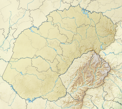
 Location of the Debeerspruit in the Free State | |
| Location | |
| Country | |
| Province | Free State |
| District municipality | Thabo Mofutsanyana |
| Local municipalities | Setsoto, Dihlabeng |
| Physical characteristics | |
| Source | |
| • coordinates | 28°09′52″S 27°44′55″E / 28.16444°S 27.74861°E |
| Mouth | |
• coordinates | 28°21′34.3″S 27°52′10.8″E / 28.359528°S 27.869667°E |
| Length | about 24 km [citation needed] |
| Basin features | |
| River system | Orange River |
Debeerspruit
[edit]Debeerspruit is a small stream in the central interior of the Free State, South Africa. The name Debeerspruit appears on Getamap.net (accessed 31 July 2025)[1] and is also listed by Geonames.org[2]. It forms part of the Orange River watershed and is a tributary of the Sand River (Free State), which itself feeds into the Vaal River[3].
Geography
[edit]Debeerspruit flows near the town of Senekal, which lies just north of the stream’s course. It is a recognisable feature on local maps and within the surrounding farming areas. The N5 road — connecting Senekal and Paul Roux — crosses the Debeerspruit and serves as a key route for the region.
The stream originates near 28°09′52″S 27°44′55″E / 28.16444°S 27.74861°E / (-28.164813, 27.749059), within the Setsoto Local Municipality, at an elevation of approximately 1,472 metres (4,829 ft). From its source, it flows southeast, traversing rural land between Arlington and Senekal, and heading towards Rosendal. It enters the Dihlabeng Local Municipality around 28°21′34.3″S 27°52′10.8″E / 28.359528°S 27.869667°E.
A road sign at the crossing simply reads "De Beer[4]", likely a shortened form of "Debeerspruit", as and symbol on sign, the nearby landscape and map context makes the full name unnecessary. This sign is visible on the N5 between Senekal and Paul Roux and can be viewed via Street View on Google Maps
Hydrology
[edit]Debeerspruit branches off from the Sand River, a tributary of the Vaal River, which itself is part of the Orange River system, which is South Africa’s largest river basin.
Significance
[edit]Though minor in size, Debeerspruit contributes to local agricultural hydrology and falls within the Upper Orange Water Management Area, which is largely contained within the Free State.
Etymology
[edit]The name Debeerspruit is formed from "De Beer," which is a common surname of Dutch origin, and spruit, meaning "stream" or "brook" in Afrikaans. The use of both elements together—De Beer and spruit—can be understood as "De Beer’s stream."
No other formal names for the stream have been recorded, though variations such as “De Beer Spruit” or “De Beer se spruit” may appear in informal or local usage, particularly in spoken Afrikaans.
Coordinates
[edit]Source: 28°09′52″S 27°44′55″E / 28.16444°S 27.74861°E
Mouth: 28°21′34.3″S 27°52′10.8″E / 28.359528°S 27.869667°E [citation needed]
References
[edit]- Amptelike plekname in die Unie en Suidwes-Afrika, Page 89 [1]
- Sand River (Free State) – tributary system overview
- Department of Water Affairs & Forestry – Upper Orange Water Management Area: DWS Official Document
- Orange River basin overview: Infosa.co.za
- Street View image of Debeerspruit sign on the N5 road
External links
[edit]Wikimedia Commons has media related to Debeerspruit.
- Debeerspruit on Wikipedya [3]
- Department of Water Affairs & Forestry – Upper Orange Water Management Area
- Definition of "spruit" at Dictionary.com
- Getamap.net – Map of Debeerspruit, Free State, South Africa
- deBeerspruit [4]
- deBeerspruit Geoname [5]
- History of the Batswana Page 357 [6]
- Orange River basin overview
- Orange-Senqu River Commission (ORASECOM) Archived 27 July 2013 at the Wayback Machine
- The War Letters of an English Burgher By Reggie Mostyn Cleave, Page 11 [7]
- What is a river basin? at internetgeography.net [8]
Suggested Wikimedia Commons File
[edit]Filename: Debeerspruit_Free_State_South_Africa_coord_map.png
Description: Map showing the path of the Debeerspruit creek in the Free State province of South Africa.
Source: Based on OpenStreetMap/topographic mapping.
License: CC BY-SA 4.0 or compatible public domain source.
- ^ Debeerspruit name observed on Getamap.net (accessed 31 July 2025).
- ^ Debeerspruit sa Geonames.org (cc-by); post updated 2012-01-18; database download sa 2017-02-28
- ^ https://core.ac.uk/download/pdf/196546504.pdf
- ^ Street View image of Debeerspruit sign on the N5 road
- ^ Map of the Orange-Senqu River Basin. Retrieved from ResearchGate


