Demoso Township
Appearance
Demoso Township
ဒီမောဆိုးမြို့နယ် | |
|---|---|
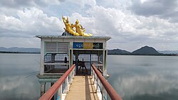
 Ngwe Taung Dam located within Demoso Township | |
 Location in Demoso district | |
| Country | |
| State | |
| District | Demoso District |
| Capital | Demoso |
| Area | |
• Total | 459.69 sq mi (1,190.6 km2) |
| Elevation | 2,982 ft (909 m) |
| Population (2023)[1] | 92,077 |
| Time zone | UTC+6:30 (MMT) |
Demoso Township (Burmese: ဒီမောဆိုးမြို့နယ်) is a township in Demoso District in the western part of Kayah State in Myanmar. The township has two towns- the principal town of Demoso and the town of Nanmekhon, which combined comprise a total of five urban wards. The township also contains 173 villages grouped into 25 village tracts.[1] In 2022, Demoso Township and its western neighbour Hpruso Township were made into their own district by the Ministry of Home Affairs.[2] [3]
References
[edit]- ^ a b General Administration Department (March 2023). Einme Myone Daethasaingyarachatlatmya အိမ်မဲမြို့နယ် ဒေသဆိုင်ရာအချက်လက်များ [Einme Township Regional Information] (PDF) (Report). Retrieved 22 December 2024.
- ^ "Expansion and Amendment of districts in Bago Region". 30 April 2022.
- ^ "Expansion of new districts in Nay Pyi Taw, regions and states". 2 May 2022.
19°32′18″N 97°09′32″E / 19.538319°N 97.158813°E

