
Copper Mountain, Colorado
Copper Mountain, Colorado | |
|---|---|
 Tucker Mountain at Copper Mountain Resort. | |
 Location of the Copper Mountain CDP in Summit County, Colorado. | |
 Copper Mountain Location of the Copper Mountain CDP, Colorado.  Copper Mountain Copper Mountain (Colorado) | |
| Coordinates: 39°30′24″N 106°08′32″W / 39.5067°N 106.1422°W[2] | |
| Country | United States |
| State | Colorado |
| County | Summit[1] |
| Government | |
| • Type | unincorporated community |
| • Body | Summit County[1] |
| Area | |
• Total | 32.058 sq mi (83.030 km2) |
| • Land | 32.058 sq mi (83.030 km2) |
| • Water | 0.000 sq mi (0.000 km2) |
| Elevation | 9,695 ft (2,955 m) |
| Population | |
• Total | 650 |
| • Density | 20/sq mi (7.8/km2) |
| Time zone | UTC−07:00 (MST) |
| • Summer (DST) | UTC−06:00 (MDT) |
| ZIP code[5] | (Frisco) 80443 |
| Area codes | 970/748 |
| GNIS place ID | 196501 |
| GNIS CDP ID | 2583226 |
| FIPS code | 08-17150 |
| Website | https://www.coppercolorado.com/ |
Copper Mountain is an unincorporated community and a census-designated place (CDP) located in and governed by Summit County, Colorado, United States. The CDP is a part of the Breckenridge, CO Micropolitan Statistical Area. The population of the Copper Mountain CDP was 650 at the United States Census 2020.[4] The Copper Mountain Consolidated Metropolitan District provides services. The Frisco post office (Zip Code 80443) serves the area.[5] The Copper Mountain CDP includes the Copper Mountain Ski Resort and Copper Mountain village.
History
[edit]Copper Mountain was originally named "Wheeler" for a local judge and developer. The Wheeler, Colorado, post office operated from April 1, 1880, until May 14, 1894.[6] The Town of Wheeler incorporated as a statutory town, but was declared abandoned in 2005.[a]
The Copper Mountain Ski Resort opened in 1972, and wished to change the former town's name. The naming question was settled by a decision from the Board on Geographic Names, which ruled in favor of "Copper Mountain" in 1977.[2] The Copper Mountain, Colorado, post office opened on September 8, 1977, but the Frisco, Colorado, post office (ZIP code 80443) now serves the area.[5]
Geography
[edit]Copper Mountain is located approximately 20 miles (32 km) north-northeast of Leadville in the White River National Forest.
At the 2020 United States Census, the Copper Mountain CDP had an area of 20,517 acres (83.030 km2), all land.[3]
Demographics
[edit]The United States Census Bureau initially defined the Copper Mountain CDP for the United States Census 2010.
| Year | Pop. | ±% |
|---|---|---|
| 2010 | 385 | — |
| 2020 | 650 | +68.8% |
| Source: United States Census Bureau | ||
See also
[edit]- Breckenridge, CO Micropolitan Statistical Area
- Copper Mountain Ski Resort
- List of census-designated places in Colorado
- List of populated places in Colorado
- List of post offices in Colorado
- White River National Forest
Notes
[edit]- ^ In 2005, the Colorado Secretary of State declared the Summit County towns of Boston, Braddoks, Carbonateville, Clinton City, Conger’s Camp, Cow Camp, Curtin, Decatur, Delaware Flats, Dickey, Dyersville, Excelsior, Farnham, Keystone, Kokomo, Lakeside, Lincoln, Masontown, Naomi, Parkville, Recen, Rexford, Robinson, Saints John, Swan City, Swandyke, Tiger, Uneva Lake, Valdoro, Wapiti, and Wheeler abandoned.
References
[edit]- ^ a b "Colorado Counties". Colorado Department of Local Affairs. Retrieved July 26, 2025.
- ^ a b c "Copper Mountain". Geographic Names Information System. United States Geological Survey, United States Department of the Interior. Retrieved July 26, 2025.
- ^ a b "State of Colorado Census Designated Places - BAS20 - Data as of January 1, 2020". United States Census Bureau. Retrieved December 27, 2020.
- ^ a b United States Census Bureau. "Copper Mountain CDP, Colorado". Retrieved April 13, 2023.
- ^ a b c "ZIP Code Lookup". United States Postal Service. Retrieved July 26, 2025.
- ^ Bauer, William H.; Ozment, James L.; Willard, John H. (1990). Colorado Post Offices 1859–1989. Golden, Colorado: Colorado Railroad Historical Foundation. ISBN 0-918654-42-4.
External links
[edit] Media from Commons
 Travel information from Wikivoyage
- State of Colorado
- Copper Mountain @ Colorado.com
- Copper Mountain @ UncoverColorado.com
- Copper Mountain Consolidated Metropolitan District website
- Copper Mountain Resort Association website
- Copper Mountain Ski Resort website
- Summit County website
- White River National Forest website
Municipalities and communities of Summit County, Colorado, United States | ||
|---|---|---|
| Towns | 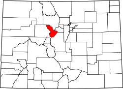 | |
| CDPs | ||
| Ghost towns |
| |
| International | |
|---|---|
| National | |