
Chromo, Colorado
Chromo, Colorado | |
|---|---|
 Entering Chromo from the south on U.S. Route 84. | |
 Chromo Location of Chromo, Colorado.  Chromo Chromo (Colorado) | |
| Coordinates: 37°02′11″N 106°50′36″W / 37.0364°N 106.8434°W[2] | |
| Country | United States |
| State | Colorado |
| County | Archuleta[1] |
| Government | |
| • Type | unincorporated community |
| • Body | Archuleta County[1] |
| Elevation | 7,284 ft (2,220 m) |
| Time zone | UTC−07:00 (MST) |
| • Summer (DST) | UTC−06:00 (MDT) |
| ZIP code[3] | 81128 |
| Area code | 719 |
| GNIS place ID | 191038 |
Chromo is an unincorporated community and U.S. Post Office in Archuleta County, Colorado, United States. The Chromo Post Office has the ZIP Code 81128.[3]
The community takes its name from nearby Chromo Mountain.[4]
History
[edit]Historically, the Ute people lived in the Chromo area. The Chromo, Colorado, post office opened on October 30, 1885.[5] In 1922 the Chromo School was built to serve the children in the area and operated from 1922 to 1954. The original school building, a concrete structure, now functions as a community center. The well-preserved building is an example of a rural school complex, containing a teacherage and an outhouse.[6]
Geography
[edit]
The Little Navajo River and Navajo River flow through the community.
Climate
[edit]This climatic region is typified by large seasonal temperature differences, with warm to hot (and often humid) summers and cold (sometimes severely cold) winters. According to the Köppen Climate Classification system, Chromo has a humid continental climate, abbreviated "Dfb" on climate maps.[7]
Education
[edit]The Archuleta County School District serves Chromo.
See also
[edit]References
[edit]- ^ a b "Colorado Counties". Colorado Department of Local Affairs. Retrieved July 8, 2025.
- ^ a b "Chromo, Colorado". Geographic Names Information System. United States Geological Survey, United States Department of the Interior. Retrieved July 8, 2025.
- ^ a b "ZIP Code Lookup". United States Postal Service. Retrieved July 8, 2025.
- ^ Dawson, John Frank (1954). Place names in Colorado: why 700 communities were so named, 150 of Spanish or Indian origin. Denver, CO: The J. Frank Dawson Publishing Co. p. 13.
- ^ Bauer, William H.; Ozment, James L.; Willard, John H. (1990). Colorado Post Offices 1859–1989. Golden, Colorado: Colorado Railroad Historical Foundation. ISBN 0-918654-42-4.
- ^ "Chromo School". History Colorado. Retrieved 21 November 2021.
- ^ Climate Summary for Chromo, Colorado
External links
[edit]Municipalities and communities of Archuleta County, Colorado, United States | ||
|---|---|---|
| Town | 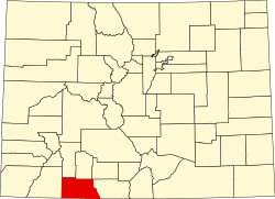 | |
| CDP | ||
| Unincorporated communities | ||
| Ghost towns | ||
| Indian reservation | ||
| Footnotes | ‡This populated place also has portions in an adjacent county or counties | |