
Cathedral, Colorado
Cathedral, Colorado | |
|---|---|
 Location of the Cathedral CDP in Hinsdale County, Colorado. | |
 Cathedral Location of Cathedral, Colorado.  Cathedral Cathedral (Colorado) | |
| Coordinates: 38°05′45″N 107°02′02″W / 38.0958°N 107.0339°W[2] | |
| Country | United States |
| State | Colorado |
| County | Hinsdale[1] |
| Government | |
| • Type | unincorporated community |
| • Body | Hinsdale County[1] |
| Area | |
• Total | 21.279 sq mi (55.113 km2) |
| • Land | 21.279 sq mi (55.113 km2) |
| • Water | 0.000 sq mi (0.000 km2) |
| Elevation | 8,914 ft (2,717 m) |
| Population | |
• Total | 15 |
| • Density | 0.70/sq mi (0.27/km2) |
| Time zone | UTC−07:00 (MST) |
| • Summer (DST) | UTC−06:00 (MDT) |
| ZIP code[5] | Powderhorn 81243 |
| Area code(s) | 970/748 |
| GNIS pop ID | 188761 |
| GNIS CDP ID | 2583219 |
| FIPS code | 08-12450 |
Cathedral is a census-designated place (CDP) located in Hinsdale County, Colorado, United States. The population of the Cathedral CDP was 15 at the United States Census 2020.[4]
History
[edit]The Cathedral, Colorado, post office operated from July 18, 1898, until September 30, 1921.[6] The Powderhorn, Colorado, post office (Zip Code 81243) now serves the area.[5]
Geography
[edit]Cathedral is located in the northeast corner of Hinsdale County on the east side of Cebolla Creek, a north-flowing tributary of the Gunnison River. The community is at the junction of County Roads 50 and 45. County Road 50 leads southwest (upstream) 15 miles (24 km) to Colorado State Highway 149 at Slumgullion Pass, from which point Lake City, the Hinsdale County seat, is 9 miles (14 km) to the northwest. County Road 50 also leads north (downstream) from Cathedral into Gunnison and eventually via County Road 27 16 miles (26 km) to Highway 149 at Powderhorn.
The Cathedral CDP has an area of 13,619 acres (55.113 km2), all land.[3]
Demographics
[edit]| Year | Pop. | ±% |
|---|---|---|
| 2010 | 14 | — |
| 2020 | 15 | +7.1% |
| Source: United States Census Bureau | ||
The United States Census Bureau initially defined the Cathedral CDP for the United States Census 2010.
See also
[edit]References
[edit]- ^ a b "Colorado Counties". Colorado Department of Local Affairs. Retrieved May 28, 2025.
- ^ a b "Cathedral, Colorado". Geographic Names Information System. United States Geological Survey, United States Department of the Interior. Retrieved May 28, 2025.
- ^ a b "State of Colorado Census Designated Places - BAS20 - Data as of January 1, 2020". United States Census Bureau. Retrieved December 22, 2020.
- ^ a b United States Census Bureau. "Cathedral CDP, Colorado". Retrieved April 5, 2023.
- ^ a b "ZIP Code Lookup". United States Postal Service. Retrieved May 28, 2025.
- ^ Bauer, William H.; Ozment, James L.; Willard, John H. (1990). Colorado Post Offices 1859–1989. Golden, Colorado: Colorado Railroad Historical Foundation. ISBN 0-918654-42-4.
External links
[edit]Municipalities and communities of Hinsdale County, Colorado, United States | ||
|---|---|---|
| Town | 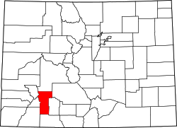 | |
| CDPs | ||
| Ghost town | ||