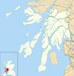
Carradale Point Fort
Dun Carradale | |
| Location | Carradale, Argyll and Bute, Scotland |
|---|---|
| Region | Kintyre Peninsula |
| Type | Hillfort, Vitrified fort |
| Area | Approx. 0.1 hectares |
| History | |
| Founded | Iron Age |
| Periods | Iron Age Scotland |
| Cultures | Celtic |
| Site notes | |
| Condition | Earthworks and stone walls remain |
| Public access | Yes |
Carradale Point Fort (also known locally as Dun Carradale) is a vitrified Iron Age hillfort situated on the summit of Carradale Point, a prominent rocky headland near the village of Carradale in Argyll and Bute, Scotland. The fort is positioned at about 15 metres above sea level and overlooks the Kilbrannan Sound and the Isle of Arran. Its dramatic setting on an elongated peninsula means that at high tide, the site can be partially cut off from the mainland, adding to its natural defences.[1][2][3]
Structure and Dimensions
[edit]The fort measures approximately 56.5 metres by 23 metres internally. Its core defences consist of a continuous stone wall, now mostly visible as a low, grass-grown bank about 4.5 metres thick. Large masses of vitrified core material, where the stones were fused by intense heat, still protrude from the wall in several places, particularly on the eastern side where they reach up to 1.5 metres in height.[1][2]
Entrances and Outworks
[edit]A gap in the bank between two large vitrified masses on the south-east may mark the original entrance. Additional defences were constructed to restrict access from the shore. These outworks include a grass-grown stony bank about 5.5 metres thick that runs up the slope to meet the main wall just south of the entrance. The fact that this bank is not bonded to the main wall suggests it was a later addition, possibly intended to reinforce the entrance approach against attack from the south.[1][3]
Defensive Features
[edit]Short lengths of walling and stone facings block the natural gullies that lead up from the shore, forming extra barriers to approach. These include stretches of surviving outer facing stones and bands of rubble core recorded by early surveys. Inside the fort, sinuous scarps are visible, which may be the result of quarrying or landscaping done during the original construction phase.[1][2][3]
Modern Condition and Survey
[edit]Surveys carried out by David Christison in 1898 and the Royal Commission on the Ancient and Historical Monuments of Scotland (RCAHMS) in 1971 provide detailed accounts of the fort’s surviving features. Some sections noted by Christison on the northwest have since deteriorated or disappeared, while new exposures of outer facing stones have been recorded in more recent visits. An oval depression north of the fort, not mentioned in earlier accounts, is thought to be of modern origin.[1]
Archaeology and Description
[edit]Although only earthworks and low stone walls remain today, Carradale Point Fort retains much of its original outline. The fort is roughly oval in shape, measuring approximately 50 metres by 25 metres. The defensive ramparts, constructed from stone and turf, enclose a slightly elevated interior platform that likely housed timber structures, possibly roundhouses typical of the Iron Age in western Scotland.[1][3]
Surveys indicate that the main entrance was probably located on the less steep western approach. The surrounding rock outcrops were skillfully integrated into the defensive design, demonstrating how Iron Age communities adapted natural landscapes for security.[3]
Historical Context
[edit]Carradale Point Fort is part of a wider network of coastal hillforts and duns scattered throughout the Kintyre and Cowal peninsulas. These sites reflect a period when local communities organized themselves into small, fortified settlements. Scholars suggest such forts were not just military structures but also centres of local power and symbols of status.[4]
The Iron Age in Scotland, roughly spanning from 700 BCE to 500 CE, saw significant developments in settlement patterns, social organization, and material culture. Coastal forts like Carradale Point may have served as defensive refuges during periods of conflict, while also functioning as hubs for trade and communication across the Firth of Clyde.[4]
See also
[edit]Notes
[edit]- ^ a b c d e f "Carradale Point". Historic Environment Scotland / Canmore. Retrieved 4 July 2025.
- ^ a b c "SC2452 Carradale Point, Argyll (Kilbrannan Sound)". Atlas of Hillforts of Britain and Ireland (University of Oxford). Retrieved 4 July 2025.
- ^ a b c d e "Poetry Magazine, Volume 58, Issue 5, Page 27". Poetry Foundation. Poetry Foundation. Retrieved 4 July 2025.
- ^ a b The Iron Age of west central Scotland (PDF) (PhD thesis). Durham University. 2021. Retrieved 4 July 2025.

