Canfield Mountain
| Canfield Mountain | |
|---|---|
 West face of Canfield Mountain, viewed from U.S. Route 95 | |
| Highest point | |
| Elevation | 4,162 ft (1,269 m)[1] |
| Prominence | 602 ft (183 m) |
| Coordinates | 47°44′00″N 116°43′36″W / 47.73333°N 116.72667°W |
| Geography | |
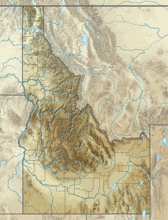
| Location | Kootenai County, Idaho, United States |
| Parent range | Coeur d'Alene Mountains, Bitterroot Range, Rocky Mountains |
| Topo map | USGS Coeur d'Alene |
Canfield Mountain is a forested ridge on the eastern edge of Coeur d'Alene in Kootenai County, northern Idaho, United States. The highest point, often labeled West Canfield Butte, reaches about 4,162 feet (1,269 m) above sea level.[2][1]
Geography
[edit]The ridge marks the southern terminus of the Coeur d'Alene Mountains, a sub-range of the Bitterroot Range within the northern Rocky Mountains.[3][4] Steep western slopes drop directly toward residential Coeur d'Alene and the Prairie Trail corridor, while gentler eastern flanks merge into Idaho Panhandle National Forests land that drains toward the Hayden Lake basin.[4]
Recreation
[edit]At the base of the west slope, the Canfield Mountain Natural Area—an open-space park owned by the City of Coeur d'Alene—covers about 24 acres (9.7 ha) and links to a large network of federal trails.[5]
Beyond the city parcel, the U.S. Forest Service manages the Canfield Mountain Trail System, offering more than 32 miles (51 km) of single-track popular with hikers, mountain-bikers and motor-bike riders.[6][7] A gated Forest Service road (Trail #1562) climbs the main ridge to a cluster of radio towers near the summit; lower spurs provide vista points overlooking downtown Coeur d'Alene, Lake Coeur d'Alene and the Spokane River valley.[6]
Wildfire history and 2025 ambush
[edit]The south-west slopes carry heavy second-growth timber and have seen several small wildfires, including a 5-acre blaze contained in August 2020.[8]
On June 29 2025, a deliberately set brush fire and ensuing ambush left two firefighters dead and another wounded, drawing national attention to the area.[9]
See also
[edit]References
[edit]- ^ a b "West Canfield Butte". United States Geological Survey. Retrieved June 30, 2025.
- ^ "West Canfield Butte, Idaho". Peakbagger.com. Retrieved June 30, 2025.
- ^ "Bitterroot Range – Mountains of Idaho & Montana". United States Geological Survey. 2023. Retrieved June 30, 2025.
- ^ a b Surficial Geologic Map of Part of the Mount Coeur d'Alene Quadrangle, Kootenai Co., Idaho (PDF) (Map). 1:24,000. Idaho Geological Survey. 2022. Retrieved June 30, 2025.
- ^ "Canfield Mountain Natural Area". City of Coeur d'Alene. Retrieved June 30, 2025.
- ^ a b "Canfield Mountain Single Track Trail System". U.S. Forest Service. Retrieved June 30, 2025.
- ^ "Canfield Mountain Trail System". Visit Idaho. Retrieved June 30, 2025.
- ^ "Firefighters knock down 5-acre blaze on Canfield Mountain". The Spokesman-Review. August 5, 2020. Retrieved June 30, 2025.
- ^ "Idaho firefighter shooting: What we know about the deadly ambush on Canfield Mountain". The Washington Post. June 30, 2025. Retrieved June 30, 2025.

