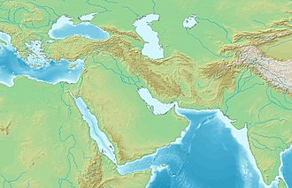
Barka, Oman
Barka
Barkāʾ (بَرْكَاء) Borca | |
|---|---|
 | |
| Coordinates: 23°41′47.1″N 57°53′16.0″E / 23.696417°N 57.887778°E | |
| Country | |
| Subdivision | Al Batinah South Governorate |
| Population (2017) | |
• Total | 130,000 |
| Time zone | UTC+4:00 United Arab Emirates Standard Time |
Barka (Arabic: بَرْكَاء, romanized: Barkāʾ) is a coastal city and Wilayah (Province) in the region Al Bāţinah, in northern Oman. Bordered by the Sea of Oman and the Hajar Mountains in southern Batinah, Barka is about a half-hour drive from As-Seeb and roughly an hour's drive from Al-Khuwair and Ruwi.
History
[edit]
Barka was destroyed in 865 CE.[1] Mohammad Taqi Khan Shirazi led a military campaign in Oman in 1738, and unsuccessfully besieged Barka on 25 May.[2]
Construction on Barka Castle started under Saif bin Sultan and was completed during the reign of Ahmad bin Said al-Busaidi.[3]
Barka was seized by rebels at the outbreak of the Muscat rebellion, but were driven from the town by the HMS Fox and HMS Dartmouth in 1914.[4]
Demographics
[edit]Barka has a community of Indian merchants in the 1910s.[5] A community of Al-Lawatia exist in Barka.[6]
Attractions
[edit]
Nearby is Bait Na'aman (Nu'man), a four-towered fort of Imam Bil'arab bin Sultan of the 17th century, renovated in 1991.[7]
Economy
[edit]Al Bloushi, Al-Farsi, Al Zadjali, Al Habsi, Al Ajmi, Al Owaisi, Al Amri, Al Badri and Al Raisi tribes live here. The area is known for its agricultural beauty, fishing, and traditional pastimes like horse and camel racing, halwa making, and Omani-style bullfighting.[8]
A new quarter is now under construction in Sawadi, called the Blue City. The development is 8 km from Sawadi beach, and many international companies are involved in Barka development projects. There is an estimated $15 billion in new construction currently taking place here. Barka is the site of several power and water plants, including:
- The Barka 2 water and power plant, with generation capacity of 678 MW and desalination capacity of 26.4 million gallons of potable water per day.[9]
- The Barka 3 gas turbine power plant, with generation capacity of 744 MW, sponsored by Engie, Yonden and Sojitz.[10]
- A new 281,000 m³/d desalination plant is to be commissioned: Itochu, Degrémont and International Power were named preferred bidders in 2015.[11]
See also
[edit]References
[edit]- ^ Yule 2014, p. 55.
- ^ Lockhart 1935, p. 164.
- ^ The Jewel of Barka 2017.
- ^ Prasad 1998, pp. 939–940.
- ^ Sachedina 2021, p. 30.
- ^ Valeri 2010, p. 254.
- ^ "Bait Na'aman". Al Batinah and Al Dhahirah Guide. Rough Guides.
- ^ "5 Reasons To Love Barka". Times of Oman. 24 April 2016. Retrieved 1 December 2019.
- ^ "Barka 2 Independent Water & Power Project". Mubadala. Retrieved 10 November 2015.
- ^ "Commercial Operations of Sohar 2 and Barka 3 IPP Projects in Oman Start". Sojitz Corporation. Retrieved 10 November 2015.
- ^ "Oman names preferred bidders for Sohar and Barka projects". The International Desalination & Water Reuse Quarterly. 21 October 2015. Retrieved 10 November 2015.
Works cited
[edit]Books
[edit]- Sachedina, Amal (2021). Cultivating the Past, Living the Modern: The Politics of Time in the Sultanate of Oman. Cornell University Press. ISBN 9781501758621.
- Yule, Paul (2014). Cross-roads: Early and Late Iron Age South-eastern Arabia. Harrassowitz Verlag. ISBN 9783447192873.
Journals
[edit]- Lockhart, Laurence (1935). "Nādir Shāh's Campaigns in 'Omān, 1737-1744". Bulletin of the School of Oriental Studies, University of London. 8 (1). Cambridge University Press: 157–171. doi:10.2307/608108. JSTOR 608108.}
- Prasad, Y. (1998). "British Interests and the Use of Indian Resources in the Persian Gulf During the Oman Revolt (1913-1920)". Proceedings of the Indian History Congress. 59. Indian History Congress: 934–943. doi:10.2307/44147066. JSTOR 44147066.}
- Valeri, Marc (2010). "High Visibility, Low Profile: The Shi'a in Oman Under Sultan Qaboos". International Journal of Middle East Studies. 42 (2). Cambridge University Press: 251–268. doi:10.2307/40784725. JSTOR 40784725.}
News
[edit]- "The Jewel of Barka". Oman Daily Observer. 7 November 2017. Archived from the original on 7 July 2025.
Further reading
[edit]- Westermann, Großer Atlas zur Weltgeschichte (in German)


