Bairiga
| Bairiga | |
|---|---|
| Ruoni | |
 Ruoni and Lopchin | |
| Highest point | |
| Elevation | 6,882 m (22,579 ft)[1] |
| Prominence | 2,444 m (8,018 ft)[2] |
| Listing | |
| Coordinates | 29°09′57″N 96°43′27″E / 29.16583°N 96.72417°E[2] |
| Geography | |
| Location | Tibet Autonomous Region, China |
| Parent range | Kangri Garpo |
| Climbing | |
| First ascent | unclimbed |
| Easiest route | snow/ice/glacier climb |
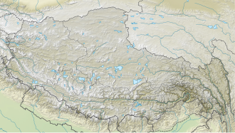
Bairiga (Chinese: 白日嘎; pinyin: Bái Rì Gä) or Ruoni (Chinese: 若尼峰; pinyin: Ruò Ní Fēng) (6,882 m) is the highest peak of Kangri Garpo Range of southeast Tibet Autonomous Region. The region has only recently been explored,[3] and before 2009 none of its 47 peaks above 6,000 m had been climbed. Bairiga / Ruoni, which remains unclimbed itself, was photographed for the first time in 1933 by the botanist explorer Frank Kingdon-Ward, at which time it was known as Choembo. [4]
In October 2003, a Japanese team attempted to climb Ruoni I via the northeast ridge. Some progress was made above two different Camp Is but avalanche risk, a huge snow cornice and a 10 day snow fall stopped the team from finding a suitable route to the summit.[5]
In 2009, a Sino-Japanese joint climbing team formed by China University of Geosciences (Wuhan) and Kobe University organized an expedition to climb Kangri Garpo II or Ruoni II (6,805 m).[6][7] On November 5, Deqing Ouzhu and Ciren Danda, Tibetan students with the CUG, were the first to reach the summit, while Koichiro Kondo and Masanori Yazaki scaled the peak two days later. In consultation with a local village leader Kangri Garpo II was renamed Lopchin (Lopchin Feng in Tibetan, Lou bu qin in Chinese), meaning "white male hawk".[8]
See also
[edit]References
[edit]- ^ "Bairiga". Peakbagger.com. Retrieved 2010-03-09.
- ^ a b "Tibet Ultra-Prominences". Peaklist.org. Retrieved 2011-11-24.
- ^ Nakamura, Tamotsu (2001). "Kangri Garpo Range". Himalayan Journal. 57. Retrieved 2025-07-10.
- ^ Tatsuo "Tim" Inoue (2011), Hidden 47 Six-thousanders in the Kangri Garpo Mountains, Japanese Alpine News 2011
- ^ Hirai, Kazumasa (2004). "Mt. Ruoni, attempt". Climbs And Expeditions. American Alpine Journal. 46 (78). Translated by Tamotsu Nakamura. American Alpine Club: 431. Retrieved 2025-07-10.
- ^ "中国地质大学体育部". Archived from the original on 2011-07-07. Retrieved 2009-11-16. (in Chinese)
- ^ http://osaka.yomiuri.co.jp/university/topics/20091108-OYO8T00293.htm?from=sub[permanent dead link] (in Japanese)
- ^ Inoue, Tatsuo “Tim” (2010). "Kangri Garpo Mountains, Lopchin (Kangri Garpo II)". Climbs And Expeditions. American Alpine Journal. 52 (84). American Alpine Club: 354. Retrieved 2025-07-10.
External links
[edit]- https://web.archive.org/web/20110615025954/http://www.kobe-u.ac.jp/info/topics/pdf/t2009_10_07_01.pdf 神戸大学・中国地質大学(武漢) 崗日嗄布(カンリガルポ)山群合同学術登山隊計画 (in Japanese)
- kangri_garpo_photos (in Japanese)
- https://web.archive.org/web/20110720032653/http://www.hb.xinhuanet.com/newscenter/2009-11/11/content_18199470.htm (in Chinese)


