Ushant Airport
Appearance
Ushant Airport Aéroport d'Ouessant | |||||||||||
|---|---|---|---|---|---|---|---|---|---|---|---|
 | |||||||||||
| Summary | |||||||||||
| Airport type | Public | ||||||||||
| Operator | Commune d'Ouessant | ||||||||||
| Serves | Ushant | ||||||||||
| Location | Lampaul, Ushant | ||||||||||
| Elevation AMSL | 142 ft / 43 m | ||||||||||
| Coordinates | 48°27′49″N 005°03′43″W / 48.46361°N 5.06194°W | ||||||||||
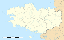
| Map | |||||||||||
 | |||||||||||
| Runways | |||||||||||
| |||||||||||
Source: French AIP[1] | |||||||||||
Ushant Airport (French: Aéroport d'Ouessant; Breton: Aerborzh Ushant) (IATA: OUI, ICAO: LFEC), is an airport serving the French island of Ushant. It is located in the commune of Lampaul within the département of Finistère.[1]
Airlines and destinations
[edit]The following airlines operate regular scheduled and charter flights at Ushant Airport:
| Airlines | Destinations |
|---|---|
| Finist'air | Brest[2] |
Statistics
[edit]This graph was using the legacy Graph extension, which is no longer supported. It needs to be converted to the new Chart extension. |
Annual passenger traffic at LFEC airport.
See Wikidata query.
References
[edit]- ^ a b LFEC – OUESSANT. AIP from French Service d'information aéronautique, effective 10 July 2025.
- ^ "LIST OF PUBLIC SERVICE OBLIGATIONS" (PDF). Aeroroutes.com. 11 March 2024. Retrieved 4 January 2025.
External links
[edit]


