
Tabuk, Saudi Arabia
Tabuk
تَبُوْك | |
|---|---|
 Skyline of Tabuk | |
 Tabuk Location in Saudi Arabia  Tabuk Tabuk (Middle East)  Tabuk Tabuk (West and Central Asia) | |
| Coordinates: 28°23′50″N 36°34′44″E / 28.39722°N 36.57889°E | |
| Country | |
| Province | Tabuk |
| Governorate | Tabuk |
| Elevation | 760 m (2,490 ft) |
| Population (2022 census)[1] | |
• City | 594,350 |
| • Metro | 623,665 (Tabuk Governorate) |
| GDP (PPP, constant 2015 values) | |
| • Year | 2023 |
| • Total (Metro) | $29.6 billion[2] |
| • Per capita | $43,100 |
| Time zone | UTC+3 (AST) |
| Area code | +966 14 |
Tabuk (Arabic: تَبُوْك Tabūk, Arabic: [taˈbu:k]) is the capital city of the Tabuk Province in northwestern Saudi Arabia. It has a population of 594,350 (as of 2022). It is close to the Jordan–Saudi Arabia border and houses the largest air force base in Saudi Arabia.[3]
History and prehistory
[edit]Tabuk Province is rich in antiquities and archaeological sites such as petroglyphs, inscriptions, forts, palaces, sections of the Syrian and Egyptian pilgrimage (Hajj) routes, aswell as remains of the Hejaz railway, an important station of which is located in Tabuk.
Hundreds of localities with rock art and inscriptions dating to different archaeological periods ranging from the Paleolithic to the Islamic period were recorded at Wadi Dam and the region west of Tabuk. A study of the art revealed rich stylistic variability with representations of both human and animal figures. Numerous sites in the area with Thamudic, Greek and Nabataean inscriptions have been found.
The ancient region of Midian roughly corresponds to what is now the Tabuk Province.[4] According to tradition, a fortified place belinging to the Aṣ-ḥāb al-Aykah ("Companions of the Wood"), the term used in the Quran for the Midianites,[5][6][7][8] is identified with Tabuk or even its fort, although the extant one is less than five centuries old.
2nd-century Alexandrine geographer Ptolemy mentioned a place by the name 'Tabawa', at the northwestern corner of Arabia. This name may be a reference to 'Tabuka' or 'Tabuk'. If this is true, the town may be as old as Ptolemy's time. Pre-Islamic Arab poets such as Antra and Nabiqa mention the mountain 'Hasmi' in their poems.[citation needed]
Tabouk became famous for the Expedition of Tabuk in 630, during the period of the Islamic prophet Muhammad. Since then, it remained a gateway to North Arabia.
Ain Sukkrah is an ancient ‘ayn (Arabic: عَيْن, romanized: spring) dating back to Pre-Islamic Arabia ("Era of Ignorance").[clarification needed] It is remembered that Muhammad camped for more than ten days near the spring during the expedition of Tabuk, and drank from its water.[9]

The Hajj fort of Tabuk we see today dates back to the 16th century, during the Ottoman period and has been restored many times since. Several forts and stations were built along the Syrian Hajj (pilgrimage) route, from Damascus to Medina, to welcome and protect the pilgrims performing the Hajj. The fort consists of two floors built around an open courtyard with a mosque, a well, and a stairway leading to the watch towers used by the guards. The Tabuk fort is considered a historical landmark of the region and is open to visitors.
Tabuk was visited by Charles Montagu Doughty in 1877.
Tabuk was captured by the Arab forces in 1918, three weeks after the British capture of Damascus.[10]
Tabuk became a centre of military activity during the 1991 Gulf War as the city faced threats from Iraqi Scud missiles and air attacks.[citation needed]
Demographics
[edit]In 1950, Tabuk had a population of 12,000. By 2022, this number had grown to 594,350.[1]
Education
[edit]Universities include:
Private schools include:
- British International School of Tabuk
- International Indian School Tabuk
- Pakistan International School of Tabuk
- Philippine International School
- King Abdulaziz Model schools
- Tabuk International School
- Bangladesh International School, Tabuk
-
-
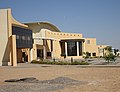
 British International School of Tabuk


Geography and climate
[edit].jpg)
| Climate data for Tabuk (1991–2020) | |||||||||||||
|---|---|---|---|---|---|---|---|---|---|---|---|---|---|
| Month | Jan | Feb | Mar | Apr | May | Jun | Jul | Aug | Sep | Oct | Nov | Dec | Year |
| Record high °C (°F) | 28 (82) |
29 (84) |
35 (95) |
37 (99) |
41 (106) |
42 (108) |
44 (111) |
44 (111) |
41 (106) |
38 (100) |
33 (91) |
28 (82) |
44 (111) |
| Mean daily maximum °C (°F) | 17.7 (63.9) |
20.6 (69.1) |
24.9 (76.8) |
29.5 (85.1) |
33.8 (92.8) |
36.9 (98.4) |
38.2 (100.8) |
38.7 (101.7) |
36.1 (97.0) |
31.1 (88.0) |
23.8 (74.8) |
18.9 (66.0) |
29.2 (84.5) |
| Daily mean °C (°F) | 10.5 (50.9) |
13.1 (55.6) |
17.3 (63.1) |
21.8 (71.2) |
26.2 (79.2) |
29.3 (84.7) |
30.9 (87.6) |
31.2 (88.2) |
28.4 (83.1) |
23.4 (74.1) |
16.7 (62.1) |
11.7 (53.1) |
21.7 (71.1) |
| Mean daily minimum °C (°F) | 3.3 (37.9) |
5.3 (41.5) |
8.7 (47.7) |
12.9 (55.2) |
17.0 (62.6) |
20.0 (68.0) |
22.0 (71.6) |
22.2 (72.0) |
19.3 (66.7) |
15.1 (59.2) |
9.6 (49.3) |
4.7 (40.5) |
13.3 (56.0) |
| Record low °C (°F) | −7 (19) |
−7 (19) |
−4 (25) |
0 (32) |
7 (45) |
11 (52) |
15 (59) |
15 (59) |
10 (50) |
5 (41) |
−3 (27) |
−6 (21) |
−7 (19) |
| Average precipitation mm (inches) | 9.1 (0.36) |
2.3 (0.09) |
4.4 (0.17) |
1.2 (0.05) |
1.8 (0.07) |
0.1 (0.00) |
0.1 (0.00) |
0.8 (0.03) |
0.1 (0.00) |
2.9 (0.11) |
3.3 (0.13) |
1.7 (0.07) |
27.8 (1.09) |
| Average precipitation days (≥ 1.0 mm) | 1.0 | 0.7 | 0.8 | 0.3 | 0.5 | 0.0 | 0.0 | 0.1 | 0.0 | 0.7 | 0.5 | 0.4 | 5.0 |
| Average relative humidity (%) | 51 | 42 | 35 | 27 | 24 | 22 | 22 | 24 | 27 | 34 | 43 | 51 | 34 |
| Average dew point °C (°F) | 0 (32) |
−1 (30) |
0 (32) |
0 (32) |
2 (36) |
4 (39) |
6 (43) |
7 (45) |
6 (43) |
5 (41) |
3 (37) |
1 (34) |
3 (37) |
| Mean monthly sunshine hours | 263.5 | 251.4 | 282.1 | 282.0 | 300.7 | 348.0 | 368.9 | 347.2 | 306.0 | 288.3 | 252.0 | 244.9 | 3,535 |
| Mean daily sunshine hours | 8.5 | 8.9 | 9.1 | 9.4 | 9.7 | 11.6 | 11.9 | 11.2 | 10.2 | 9.3 | 8.4 | 7.9 | 9.7 |
| Source 1: World Meteorological Organization,[11] Jeddah Regional Climate Center (humidity 1985-2010)[12] (Red Sea International Airport) | |||||||||||||
| Source 2: Deutscher Wetterdienst (sun 1986-1990),[13] Time and Date (dewpoints, 1985-2015) | |||||||||||||
Transportation
[edit]Tabuk Regional Airport is served by Saudia[14] and other airlines, with both domestic and international destinations.[15]
See also
[edit]- 1068 Near East earthquake, catastrophic event whose epicentre was in the area of Tabuk[16]
- Al-Hijr Archaeological Site (Hegra)
- AlUla
- Rakuba
- Mawqaq
- Hejaz
References
[edit]- ^ a b "Tabuk Governorate". www.citypopulation.de. Retrieved 2024-02-03.
- ^ "TelluBase—Saudi Arabia Fact Sheet (Tellusant Public Service Series)" (PDF). Tellusant. Retrieved 2025-03-31.
- ^ Mackey, Sandra (2002), The Saudis: Inside the Desert Kingdom, New York: W.W. Norton and Company, p. 234, ISBN 0-393-32417-6 Updated Edition. Norton Paperback. First edition: 1987; Pbk.
- ^ Edwards, Grace (2023-12-19). "6: Tabuk and Medina Provinces". Saudi Arabia. Bradt Travel Guides. pp. 188–246. ISBN 978-1-7847-7933-7.
- ^ Quran 15:78-79
- ^ Quran 26:176-189
- ^ Quran 38:13-15
- ^ Quran 50:12-14
- ^ Book of hadith of Sahih Muslim
- ^ Saunders, Nicholas J. (2020-08-12). Desert Insurgency: Archaeology, T. E. Lawrence, and the Arab Revolt. Oxford University Press. p. 683. ISBN 978-0-19-103071-0.
- ^ "World Meteorological Organization Climate Normals for 1991–2020". World Meteorological Organization. Archived from the original on 28 February 2024. Retrieved 2 August 2023.
- ^ "Climate Data for Saudi Arabia". Jeddah Regional Climate Center. Archived from the original on 1 April 2016. Retrieved June 13, 2022.
- ^ "Klimatafel von Tabuk / Saudi-Arabien" (PDF). Federal Ministry of Transport and Digital Infrastructure. Retrieved September 17, 2016.
- ^ "HZ-AAK Accident description". Aviation Safety Network. Retrieved 5 September 2010.
- ^ DoD Flight Information Publication (Enroute) – Supplement Europe, North Africa and Middle East. St. Louis, Missouri, the U.S.A.: National Geospatial-Intelligence Agency. 2021. pp. B-419 – B-420.
- ^ mbraseys, N. N.; Melville, C. P.; Adams, R. D. (2005). The Seismicity of Egypt, Arabia and the Red Sea: A Historical Review. Cambridge University Press. pp. 30–32, 101. ISBN 978-0-521-02025-1.
External links
[edit]- Tabouk - Saudi Arabia
- Tabuk City on Saudi Tourism Site Archived 2017-04-05 at the Wayback Machine
| 1,000,000 and more | |
|---|---|
| 300,000-999,999 | |
| <300,000 | |
Source: cdsi.gov.sa | |
| |||||||

| International | |
|---|---|
| National | |
| Other | |