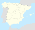
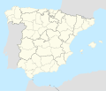
File:Spain location map with provinces (including Canary Islands).svg
Appearance

Size of this PNG preview of this SVG file: 699 × 600 pixels. Other resolutions: 280 × 240 pixels | 559 × 480 pixels | 895 × 768 pixels | 1,193 × 1,024 pixels | 2,387 × 2,048 pixels | 1,184 × 1,016 pixels.
Original file (SVG file, nominally 1,184 × 1,016 pixels, file size: 3.48 MB)
File history
Click on a date/time to view the file as it appeared at that time.
| Date/Time | Thumbnail | Dimensions | User | Comment | |
|---|---|---|---|---|---|
| current | 08:47, 1 June 2025 |  | 1,184 × 1,016 (3.48 MB) | UluhKota | Thickening the border line between {{w|Province of Las Palmas|Las Palmas}} and {{W|Province of Santa Cruz de Tenerife|Santa Cruz de Tenerife}}. |
| 03:51, 1 June 2025 |  | 1,184 × 1,016 (3.28 MB) | UluhKota | Change the color of the Canary Islands map to #FDFCEB. | |
| 02:45, 1 June 2025 |  | 1,184 × 1,016 (1.23 MB) | UluhKota | Uploaded a work by {{U|Vivaelcelta|Roi González Villa (Vivaelcelta)}}<br>Brgesto {{small|(Added Canary Islands map from File:Spain 2 location map.svg)}} from {{Based|Spain location map.svg|A Coruna in Spain.svg|Spain 2 location map.svg|b1=NNW|b2=TUBS|b3=HansenBCN and Miguillen|d=96|o=l}} with UploadWizard |
File usage
The following 2 pages use this file:
Global file usage
The following other wikis use this file:
- Usage on ace.wikipedia.org
- Usage on af.wikipedia.org
- Cadaqués
- Alt Empordà
- Almazán
- Ágreda
- San Leonardo de Yagüe
- Abejar
- Adradas
- Alconaba
- Alcubilla de las Peñas
- Aldealafuente
- Alcubilla de Avellaneda
- Aldealices
- Almajano
- Yelo
- Aldealpozo
- Aldealseñor
- Alentisque
- Aliud
- Almaluez
- Almarza
- Cubilla
- Covaleda
- Ciria
- Cigudosa
- Dévanos
- Cihuela
- Coscurita
- Barca
- Nepas
- Nolay
- Noviercas
- Liceras
- La Losilla
- Portillo de Soria
- Oncala
- Ólvega
- Rioseco de Soria
- La Riba de Escalote
- Renieblas
- Quintana Redonda
- Los Rábanos
- Recuerda
- Rebollar
- Almazul
- Baraona
- Blacos
- Calatañazor
- Candilichera
View more global usage of this file.


