
File:Map of Los Pedroches in the province.svg

Size of this PNG preview of this SVG file: 301 × 376 pixels. Other resolutions: 192 × 240 pixels | 384 × 480 pixels | 615 × 768 pixels | 820 × 1,024 pixels | 1,639 × 2,048 pixels.
Original file (SVG file, nominally 301 × 376 pixels, file size: 334 KB)
| This is a file from the Wikimedia Commons. Information from its description page there is shown below. Commons is a freely licensed media file repository. You can help. |
Summary
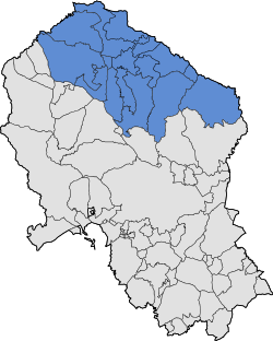
| Description | Map of Los Pedroches in the province of Córdoba, Spain |
| Date | |
| Source | Own work |
| Author | Américo Toledano |
Licensing

|
Permission is granted to copy, distribute and/or modify this document under the terms of the GNU Free Documentation License, Version 1.2 or any later version published by the Free Software Foundation; with no Invariant Sections, no Front-Cover Texts, and no Back-Cover Texts. A copy of the license is included in the section entitled GNU Free Documentation License. |
| This file is licensed under the Creative Commons Attribution-Share Alike 3.0 Unported license. | ||
| ||
| This licensing tag was added to this file as part of the GFDL licensing update. |
File history
Click on a date/time to view the file as it appeared at that time.
| Date/Time | Thumbnail | Dimensions | User | Comment | |
|---|---|---|---|---|---|
| current | 02:32, 23 January 2008 | | 301 × 376 (334 KB) | Hameryko | == Sumario == {{Information |Description=Map of Los Pedroches in the province of Córdoba, Spain |Source=self-made |Date=23/jan/2008 |Author= Hameryko |Permission=see below |other_versions= }} Category:Maps of regions of Córdoba == |
File usage
The following page uses this file:
Global file usage
The following other wikis use this file:
- Usage on ca.wikipedia.org
- Usage on es.wikipedia.org
- Usage on gl.wikipedia.org
- Usage on ru.wikipedia.org
- Usage on sco.wikipedia.org
- Usage on uk.wikipedia.org
- Usage on www.wikidata.org
- Usage on zh.wikipedia.org