
File:Chicago Demographics in 1950 Map.jpg
Size of this preview: 400 × 599 pixels. Other resolutions: 160 × 240 pixels | 320 × 480 pixels | 513 × 768 pixels | 683 × 1,024 pixels | 1,984 × 2,972 pixels.
Original file (1,984 × 2,972 pixels, file size: 1.28 MB, MIME type: image/jpeg)
| This is a file from the Wikimedia Commons. Information from its description page there is shown below. Commons is a freely licensed media file repository. You can help. |
Summary
| Description |
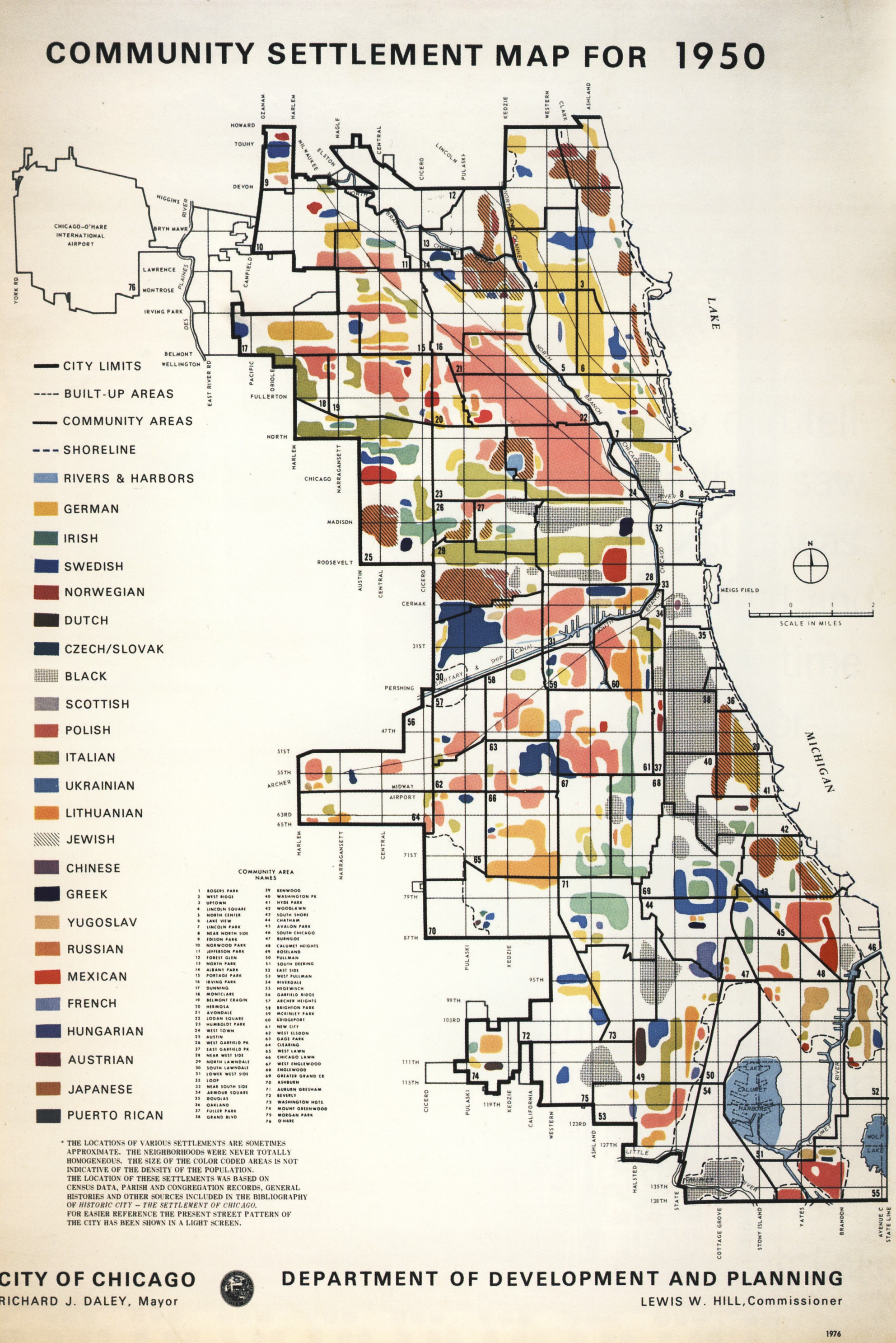
English: Map illustrating the dominant ethnicities of different areas of Chicago in 1950
Polski: Mapa ukazujaca rozmieszczenie poszczegolnych narodowosci w Chicago w r. 1950. |
| Date | |
| Source | City of Chicago Department of Planning and Development |
| Author | City of Chicago Department of Planning and Development |
| Permission (Reusing this file) |
PD-US-1978-89 |
Licensing
This work is in the public domain because it was published in the United States between 1978 and March 1, 1989 without a copyright notice, and its copyright was not subsequently registered with the U.S. Copyright Office within 5 years.
|
 |
File history
Click on a date/time to view the file as it appeared at that time.
| Date/Time | Thumbnail | Dimensions | User | Comment | |
|---|---|---|---|---|---|
| current | 02:55, 8 June 2009 | | 1,984 × 2,972 (1.28 MB) | Orestek | {{Information |Description={{en|1=Map illustrating the dominant ethnicities of different areas of Chicago in 1950}} {{pl|1=Mapa ukazujaca rozmieszczenie poszczegolnych narodowosci w Chicago w r. 1950.}} |Source=City of Chicago Department of Planning and D |
File usage
The following page uses this file:
Global file usage
The following other wikis use this file:
- Usage on no.wikipedia.org