
File:Batum Treaty.svg

Size of this PNG preview of this SVG file: 512 × 352 pixels. Other resolutions: 320 × 220 pixels | 640 × 440 pixels | 1,024 × 704 pixels | 1,280 × 880 pixels | 2,560 × 1,760 pixels.
Original file (SVG file, nominally 512 × 352 pixels, file size: 876 KB)
| This is a file from the Wikimedia Commons. Information from its description page there is shown below. Commons is a freely licensed media file repository. You can help. |

Summary
| Description |
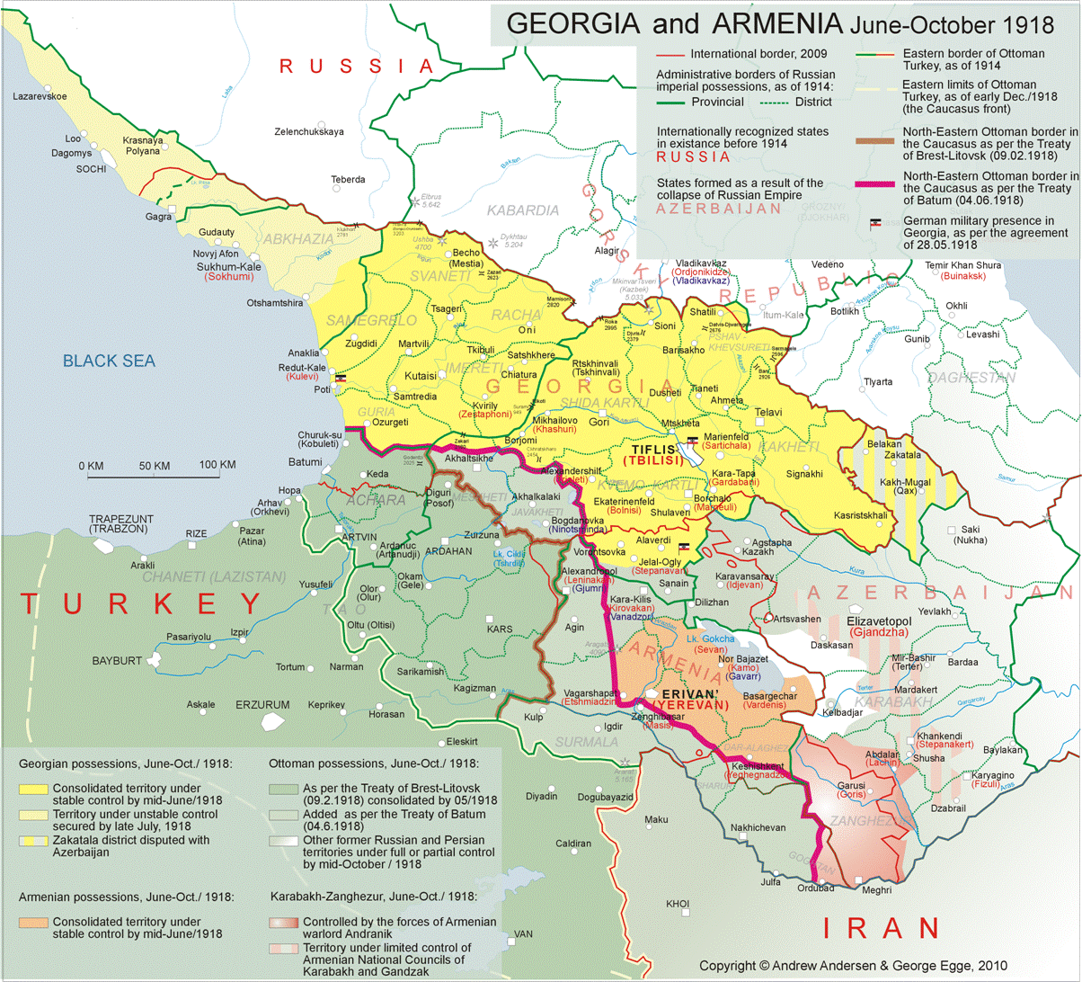
English: The treaty of Batum signed by the Caucasus states. Original can be found File:Treaty_of_Batum.png here, and also updated with minor changes taken from [this] |
| Date | |
| Source | Own work |
| Author | Peachy1621 |
Licensing
I, the copyright holder of this work, hereby publish it under the following license:
| This file is made available under the Creative Commons CC0 1.0 Universal Public Domain Dedication. | |
| The person who associated a work with this deed has dedicated the work to the public domain by waiving all of their rights to the work worldwide under copyright law, including all related and neighboring rights, to the extent allowed by law. You can copy, modify, distribute and perform the work, even for commercial purposes, all without asking permission.
|
File history
Click on a date/time to view the file as it appeared at that time.
| Date/Time | Thumbnail | Dimensions | User | Comment | |
|---|---|---|---|---|---|
| current | 23:03, 8 March 2025 | | 512 × 352 (876 KB) | Peachy1621 | Some updates |
| 17:46, 20 February 2025 |  | 512 × 352 (918 KB) | Peachy1621 | Nakhijevan was declared as under the RSFSR's suzerainty by Andranik, not an SSR* | |
| 20:47, 22 January 2025 |  | 512 × 352 (901 KB) | Peachy1621 | Zagatala borders changed (used to be included within Georgia) to a neutral dashed line. Red army dark red outline fixed, and Ejmiatsin adjusted. Shushi Council updated as well with a dashed line for a border. | |
| 07:32, 8 January 2025 |  | 512 × 352 (897 KB) | Peachy1621 | Added the Armenian Nakhijevan SSR (declared by Andranik Ozanian in mid-1918) and fixed Zagatala, as the borders near Georgia and Azerbaijan were doing some weird z-fighting of some sort. | |
| 05:41, 8 January 2025 |  | 512 × 352 (835 KB) | Peachy1621 | Color of the lakes and rivers changed to match the coast. | |
| 22:29, 25 September 2024 |  | 512 × 352 (770 KB) | Peachy1621 | {{Information |Description= |Source= |Date= |Author= |Permission= |other_versions= }} | |
| 22:20, 25 September 2024 |  | 512 × 352 (778 KB) | Peachy1621 | Map fixed (borders were adjusted, and some stuff reinstated and renamed.) | |
| 02:52, 4 June 2024 |  | 512 × 352 (736 KB) | Peachy1621 | Uploaded own work with UploadWizard |
File usage
The following 4 pages use this file:
Global file usage
The following other wikis use this file:
- Usage on fa.wikipedia.org
- Usage on tr.wikipedia.org
- Usage on zh.wikipedia.org