
Geography of Australia
 | |
| Continent | Oceania (continent) |
|---|---|
| Region | Oceania |
| Coordinates | 27°00′00″S 144°00′00″E / 27.000°S 144.000°E |
| Area | Ranked 6th |
| • Total | 7,688,287[1] km2 (2,968,464 sq mi) |
| • Land | 98.21% |
| • Water | 1.79% |
| Coastline | 59,681 km (37,084 mi) |
| Borders | None |
| Highest point | Mount Kosciuszko 2,228 m (7,310 ft) |
| Lowest point | Lake Eyre, −15 m (−49 ft) |
| Longest river | Murray River, 2,375 km (1,476 mi) |
| Largest lake | Lake Eyre 9,500 km2 (3,668 sq mi) |
| Climate | Mostly desert or semi-arid, south-east and south-west corners: temperate, north: tropical climate, varied between tropical rainforests, grasslands, part desert, mountainous areas: subantarctic tundra |
| Terrain | Mostly low plateau with deserts, rangelands and a fertile plain in the southeast; mountain ranges in the east and south-east. |
| Natural resources | Minerals, coal, and timber |
| Natural hazards | Cyclones along the northern coasts, severe thunderstorms, droughts, occasional floods, heat waves, and frequent bushfires |
| Exclusive economic zone | 8,148,250 km2 (3,146,060 sq mi) |
The geography of Australia encompasses a wide variety of biogeographic regions being the world's smallest continent, while comprising the territory of the sixth-largest country in the world. The population of Australia is concentrated along the eastern and south-eastern coasts. The geography of the continent is extremely diverse, ranging from the snow-capped mountains of the Australian Alps and Tasmania to large deserts, tropical and temperate forests, grasslands, heathlands and woodlands.
The countries that govern nearby regions include Indonesia, East Timor, and Papua New Guinea to the north; the Solomon Islands, Vanuatu, and the French dependency of New Caledonia to the east; and New Zealand to the southeast.
Physical geography
[edit]
_(Oceania_centered)_with_borders.svg)
Australia is a country and an island located in Oceania between the Indian Ocean and the South Pacific Ocean. It shares its name with the country that claims control over it. Properly called the Commonwealth of Australia, its territory consists of the entire continent and smaller outlying islands. This makes it the sixth-largest country in the world by area of jurisdiction, which comprises 7,686,850 km2 (2,967,910 sq mi) (including Lord Howe Island and Macquarie Island), which is slightly smaller than the 48 states of the contiguous United States and 31.5 times larger than that of the United Kingdom.
The Australian mainland has a total coastline length of 35,821 km (22,258 mi) with an additional 23,860 km (14,830 mi) of island coastlines.[2] There are 758 estuaries around the country with most located in the tropical and sub-tropical zones.[3] A recent global remote sensing analysis suggested that there was 8,866 km2 (3,423 sq mi) of tidal flat area in Australia, making it the third-ranked country in terms of how much tidal flat occurs there.[4] Australia has the third-largest exclusive economic zone of 8,148,250 km2 (3,146,060 sq mi). This EEZ does not include the Australian Antarctic Territory (an additional 5,896,500 km2 (2,276,700 sq mi)).
Australia has the largest area of ocean jurisdiction of any country on Earth.[5] It has no land borders. The northernmost points of the continental mainland are the Cape York Peninsula of Queensland and the Top End of the Northern Territory, but the northernmost point of the country lies in the Torres Strait Islands.
The western half of Australia consists of the Western Plateau, which rises to mountain heights near the west coast and falls to lower elevations near the continental centre. The Western Plateau region is generally flat, though broken by various mountain ranges such as the Hamersley Range, the MacDonnell Ranges, and the Musgrave Range. Surface water is generally lacking in the Western Plateau, although there are several larger rivers in the west and north, such as the Murchison, Ashburton, and Victoria rivers.
The Eastern Highlands, or Great Dividing Range, lie near the eastern coast of Australia, separating the relatively narrow eastern coastal plain from the rest of the continent. These Eastern Australian temperate forests have the greatest relief, the most rainfall, the most abundant and varied flora and fauna, and the densest human settlement.
Between the Eastern Highlands and the Western Plateau lies the Central Lowlands, which are made up of the Great Artesian Basin and Australia's largest river systems, the Murray–Darling basin and the Lake Eyre Basin.
Off the north-eastern coast of Australia is the world's largest coral reef complex, the Great Barrier Reef. The large and mountainous island of Tasmania, also a State of Australia, lies south of the south-eastern corner of the Australian mainland. It receives abundant rainfall, and has highly fertile soils particularly in comparison to the mainland.
In Australia forest cover is around 17% of the total land area, equivalent to 134,005,100 hectares (ha) of forest in 2020, up from 133,882,200 hectares (ha) in 1990. In 2020, naturally regenerating forest covered 131,614,800 hectares (ha) and planted forest covered 2,390,300 hectares (ha). Of the naturally regenerating forest 0% was reported to be primary forest (consisting of native tree species with no clearly visible indications of human activity) and around 18% of the forest area was found within protected areas. For the year 2015, 67% of the forest area was reported to be under public ownership, 32% private ownership and 1% with ownership listed as other or unknown.[6][7]
Geology
[edit]
Australia is the lowest, flattest, and oldest continental landmass on Earth[8] and it has had a relatively stable geological history. Geological forces such as the tectonic uplift of mountain ranges and clashes between tectonic plates occurred mainly in Australia's early prehistory, when it was still a part of Gondwana. Its highest peak is Mount Kosciuszko at 2,228 m (7,310 ft), which is relatively low in comparison to the highest mountains on other continents.
Charles Rowland Twidale estimates that between 10% and 20% of Australia's modern landscapes formed during the Mesozoic when the continent was part of Gondwana.[9]
Australia is situated in the middle of the tectonic plate, and therefore currently has no active volcanism. Minor earthquakes which produce no damage occur frequently, while major earthquakes measuring greater than magnitude 6 occur on average every five years.[10] The terrain is mostly low plateau with deserts, rangelands and a fertile plain in the southeast. Tasmania and the Australian Alps do not contain any permanent icefields or glaciers, although these may have existed in the past. The Great Barrier Reef, by far the world's largest coral reef, lies a short distance off the north-east coast.
Regions
[edit]
The Australian continental landmass consists of six distinct landform divisions.[11] These are:
- The Eastern Highlands—including the Great Dividing Range, the fertile Brigalow Belt strip of grassland behind the east coast, and the Eastern Uplands
- The Eastern alluvial Plains and Lowlands—the Murray Darling basin covers the southern part; also includes parts of the Lake Eyre Basin and extends to the Gulf of Carpentaria
- The South Australian Highlands—including the Flinders Range, Eyre Peninsula, and Yorke Peninsula
- The Western Plateau—including the Nullarbor Plain
- The Central Deserts
- Northern Plateau and Basins—including the Top End
Hydrology
[edit]

As the driest inhabited continent, Australia does not have many large, fast-flowing rivers or large permanent lakes. Many of Australia's rivers do not have a regular flow; they can have years of very low flows, followed by one or more years of flooding.[13] Australia's rainfall regime is highly variable, with low mean annual rainfall over most of the continent and heavy seasonal falls in the tropics, concentric around the continent's extensive arid core. The effects of this varied rainfall pattern and Australia's drainage system can result in parts of the continent being in drought, but inundated by water from rainfall thousands of kilometres away.[14] On average, only 9% of Australia's rainfall is converted to surface runoff, and about 2% percolates through the ground to recharge groundwater.[13]
The Great Artesian Basin is an important source of water, the world's largest and deepest fresh water basin. Access to water from the basin has led to the expansion of grazing into areas that were previously far too dry for livestock. Towns and cities across the country sometimes face major water storage and usage crises in which restrictions and other measures are implemented to reduce water consumption. Water restrictions are based on a gradient of activities that become progressively banned as the situation worsens.
Billabong is the Australian name given to the oxbow lakes that can form along a meandering river's course.[15] In a worldwide comparison of height, Australia's waterfalls are relatively insignificant, with the longest drop ranked 135th according to the World Waterfall Database.[16]
Political geography
[edit]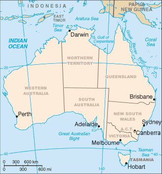
Australia consists of six states, two major mainland territories, and other minor territories. The states are New South Wales, Queensland, South Australia, Tasmania, Victoria, and Western Australia. The two major mainland territories are the Northern Territory and the Australian Capital Territory. Western Australia is the largest state, covering just under one third of the Australian landmass, followed by Queensland, South Australia, and New South Wales.
Australia also has several minor territories; the federal government administers a separate area within New South Wales, the Jervis Bay Territory, as a naval base and seaport for the national capital. In addition Australia has the following inhabited, external territories: Norfolk Island, Christmas Island, Cocos (Keeling) Islands, and several largely uninhabited external territories: Ashmore and Cartier Islands, Coral Sea Islands, and Heard Island and McDonald Islands. Australia also claims a portion of Antarctica as the Australian Antarctic Territory, although this claim is not widely recognized.
Western Australia is the largest state, occupying 32.9% of Australia's land area (2,527,013 km2 (975,685 sq mi)), followed by Queensland (1,723,030 km2 (665,270 sq mi)), South Australia (979,651 km2 (378,245 sq mi)) and New South Wales (801,137 km2 (309,321 sq mi)). The Northern Territory, the largest of the territories, occupies 17.5% of the country's land area (1,334,404 km2 (515,216 sq mi)), while the rest of territories together occupy less than 1% of the country's land area.[17]
Human geography
[edit]This section needs expansion. You can help by adding to it. (January 2022) |
Due to various geographical features of Australia, almost 80% of the Australian population live within 25 km of the coast,[18] where most of its capital cities and suburban satellites exist. The largest inland city in Australia is Canberra, the capital city of Australia. Australia's mean population density is 3.3/km2, one of the lowest in the world.[19]
A significant immigrant population occupied these places with relatively little dispute and few inner city ghettoes.[20] The main countries of origin of these immigrants are England, India, China and New Zealand, with all four countries having more than 500,000 residents in Australia as of 2020.[21]
Australia also has a significant indigenous population in each state and territory. Northern Territory has the greatest proportion of Indigenous population, at 26.3% as of 2021.[22]
Sport plays an important social and cultural role in Australia with more than 90% of adults having an interest in sport.[23] English is the most common language in Australia. Australians enjoy a very high rate of private property ownership.[20] Australians have a preponderance to engage in gambling, experiencing the largest per capita losses in the world.[24]
Climate
[edit]
By far the largest part of Australia is arid or semi-arid. A total of 18% of Australia's mainland consists of named deserts (around 1,371,000 km2 (529,000 sq mi)).[25] Only the south-east and south-west corners have a temperate climate and moderately fertile soil. The northern part of the continent has a tropical climate: part is tropical rainforests, part grasslands, and part desert.
Australia's unique location under a subtropical high-pressure belt and surrounded by other climate drivers like El Niño–Southern Oscillation and the Indian Ocean Dipole makes most of Western Australia a hot desert, and aridity a marked feature of most of the continent.[26] Recently, research has linked Australia's desertification to human settlers who arrived some 50.000 years ago, and periodic burning by these settlers may have prevented the monsoons from reaching the Australian interior.[27] The Outback, the vast and remote centre of Australia, covers approximately 70% of the continent.[28]
Because Australia is a medium-sized continent, separated from the polar regions by the Southern Ocean, it is not subject to cold polar air movements during winter of the kind that sweep the northern hemisphere continents during their winters. Consequently, the Australian winter is relatively mild, with less contrast between summer and winter temperatures than on the northern continents, although the transition is more pronounced in Australia's alpine regions and at high altitudes. Seasonal maximum and minimum temperatures can be considerable, with temperatures ranging from a maximum of 40 °C (104 °F) in the central desert regions to 0 °C (32 °F) in the higher regions of the south-east.[14]
Rainfall is highly variable, with frequent droughts lasting several seasons, caused in part by the El Niño–Southern Oscillation.[26] According to the Bureau of Meteorology, 80% of the land area receives less than 600 mm (24 in) of annual rainfall and 50% less than 300 mm (12 in).[29] Overall, Australia has a very low average annual rainfall of 419 mm (16 in).[30]
Natural disasters
[edit]This section needs expansion. You can help by adding to it. (December 2024) |
Cyclones
[edit]Cyclones in Australia are common, which the North-western coast in Western Australia being the most cyclone prone area in all of Australia.[31] Additionally, cyclone formations can also occur off the North-eastern coast in Queensland, such as Cyclone Jasper and Cyclone Niran in recent years. Such cyclones cause widespread economic damage, and triggers floods and other disasters.[32]
Bushfires
[edit]Bushfires are another frequently occurring natural disaster within Australia. This is due to the unique flora that exists, which is highly flammable, and some species actually requiring fire to regenerate and spread.[33] While bushfires can occur at any time of the year, the risk is the highest during the summer and autumn months for the majority of the country, and spring months for the most northern regions of the country.[34]
Heatwaves
[edit]Heatwaves, or consecutive days of extreme temperatures, are also prominent in Australia. They are the deadliest natural disasters in Australia, accounting for more deaths than bushfires, cyclones, earthquakes, floods and severe storms combined.[35] Extreme temperatures are defined as days where the peak temperature is greater than 35 degrees.
Droughts
[edit]The prominence and severity of droughts in Australia has increased in recent times due to accelerated climate change.[36] As Australia is the driest inhabited continent, such droughts can limit the streamflow of the few major rivers in the country, creating a myriad of knock-on effects.[37] Droughts are especially detrimental to Australian agricultural industries, who face unpredictability in their quantity of produce.
Floods
[edit]Earthquakes
[edit]While Australia is not a seismically active zone, it does experience small scale earthquakes, caused by compressive stress built up over time, in the interior of the Australian tectonic plate. On average, around 100 earthquakes of above magnitude 3 are experienced in Australia every year, with the largest recorded earthquake occurring at Tennant Creek in the Northern Territory, with a magnitude of 6.6.[38]
Environment
[edit]
Current environmental issues include: soil erosion from overgrazing, industrial development, urbanization, and poor farming practices; soil salinity rising due to the use of poor quality water; desertification (partly as a result of the introduction by European settlers of rabbits); introduced pest species; clearing for agricultural purposes threatens the natural habitat of many unique animal and plant species; the Great Barrier Reef off the northeast coast, the largest coral reef in the world, is threatened by increased shipping and its popularity as a tourist site; limited natural fresh water resources; and threats from invasive species.
International agreements:
- party to: Antarctic-Environmental Protocol, Antarctic Treaty, Kyoto Protocol, Biodiversity, China–Australia Migratory Bird Agreement, Climate Change, Endangered Species, Environmental Modification, Hazardous Wastes, Japan–Australia Migratory Bird Agreement, Law of the Sea, Marine Dumping, Marine Life Conservation, Nuclear Test Ban 1963, Nuclear Non-Proliferation, Ozone Layer Protection, Ship Pollution, Tropical Timber 1994, Ramsar Convention, Whaling
- signed, but not ratified: Desertification


.jpg)

See also
[edit]- Australasian realm
- Australia-New Guinea
- List of cities in Australia by population
- List of drainage basins of Australia
- List of extreme points of Australia
- List of islands of Australia
- List of lakes of Australia
- List of mountains in Australia
- List of regions of Australia
- List of rivers of Australia
- List of valleys of Australia
- List of waterfalls in Australia
- Protected areas of Australia
References
[edit]- ^ "Area of Australia – States and Territories". 27 June 2014.
- ^ "Border Lengths – States and Territories". Geoscience Australia. Commonwealth of Australia. 2004. Retrieved 18 August 2016.
- ^ Dennison, William C.; Abal, Eva G. (1999). Moreton Bay Study: A Scientific Basis for the Healthy Waterways Campaign. Brisbane: South East Queensland Regional Water Quality Management Strategy Team. p. 220. ISBN 0-9586368-1-8.
- ^ Murray, N.J.; Phinn, S.R.; DeWitt, M.; Ferrari, R.; Johnston, R.; Lyons, M.B.; Clinton, N.; Thau, D.; Fuller, R.A. (2019). "The global distribution and trajectory of tidal flats". Nature. 565 (7738): 222–225. doi:10.1038/s41586-018-0805-8. PMID 30568300. S2CID 56481043.
- ^ Non-Fisheries Uses in Australia's Marine Jurisdiction National Marine Atlas. Department of the Environment, Water, Heritage and the Arts
- ^ Terms and Definitions FRA 2025 Forest Resources Assessment, Working Paper 194. Food and Agriculture Organization of the United Nations. 2023.
- ^ "Global Forest Resources Assessment 2020, Australia". Food Agriculture Organization of the United Nations.
- ^ Pain, C.F., Villans, B.J., Roach, I.C., Worrall, L. & Wilford, J.R. (2012): Old, flat and red – Australia's distinctive landscape. In: Shaping a Nation: A Geology of Australia. Blewitt, R.S. (Ed.) Geoscience Australia and ANU E Press, Canberra. pp. 227–275 ISBN 978-1-922103-43-7
- ^ Rowland, C.R. (1994). "Gondwanan (Late Jurassic and Cretaceous) palaeosurfaces of the Australian craton". Palaeogeography, Palaeoclimatology, Palaeoecology. 112 (1–2): 157–186. Bibcode:1994PPP...112..157T. doi:10.1016/0031-0182(94)90139-2.
- ^ Mccue, Kevin (26 February 2010). "Land of earthquakes and volcanoes?". Australian Geographic. Archived from the original on 6 March 2010. Retrieved 25 April 2010.
- ^ Loffler, Ernst; Anneliese Loffler; A. J. Rose; Denis Warner (1983). Australia:Portrait of a continent. Hutchinson Group. p. 18. ISBN 0-09-130460-1.
- ^ "Australian Hydrological Geospatial Fabric (Geofabric): Topographic Drainage Divisions and River Regions" (PDF). Bureau de Meteorología. 2012. Retrieved 27 May 2023.
- ^ a b "Natural water systems". dcceew.gov.au. Retrieved 27 May 2025.
- ^ a b "Climatic Extremes". Geoscience Australia. Retrieved 26 May 2025.
- ^ "Billabongs". University of Melbourne. 28 May 2020. Archived from the original on 14 March 2024.
- ^ "Significant Waterfalls". Geoscience Australia. Commonwealth of Australia. Archived from the original on 25 May 2010. Retrieved 11 June 2010.
- ^ "Area of Australia - States and Territories". Geoscience Australia. Retrieved 25 May 2025.
- ^ Chen, Keping; McAneney, John (August 2006). "High-resolution estimates of Australia's coastal population". Geophysical Research Letters. 33 (16). Bibcode:2006GeoRL..3316601C. doi:10.1029/2006GL026981. ISSN 0094-8276.
- ^ Neill, Simon P.; Hemer, Mark; Robins, Peter E.; Griffiths, Alana; Furnish, Aaron; Angeloudis, Athanasios (June 2021). "Tidal range resource of Australia". Renewable Energy. 170: 683–692. Bibcode:2021REne..170..683N. doi:10.1016/j.renene.2021.02.035. hdl:20.500.11820/39c65964-e961-4018-ac46-e67faeadf447. S2CID 233552671.
- ^ a b Peace, Adrian (2015). "Australia, Sociocultural Overviews: Australian Settler Society". International Encyclopedia of the Social & Behavioral Sciences (Second Edition): 239–244. doi:10.1016/B978-0-08-097086-8.12022-7. ISBN 9780080970875. Retrieved 21 October 2022.
- ^ "Estimated resident population, Country of birth - as at 30 June, 1996 to 2020". Australian Bureau of Statistics. 13 December 2024.
- ^ "2021 Northern Territory, Census All persons QuickStats | Australian Bureau of Statistics". Australian Bureau of Statistics. Retrieved 13 December 2024.
- ^ "About sport in Australia". Department of Health and Aged Care. Commonwealth of Australia. 22 February 2022. Retrieved 22 October 2022.
- ^ "Gambling in Australia". Australian Institute of Health and Welfare. Retrieved 27 October 2022.
- ^ "Areas of Australian and territory deserts". Geoscience Australia. 25 November 2022. Retrieved 26 May 2025.
- ^ a b Kate, Doyle (31 July 2018). "What you need to know about droughts: Why they happen and how they are defined". Australia Broadcasting Corporation. Retrieved 26 May 2025.
- ^ Karl-Heinz, Wyrwoll (11 January 2012). "How Aboriginal burning changed Australia's climate". The Conversation. Retrieved 26 May 2025.
- ^ "The Modern Outback" (PDF). The Pew Charitable Trusts. October 2014. p. 3. Retrieved 8 May 2025.
- ^ "Climate of Australia". Bureau of Meteorology. Archived from the original on 17 March 2009. Retrieved 26 May 2025.
- ^ Bart, Geerts (1997). Climates and Weather Explained: An Introduction from Southern Perspective. Routledge. p. 376. ISBN 978-0-415-12519-2.
- ^ "BOM says cyclones could grow in intensity despite 'average' season forecast". Australia: ABC News. 8 October 2024. Retrieved 14 December 2024.
- ^ "MSN". MSN. Retrieved 14 December 2024.
- ^ Australia, Geoscience (7 September 2022). "Bushfire". Geoscience Australia. Retrieved 14 December 2024.
- ^ "Fire weather seasons". Bureau of Meteorology. 14 December 2024.
- ^ corporateName=National Museum of Australia; address=Lawson Crescent, Acton Peninsula. "National Museum of Australia – Heatwaves". National Museum of Australia. Retrieved 14 December 2024.
{{cite web}}: CS1 maint: multiple names: authors list (link) - ^ "A 20-year 'mega-drought' in Australia? Research suggests it's happened before – and we should expect it again". ANU Institute for Climate, Energy & Disaster Solutions. 3 April 2024. Retrieved 14 December 2024.
- ^ "Natural water systems". 14 December 2024.
- ^ Australia, Geoscience (7 September 2022). "Earthquake". Geoscience Australia. Retrieved 14 December 2024.
 This article incorporates public domain material from The World Factbook (2025 ed.). CIA. (Archived 2000 edition.)
Further reading
[edit]- Miller, Gifford; Mangan, Jennifer; Pollard, David; Thompson, Starley; Felzer, Benjamin; Magee, John (2005). "Sensitivity of the Australian Monsoon to insolation and vegetation: Implications for human impact on continental moisture balance". Geology. 33 (1): 65–68. Bibcode:2005Geo....33...65M. doi:10.1130/G21033.1.
- "Highest Mountains". National Mapping – Fab Facts, Landforms, Australian Mountains. Archived from the original on 17 June 2005. Retrieved 7 July 2005.
- Weatherley, A.H., ed. (1967). Australian Inland Waters and their Fauna. Eleven Studies (PDF, 19Mb). Canberra: Australian National University Press. OCLC 594806492.
External links
[edit]- (in English and French) Map of Australia from 1826
 Wikimedia Atlas of Australia
- (in English) Water Usage in Australia